
On April 22, NYSDOT (finally) released its plans for the I81 viaduct in Downtown Syracuse. The highway’s coming down, and it’s staying down. This is good news for the City, but it’s not the end of the process. NYSDOT still has to finalize its designs, hire contractors, and actually do the work. Syracuse needs to stay engaged to ensure that this process results in a better more equitable city.
NYSDOT’s plans should also direct the City’s attention to the future. Removing the viaduct means rebalancing Syracuse’s citywide transportation network to elevate walking, biking, and busing—not just driving. The DEIS includes some of the new infrastructure necessary for that rebalanced transportation system, but, because NYSDOT confined itself to the area immediately adjacent to the existing highway, its plans are just the beginnings of a truly citywide system. It’s up to the City to build out the rest.
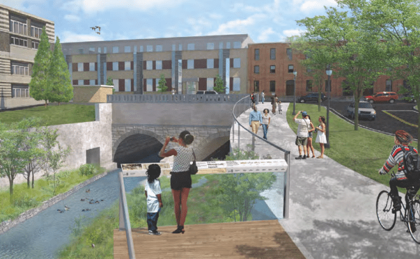
Take the planned addition to the Creekwalk. That new trail will follow the creek’s west bank from Erie Boulevard to Evans Street, it will provide new views of the old Erie Canal culvert, and it will actually be useful for people getting between the Westside and Franklin Square.
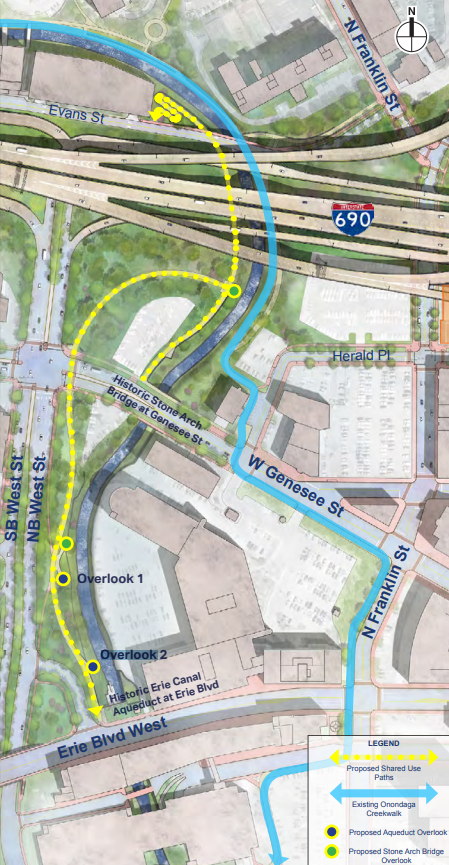
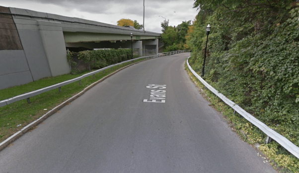
But Evans Street has no sidewalks where it connects with this new trail. It’s just a blind curvy street—not a good place for people to walk. If the new trail is going to actually be useful for people getting around on foot, Evans Street needs new sidewalks.
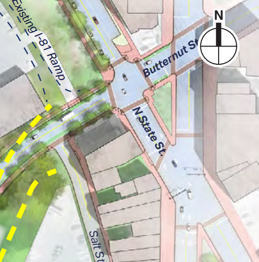
Or look at this plan for a bike lane for State Street:
“A two-way raised cycle track would be provided on the west side of State Street between James Street and Erie Boulevard. A shared use (bicycle and pedestrian) path would be installed between Erie Boulevard and the Empire State Trail on Water Street”
That’s a great adjustment to a street that will see a lot less car traffic once it stops feeding the highway, and a raised cycle track is far superior to a lot of the bike infrastructure that Syracuse has now, but NYSDOT’s planned track only runs for 2 blocks. At one end, the track will connect to the Canalway Trail, but at the other it just stops at a big car-dominated intersection.
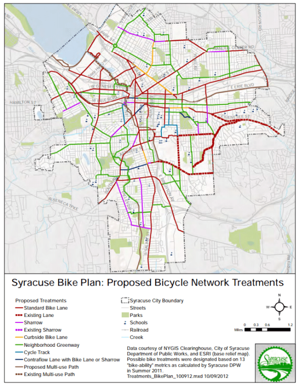
City Hall’s 2012 Bike Plan included bike lanes for both State and James Streets at this intersection. If they existed, then NYSDOT’s 2-block cycle track could actually be useful to someone trying to get across town by bike.
A few blocks north, NYSDOT’s plans to remove the northbound highway onramp from the Butternut Street bridge will mean a lot less traffic at the intersection of Salina, State, and Butternut Street.
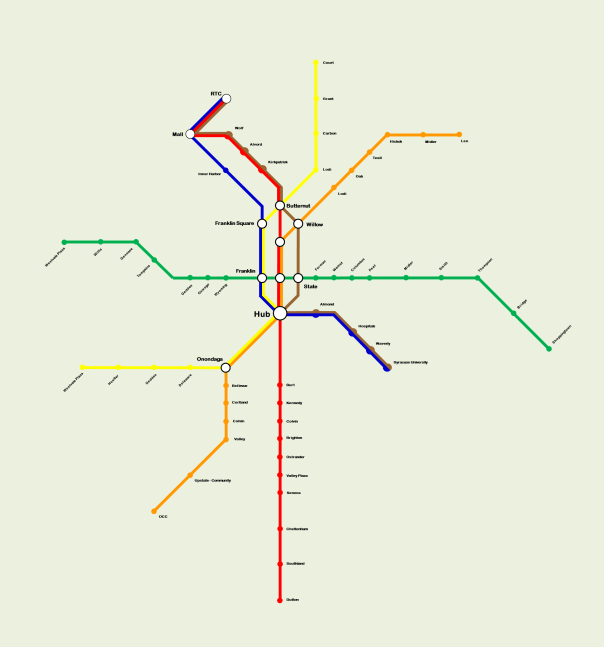
That’s good news for Centro, whose eventual BRT network should make that intersection a major transfer point for Northside buses. NYSDOT is offering to “coordinate with Centro on potential street improvements (transit amenities such as bus stops and shelters, bus turnouts, and layover and turnaround places) in the project limits to enhance and support access to Centro’s transit initiatives”—what a great opportunity for Centro to build a high quality transfer station built with somebody else’s money! It’d be hard to make that ask now, though, because, as it stands, there isn’t a transfer station planned for that intersection because there aren’t even any planned BRT lines that could intersect there. Centro needs to get a move on with it’s BRT network before this opportunity slips away.
The decade-long fight over the I81 has been a fight over what kind of city Syracuse is going to be. One that caters to car-owners over everybody else, or one that balances and incorporates the different needs and habits of everybody who lives in and uses the City. Hopefully, this DEIS means that fight is over. The challenge now is to actually remake Syracuse in that image. These three projects are just examples of ways to do that—the DEIS is full of other starts and suggestions. The important thing is to act on them and make Syracuse into the city that it needs to be.
