Tag Archives: I81

Replacing connections removed by urban renewal

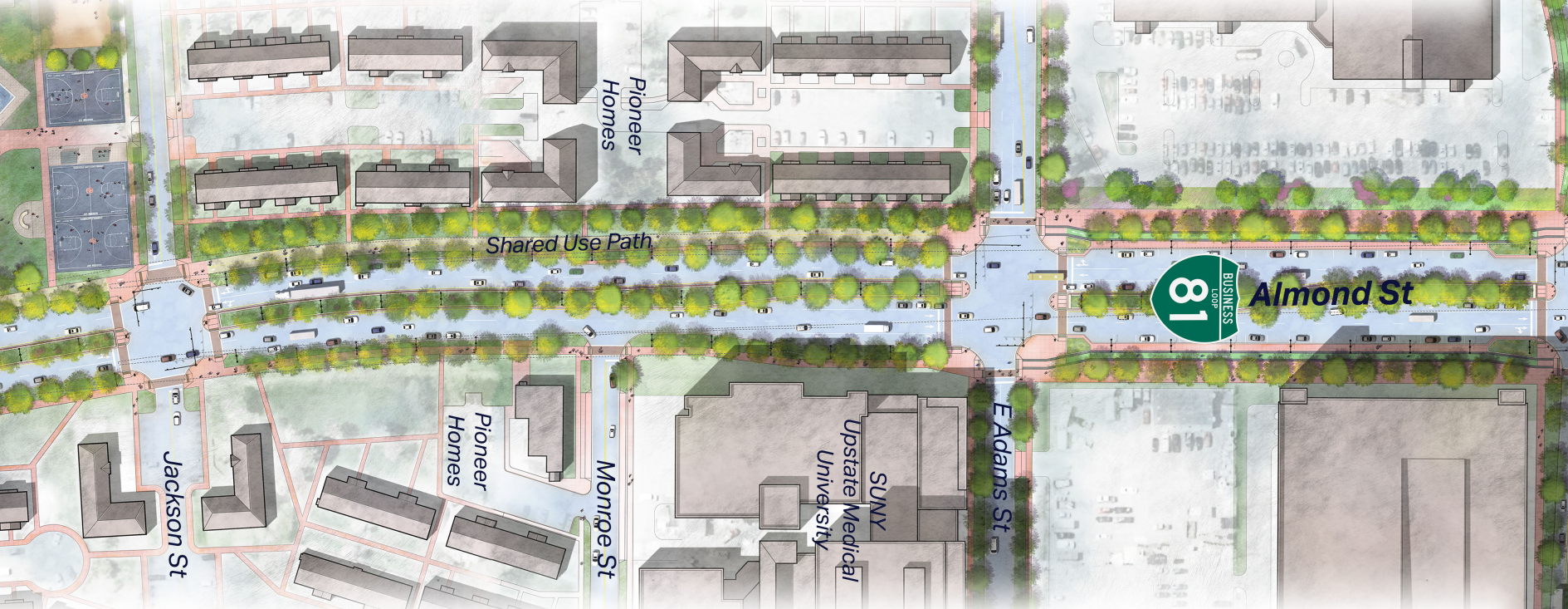
When the Syracuse Police Department moves its main offices out of the Public Safety Building on State Street, City Hall should build a path through the property to reconnect Downtown with the neighborhoods immediately to its east.

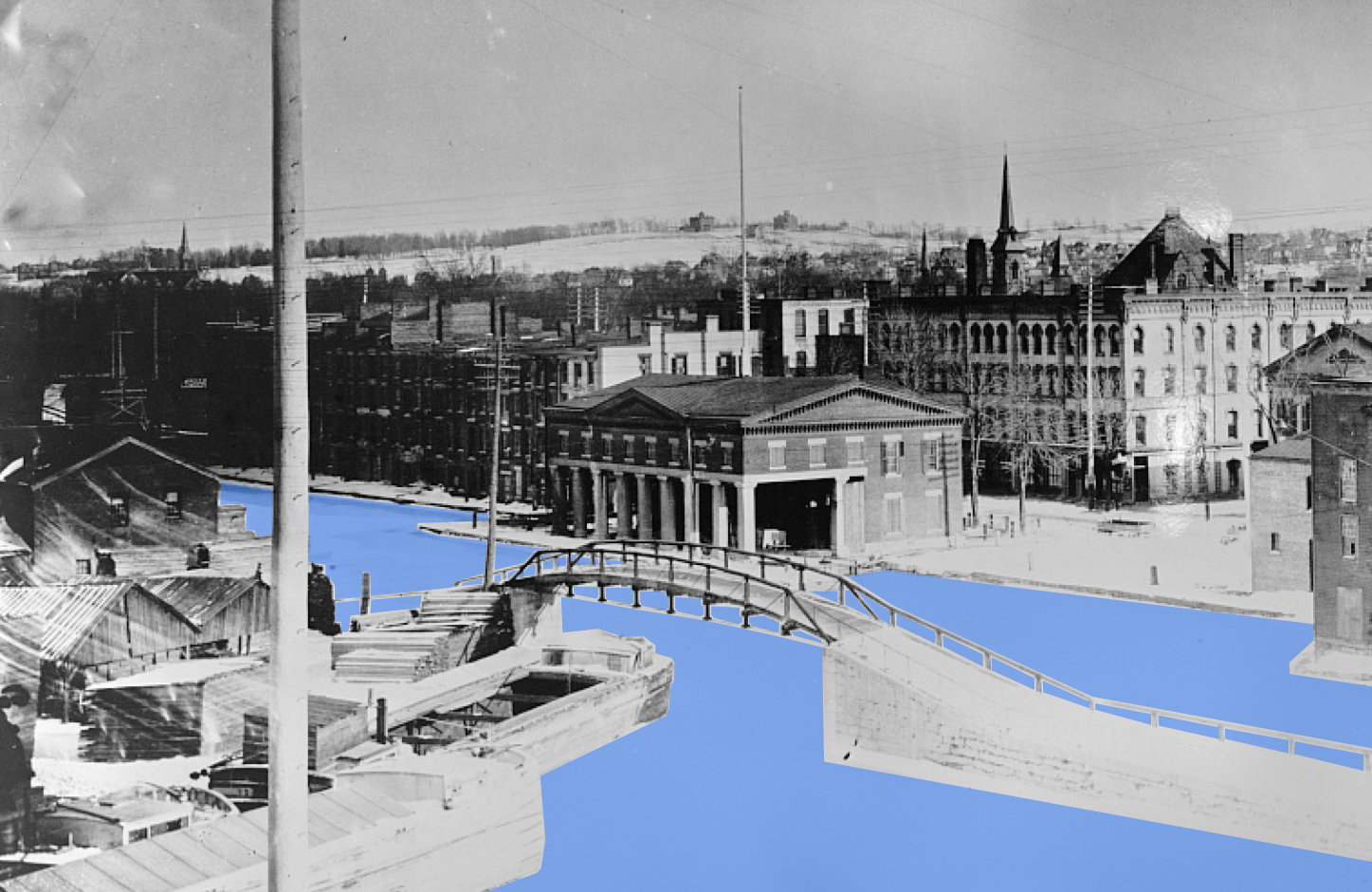
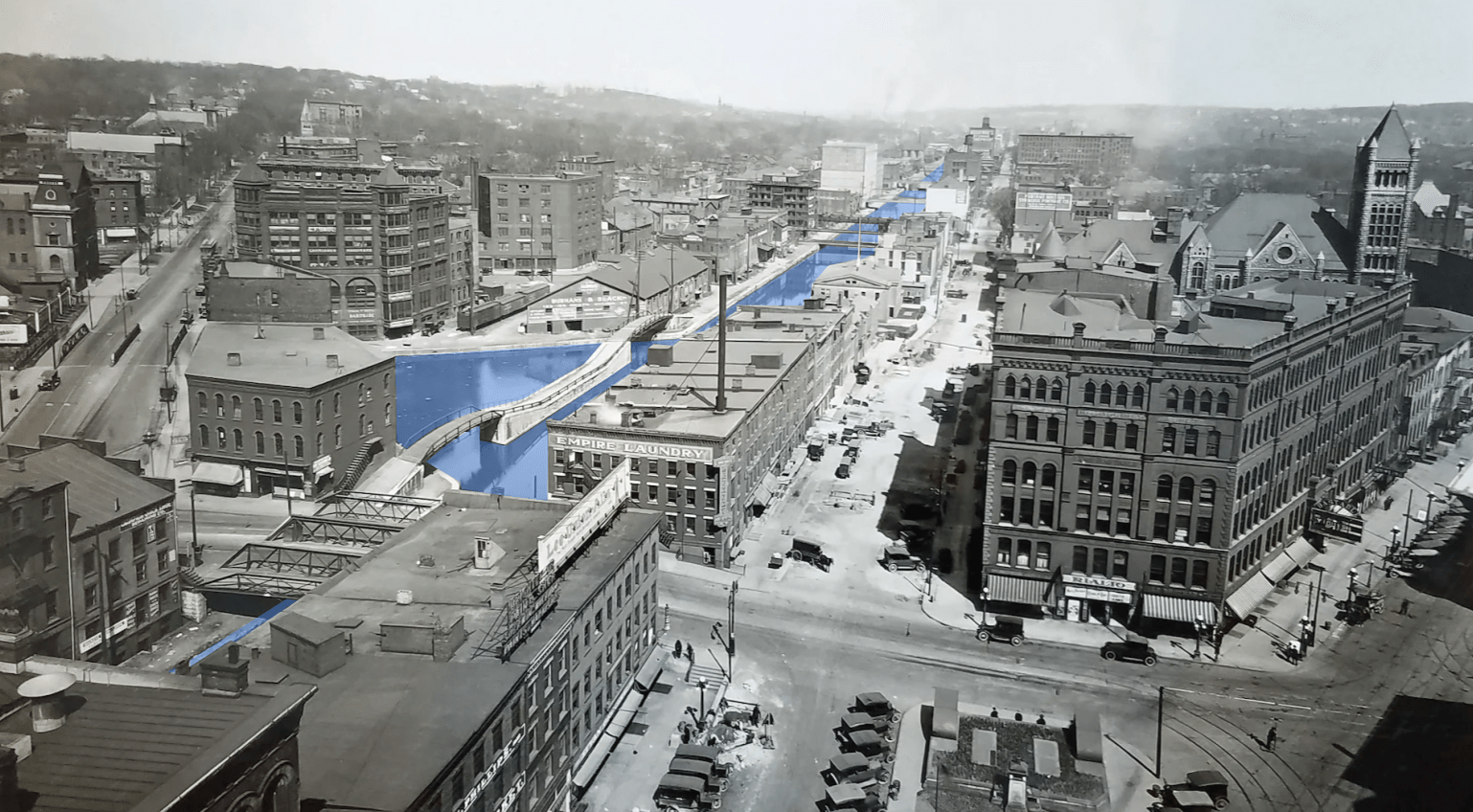
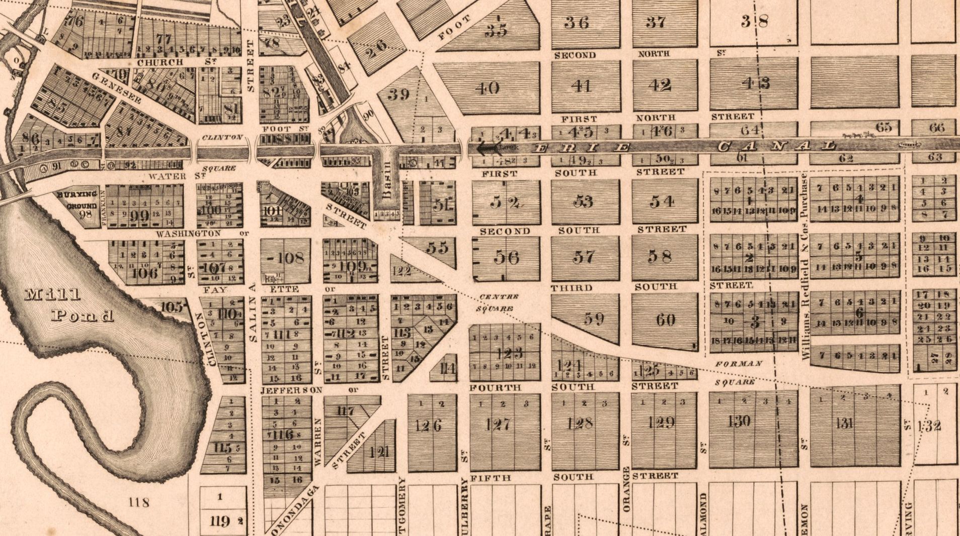
City Hall built the present Public Safety Building as part of an urban renewal project explicitly designed to cut Downtown off from Syracuse’s close-in residential neighborhoods. It did this most effectively by totally demolishing one such neighborhood—the 15th Ward—and by closing short local streets better suited to pedestrian traffic than long-distance car commuting. South of Genesee Street, five local streets used to enter Downtown from the east. Today, only two—Harrison and Adams—are left, and both are too wide and carry too many cars driving too fast to be a safe and pleasant route for anybody travelling by bike, foot, or mobility device.

If I-81’s removal is going to really change the way people get around town—and it must—then City Hall needs to find ways to reestablish those lost connections. Piercing the superblocks around the Public Safety Building is a good place to start. All three of the lost east-west connections—Jefferson, Cedar, and Madison Streets—were removed to build Presidential Plaza and the Courthouse/Public Safety Building/Justice Center/Everson Museum complex.

street grid removal for urban renewal superblocks

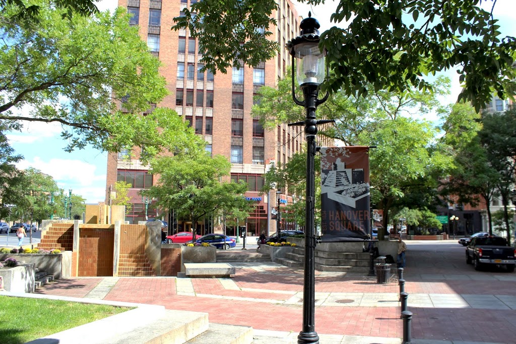
Traces of each remain. The tree-covered walk along the north side of the Everson fountain follows Madison Street’s path. Privately-owned Presidential Court sits where Cedar Street used to run. Eastbound traffic on Genesee Street runs south of Forman Park on what used to be the easternmost block of Jefferson Street.

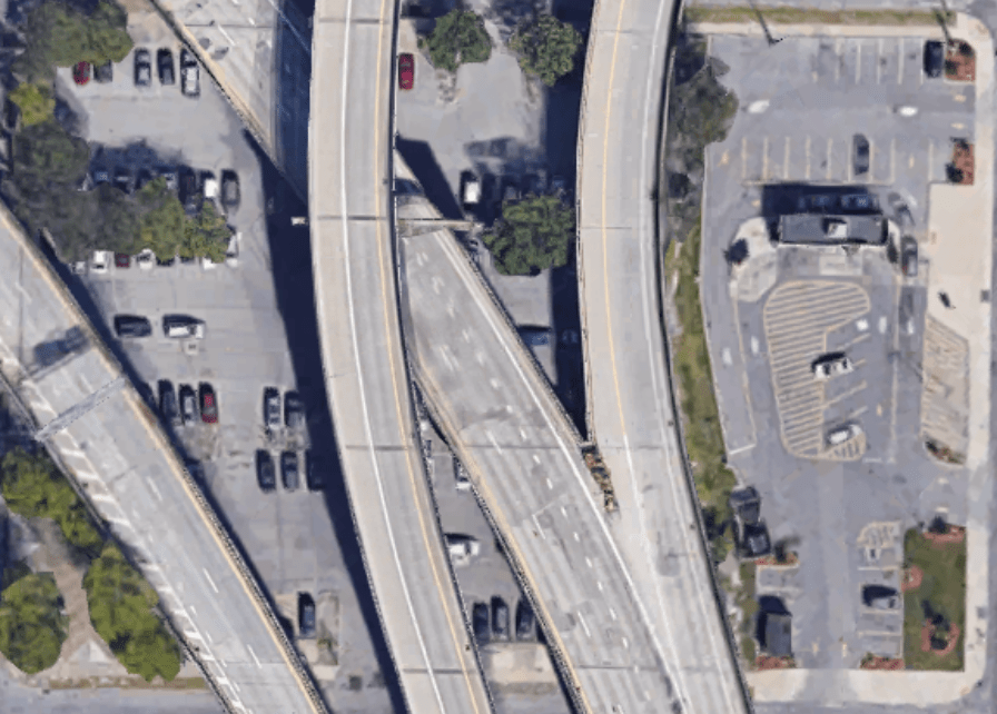
But although there are pieces of all these old streets, they are disconnected and do not form a path between University Hill and Downtown. Urban renewal superblocks, highway offramps, and a distinct lack of crosswalks all conspire to create a sort of pedestrian black hole between State, Genesee, Harrison, and Almond Streets.

traces of Cedar Street between Montgomery and Almond Streets

I-81’s demolition and the police department’s move out of the Public Safety Building present the opportunity to restore connections to Downtown. First, City Hall should pierce the State Street superblock by building a path across it in the area of the present Public Safety Building (the remainder of the large site can be redeveloped with homes and commercial space, some of which should front the path). Second, City Hall should work with NYSDOT and Sutton Real Estate Company—the owner of Presidential Court—to reopen connections across the Presidential Plaza superblock by linking Presidential Court with Almond Street. Third, City Hall and NYSDOT should install crosswalks and traffic lights on Almond, Townsend, and State Streets where those streets intersect reestablished east-west connections.

These are the kinds of interventions Syracuse needs to reconnect neighborhoods divided by urban renewal. The City has been carved up by highways and superblocks, and people getting around on foot, by bike, or with a mobility device have too few direct, safe options for travelling between neighborhoods. A new route through the Public Safety Building property would help reconnect small safe streets like Madison, Jefferson, and Cedar and play an important part in a larger network of safe routes across the whole City.

Save81’s Environmental Nihilism

Of all the lies, half-truths, and obfuscations being peddled by the most recent iteration of the Save81 crowd, the biggest whopper might be their contention that I81 is good for the environment and that making it bigger will decrease greenhouse gas emissions. This is laughably wrong, but it’s helpful to have the opportunity to explain exactly how tearing down the viaduct and building the Community Grid will help in the fight against climate change, and to expose how bankrupt Save81’s version of “environmentalism” is.

Save81’s basic argument is this: the best way to reduce greenhouse gas emissions from cars (America’s #1 source of climate pollution) is to let them drive as fast as possible while making sure they have to brake as little as possible because cars get better gas-mileage on uncongested freeways than they do on local streets. Therefore, they claim, building a newer bigger viaduct is the environmentally friendly option because it will let cars drive faster.

This is wrong-headed for so many reasons (induced demand congests highways after they’re widened, eliminating any emissions “savings” per trip, for instance), but the main issue is that Save81 fails to account for how tearing down the viaduct and building the Community Grid will give people more and better options when they choose where to live, and those choices will reduce greenhouse gas emissions by taking cars off the highway and eliminating many car trips entirely.

Highways cause more driving by destroying the centers of communities and spurring suburban sprawl. Transportation is America’s #1 source of climate pollution because our interstate highway system has demolished walkable, bikeable, transit-oriented neighborhoods and replaced them with car-dependent sprawl in metropolitan areas across the county.

A neighborhood paved over

Tear down I81, and Syracuse will become a more environmentally sustainable community by giving more people the option of living in neighborhoods with more sustainable—and more freeing—transportation options. The viaduct takes up so much space—and blights so much more—in the very center of town where thousands of people used to live, and where thousands more want to live now. This spot is smack dab in the middle of the region’s biggest, densest job center. It’s an area served by decent public transportation, an area where it is very possible to get around without firing up an internal combustion engine (and even if someone did drive from McBride Street to Harrison Street for work everyday, they’d still emit less carbon than if they started their trip in Manlius).

Tear down the highway, rebuild those thousands of homes, and a lot of people who might otherwise have had to find housing on the sprawling, car-dependent, farm-killing exurban fringe will instead be able to make a life in the walkable, bikeable, transit-oriented city center. That’s how the Community Grid will reduce greenhouse gas emissions and combat climate change.

At root, Save81’s faux-environmentalist argument is built on the cynical belief that we can’t make things better. They say that a once-in-a-generation infrastructure project to shift the geography of transportation and housing in Onondaga County won’t really change anybody’s behavior. They reject the notion that our community has the power to remake itself into a better, more equitable, more sustainable place. Nobody who calls themselves an environmentalist—who’s really committed to combating climate change—should give this kind of environmental nihilism a minute’s thought.

Restore the canal without recreating its problems

More and more people are starting to talk about the benefits of rewatering the Erie Canal in Downtown Syracuse. Old photos of Syracuse are tantalizing. Clinton Square is full of people watching the canal, and the City looks like Venice or Amsterdam or Suzhou. Compared to the Erie Boulevard of today, it can seem like Syracuse was crazy to erase this urban waterway 100 years ago.

But back then, a lot of people thought the canal was a huge nuisance, and they were happy to see it go.

If Syracuse is going to rewater the canal—and we should—then we have to understand why people wanted it gone, and we have to make sure that a restored canal doesn’t recreate the original canal’s problems.

Syracuse filled in the canal for three very good reasons. First, it was gross. 19th century industrial cities used waterways as open sewers and garbage pits, and the Erie Canal was no exception.

Second, the City wanted more roads. Car ownership was exploding in the 1920s and real estate developers were building new neighborhoods—like Scottholm—out of walking distance of the City’s center. That meant a lot more cars driving across Syracuse, and they wanted more room on the roads.

Third, and most important, the canal blocked traffic and divided the City. Dozens of bridges crossed the canal (and dozens more streets just dead-ended at the water), many of those bridges moved up and down to let boats pass underneath, and they broke down all the time so people couldn’t get across the canal.

These are real practical problems, and it would be crazy to bring them back into Syracuse today.

Luckily, it’s possible to get the best of both worlds—to bring water back to Erie Boulevard without bringing back the nuisances of the original canal. NYSDOT already intends to build a fountain at the corner of Oswego and Erie Boulevards as part of their plan for a ‘Canal District.’ They should simply extend that fountain into Erie Boulevard and stretch it west to Clinton Square.

Combined with Clinton Square, this would recreate a 3-block stretch of the Erie Canal’s original path through Syracuse, and it would sidestep the three main problems that led Syracuse to fill in the canal 100 years ago.

First, cleanliness. Syracuse’s rewatered canal will be a large fountain instead of a working waterway. That means boat crews won’t use it as a sewer, factories won’t use it as a trash bin, and dead mules won’t fall into it. It also means the water won’t stagnate, and it can be treated to prevent algal blooms. A canal fountain will be a lot cleaner and smell a lot better than the actual canal did.

Second, road capacity. When Syracuse built Erie Boulevard, it was the City’s primary east/west highway and carried a lot of cars. But now we have 690 for that, and nobody in their right mind would drive from DeWitt to Camillus on Erie Boulevard anymore. The two blocks between Salina and Montgomery Streets, in particular, are not useful for getting from point A to point B, and Syracuse could easily repurposed them without any noticeable effect on road capacity.

And third, bridges. A rewatered canal stretching from Montgomery Street to Clinton Square wouldn’t require dozens of bridges like the original canals did. A rewatered canal would also not carry any barges, so the one necessary bridge (at Warren Street) wouldn’t need to move to allow boat traffic to pass underneath.

A two-block fountain stretching from Clinton Square to the site of the Erie/Oswego confluence at Montgomery Street will restore the canal’s presence in the City’s center without recreating the problems that made the canal a nuisance.

Fixing the Creekwalk Downtown

The Creekwalk has a problem: its most interesting spots—the places where people stop and stare, where they can get close to the water, the places that make it unique—flood and have to get blocked off after heavy rains. Seen from the other side, the Creekwalk’s most reliably dry portions—the sidewalks Downtown—are its most boring.

interesting but flood-prone vs boring but flood-proof

The I81 project shows how City Hall can fix this problem. As part of the removal of the West Street interchange, NYSDOT is going to build a new section of Creekwalk along the west bank of the Creek from Erie Boulevard to Evans Street. The new section of trail will have views of the canal aqueduct that still carries Erie Boulevard over the Creek. The new trail will also function like a bypass of the flood prone but beautiful part of the Creekwalk that currently dips below 690 and runs right near the water into Franklin Square.

the flood-prone portion of the Creekwalk is shown in blue. The image on the left shows NYSDOT’s planned Creekwalk extension which can function as a detour around flooding when the Creek is high.

So once NYSDOT builds the new section of trail, it will never really be a problem when the Creek rises after heavy rains. City Hall can block off the flooded section, and people using the trail can take the—much higher and unlikely to flood—west bank path to avoid the problem area entirely. (for this reason, the Empire State Trail—which follows the Creekwalk from Downtown to the Inner Harbor—should shift to the new west bank path once it’s complete).

City Hall should apply this same logic to more of the trail. In effect, the Downtown section of the Creekwalk we have now is more like a flood-time detour than a real multi-use path. It crosses city streets, uses existing sidewalks, and is totally out of sight of the Creek all to avoid dealing with flooding closer to the water’s edge. The result is flood-proof but boring.

And it’s a huge missed opportunity because the Downtown section of Onondaga Creek is one of the most interesting spots in Syracuse. Beneath the modern city at street level, the Creek winds through old stone bridges, some built before the Civil War. The running water drowns out traffic noise, and the shade and stonework makes the path along the Creek cool and comfortable on hot days. It’s an amazing space, and more people should be able to experience it.

All City Hall has to do to make this happen is clear out some weeds, install a couple bridges, and build a few short connections between the existing path at the Creek’s edge and the current official Creekwalk up at street level. The end result would be two continuous parallel paths from Onondaga Place on the Westside to Plum Street in Franklin Square.

One—the current Creekwalk plus NYSDOT’s planned west bank detour, shown in green on the map below—would be totally flood proof, a viable option for using the Creekwalk no matter the weather, and a good route for the Empire State Trail.

The other—a water-level route along the Creek bank all the way through Downtown and Franklin Square, shown in blue on the map below—would keep people away from street traffic and follow the water’s hidden path through the very center of the City.

The Creekwalk is a huge success story. It’s the most impressive park City Hall has built in decades. It connects neighborhoods across Syracuse and puts people in touch with parts of the City they would never experience otherwise. But the oldest part of the path—the street-level portions Downtown—are simply not up to the high standards this success has set. City Hall can fix that by adding a water-level route that parallels existing street-level path through Downtown.

Right-sizing Almond Street

When NYSDOT tears down the viaduct and builds the Community Grid, Almond Street should have the narrowest right-of-way possible. Last summer’s Draft Environmental Impact State showed Almond Street much too wide, but the Final Environmental Impact Statement NYSDOT released last week showed a path towards making Almond Street a more reasonable width.

A primary goal of the I81 project should be to restore the City’s center as an equitable, sustainable neighborhood that offers good housing to lots of people. Almond Street’s width affects that goal in two ways.

First, wide roads lead to speeding cars and dead pedestrians. Wide lanes, wide intersections, and a wide field of view make drivers feel like they should go fast no matter what the speed limit says. NYSDOT knows this and is planning to build Almond Street so that drivers feel comfortable driving 35 mph, even though a car traveling that speed is much more likely to kill a pedestrian than a car traveling 25 mph. Narrowing lanes, tightening turns, and bringing buildings closer to the street will all encourage car drivers to go slower, and that will make the City’s center a better connected neighborhood and a more pleasant place to live.

Second, the less room Almond Street takes up, the more room there will be for people’s homes. The DEIS showed Almond Street’s right-of-way stretching 174’ across. For reference, Salina St is 99’ wide, and the West Street Arterial—including the high-speed lanes, the Creekwalk, and the access road—is about 140’ wide. NYSDOT could easily fit all of the infrastructure they want for Almond Street—4 travel lanes, turning pockets, parking lanes, sidewalks, bike paths, and a median—in a 122’ wide right-of-way. That extra 52’ translates to more than 3 acres of land between Monroe Street and Erie Boulevard, and that’s plenty of room to build new, quality, affordable housing for more than 100 people.

narrowing the Almond Street right-of-way creates new space where people can live

But Syracuse won’t enjoy any of these benefits if NYSDOT pushes ahead with the plans it’s presented for Almond Street. Luckily, the FEIS showed how we can change those plans before the Grid gets built.

A good portion of NYSDOT’s 172’ wide Almond Street right-of-way is taken up by grass. There’s grass between the sidewalk and the bike lane. There’s grass between the bike land and the curb. And there’s grass running down the center median. Grass is good for reducing rainwater runoff, and these grassy areas provide nice places to plant trees, but there’s really no good reason to waste so much space on grass when Syracuse has a housing crisis.

City Hall said as much in its official comments on the DEIS:

Given the excessive widenings planned for Almond Street… NYSDOT’s proposal may in fact diminish neighborhood cohesion at the expense of the City’s property values. NYSDOT rationalizes proposed takings by noting that many of the proposed locations are currently underutilized; however, that is more reason not to devote them to overbuilt infrastructure than to productive use. To return more State land to taxable private use, NYSDOT should narrow proposed lane widths, narrow proposed rights-of-way, and reduce proposed takings in street corridors.

NYSDOT’s response opens the possibility that they will narrow the Almond Street right-of-way:

The Community Grid Alternative would result in approximately 10 to 12.5 acres of surplus property not needed for transportation purposes that could return land to the City’s existing inventory of taxable real estate. As the Project progresses into the final design and construction phases, NYSDOT will continue to minimize the necessary work outside the right-of-way without compromising the safety of the transportation system.

This is good news! Reducing the overall width of the right-of-way will yield significant benefits to the surrounding neighborhood, and it is good that NYSDOT is willing to reexamine some of the details of the DEIS’ Almond Street design. Narrowing the median, shrinking or eliminating some of the many planted buffers, and narrowing the bike lane from 10’ wide to NACTO’s recommended 6.5’ are all very good ideas that NYSDOT should implement during the final design phase.

But that good news is tempered by NYSDOT’s insistence that Almond’s travel lanes must be 12’ wide. That’s the design standard for interstate highways, it’s totally out of character with Almond’s city-center environment, it is a waste of land where people could live, and it will get pedestrians killed. Despite all that, NYSDOT claims that the lanes must be 12’ wide because Almond Street will be a “qualifying highway”:

BL 81 [Almond Street] would be designated as a Qualifying Highway and designed to handle buses, recreational vehicles, and trucks, including large, heavy vehicles with a width limit of 102 inches… As a Qualifying Highway, BL 81 would be designed with the physical characteristics to accommodate large, heavy vehicles along its length. These characteristics include appropriate horizontal and vertical alignments, lane widths (12 feet wide), turning radii, sight distance, and auxiliary lanes with acceleration/deceleration lanes of sufficient length and storage.

Leaving aside whether it’s necessary for Almond Street to be designated a qualifying highway (it’s not necessary at all) and whether Syracuse wants large heavy vehicles speeding through the City’s center (we don’t), it’s obvious that this designation doesn’t force NYSDOT to use bad standards designed for high speed traffic. There is an entire appendix in the FEIS called “Nonstandard and Nonconforming Features Recommended to be Retained,” and it is full of instances where NYSDOT intends to deviate from official design standards in the construction of the Community Grid. In particular, this document contains seven streets where NYSDOT is comfortable designing narrower lanes than the standards recommend.

Clearly, NYSDOT does not need to design Almond Street as a high-speed arterial, and it could simply choose to narrow the travel lanes to 10’ during the projects final design phase. NYSDOT should make that choice, and it should narrow other elements of the Almond Street right-of-way like the bike lanes, the center media, and the planted buffers. Taken together, those changes will create an additional 3 acres of land in the City’s center where people can live, and it will make Almond Street safer and easier to cross for people on foot. Those are the kinds of technical changes that NYSDOT must make for the I81 project to succeed.

Housing and highways in Onondaga County, 1940-2019

Central New York’s highways remade the geography of where people live in Onondaga County. A new dataset makes it possible to track change in the number of housing units in each of the County’s census tracks from 1940-2019. These numbers show heavy housing losses in the few highway-adjacent neighborhoods that had lots of housing in 1940, and they also show thinly spread housing construction in previously rural census tracts now served by the highways.

The maps above show housing units per square mile by census tract in Onondaga County and the City of Syracuse in 1940. Housing was highly concentrated in the center of the County. There were some suburban pockets of moderate density in villages like Baldwinsville, Fayetteville, and North Syracuse—and also in some early inner ring suburbs like Mattydale and Westvale—but the vast majority of the County’s land was rural, and most of its people lived in city neighborhoods at the County’s center.

By 2019 that sharp division between city and rural had blurred. Suburban subdivisions sprawled out from Syracuse and covered the northern half of Onondaga County with tract developments that are much denser than the countryside but nowhere near as tight-knit as traditional City neighborhoods. This new kind of in-between neighborhood now accounts for the vast majority of Onondaga County’s urbanized area.

The highways caused these changes. These maps show the change in housing unit density between 1940 and 2019. Tracts shaded blue saw a net increase in the number of housing units, tracts shaded red lost housing. The yellow lines trace Onondaga County’s limited-access freeways.

Housing growth followed the freeways out of Syracuse and into the suburbs. In general, rural areas where highways were built transformed to sprawl while rural areas without highways remained rural. City neighborhoods immediately adjacent to the highways lost housing through urban renewal and targeted disinvestment, while neighborhoods away from highways gained housing.

For eighty years, the highways drove sprawl towards the County’s edges. Today, the northern and eastern suburbs have just about passed over into Oswego and Madison Counties. If this sprawl continues, it will leave Onondaga County with huge infrastructure maintenance bills, and little tax base to pay them. The County’s biggest challenge in the 21st century is figuring out how to grow without sprawling ever outward.

Removing the City’s highways is a good first step. They left a gaping hole in the County’s center and decimated neighborhoods that were built to accommodate growing communities through the 19th and early 20th centuries. Once the highways are gone, those same city center neighborhoods will provide better homes for our growing community today.

The Hub of New York State

Syracuse is and has always been a crossroads city. Civic boosters used to call it “the Central City” and “the Hub of New York State” because it is so easy to travel from Syracuse to other parts of the state.

Some highway enthusiasts have pointed to this history to argue that removing the I-81 viaduct would go against Syracuse’s very nature. Here’s how AM Bill Magnarelli put it in a letter published in the Post-Standard last August:

For some 60 years, Interstate 81 has served as a major thoroughfare and economic driver for the entire Central New York region continuing and reinforcing Syracuse’s historical identity as the “Hub of New York”… Why should I-81 in Syracuse be the first Tier One Federal Highway in the United States to be decommissioned? It has served as a north-south conduit for people and goods for decades. It is part of what makes Syracuse the “Hub of New York.”

Historically, this argument is half right. Analytically, it’s all wrong. Syracuse has benefitted from access to intercity transportation routes throughout its entire history. However, the benefit has been that people can travel to and from Syracuse—not through it—and the community has always tried to keep intercity transportation infrastructure out of the City’s center and away from people’s homes.

Removing I-81 from the middle of town fits right in with the City’s long struggle to improve quality of life by pushing highways, canals, and railroads out of neighborhoods.

Seneca Turnpike

New York State built Seneca Turnpike in 1794. Syracuse didn’t exist then. Onondaga Hill was the county seat, Onondaga Hollow (now called the Valley) was the biggest settlement, and Seneca Turnpike runs through both.

By 1806 Onondaga County’s population center had shifted north, and the State built a detour from the Seneca Turnpike between Seneca Falls and Chittenango. This detour passed through Elbridge, Geddes, Fayetteville, and Manlius. Today we call this intercity highway Genesee Street, and it crossed the road between Onondaga Hollow and Salina in what was then a swamp but is now the site of Clinton Square.

This northern branch of the Seneca Turnpike helped create Syracuse. Henry Bogardus built a tavern on the Turnpike at the Salina road to serve stagecoaches, and the hamlet that formed around the crossroads was initially called Bogardus’ Corners. 

Village squares break up the highway’s path through town in this 1834 map of the Village of Syracuse

As the hamlet grew into a village (and renamed itself Syracuse), it began removing parts of the intercity highway within the populated part of the community. First, the Erie Canal diverted the road in front of Bogardus’ tavern to form Clinton Square. Then as the village spread east, it built Centre Square and Forman Square (now Fayette and Forman Parks) on top of Genesee Street. This turned an intercity highway into quiet greenspaces surrounded by residential buildings.

In the time since, Syracuse has turned several more blocks of Genesee Street into parks and building sites. The improvement is obvious at Hanover Square, which transformed from a sea of asphalt into a leafy city square.

Erie Canal

The Erie Canal came to Syracuse while the hamlet was still just a handful of houses. As Syracuse grew from its starting point at Clinton Square—the intersection of the Seneca Road and the Erie Canal—the Canal became a major dividing line that separated the Northside from the Southside (as those terms were understood at the time).

Crossing the canal could be a hassle. The bridges that crossed it moved up and down to allow boats to pass below, but they often malfunctioned and blocked all horse, trolley, and automobile traffic.

So, when NYS routed the Barge Canal north of the City in 1918, Syracuse was all too happy to fill the canal in and eliminate all those bridges for the benefit of local movement between the two halves of the City.

“United Syracuse”: the Syracuse Herald celebrated the removal of the Erie Canal

New York Central Railroad

The Village of Syracuse granted the Syracuse & Utica Railroad a perpetual charter to run trains at street level along Washington Street in 1837. In the early 19th Century, Washington Street was still outside the middle of town, so it seemed like a good place to put this new kind of intercity transportation infrastructure.

That changed fast. The train station at Vanderbilt Square became a hub of activity, the Village grew to surround it, and train traffic became a nuisance. Soot covered the buildings, trains hit people, and by the 20th century more than 100 daily trains blocked the streets for hours everyday. Eliminating “grade crossings” became the local issue in Syracuse.

City Hall finally got the trains out of the streets in 1936 by building a new elevated rail viaduct just north of Downtown. Even that incredibly expensive solution was not enough, though, as the new viaduct still brought intercity freight trains through the center of town. When NYSDOT started looking for a route to build 690 in the 1960’s, Syracuse gladly offered up the rail viaduct and pushed the trains out north of the City where they still run today.


Syracuse sits at the mouth of a long valley along the foothills of the Allegheny Plateau. It is a natural crossroads, and the City has long benefitted from intersecting intercity transportation infrastructure.

But for just as long, Syracuse has also taken great pains to mitigate the negative impacts of that transportation infrastructure by either slowing intercity traffic’s movement through the City, or by shifting intercity routes out around the city. Removing the I-81 viaduct and replacing it with a locally-oriented network of safe streets in order to improve the quality of life in city neighborhoods is simply the next step in this long history.

Two versions of the Grid

There are two possible versions of the Community Grid. The better version has safe streets, clean air, and quiet neighborhoods. The worst possible version of the Grid is one where interstate vehicular traffic drives through city neighborhoods instead of following I81 around Syracuse. NYSDOT risks building the bad version of the Grid because they continue to prioritize high-speed through traffic over neighborhood well-being.

The Grid needs to reduce traffic speeds and traffic volumes in order to fulfill its promise of creating safe, healthy, connected neighborhoods. But that can only happen if removing the viaduct also removes cars from the middle of Syracuse. It’s cars that emit exhaust, cause a racket, and crash into people. 

Removing the viaduct should lower traffic volumes immediately. Cars and trucks traveling through Syracuse from somewhere else to somewhere else should avoid the densely populated neighborhoods of the Grid and instead just follow 81 (currently 481) around the City.

But the Grid will only bring this benefit if it is in fact faster to take the highway around the city than to drive on local streets through it. If cars can drive faster from Tully to Brewerton by taking the Grid instead of the highway, then that’s what they’ll do because their phones will tell them to. Syracuse knows too well that no amount of signage can convince a driver to take the route that traffic engineers want if google maps says some other route is faster.

those signs ought to take care of it

NYSDOT is coming dangerously close to this worst-case outcome. First off, they’re keeping almost all of the highway in place and even widening it north of Downtown so that more cars can drive faster. Second, they are designing Almond Street and Erie Boulevard to accommodate (illegal) speeds of 35 mph with too-wide lanes, too-huge intersections, and traffic signals that will show speeding drivers a “sea of green.” And third, even when Syracuse demands that NYSDOT take steps to reduce traffic volumes and pollution at key sites like an elementary school, NYSDOT’s response is to make the highways even longer and the Grid’s local streets even shorter.

You can tell this is the worst version of the Grid, because it’s exactly what the Save81 crowd describes when they want to discredit the very idea of reconnecting neighborhoods and reducing noise and air pollution in people’s homes. You want ALL the cars from I81 running through the middle of town? they ask. It will be total gridlock. Tens of thousands of cars clogging local streets and spewing exhaust into people’s homes.

It’s worth saying that, as bad as this version of the Grid would be, it’s still better than building a brand new bigger, wider viaduct through the middle of town. A too-wide, too-fast Almond Street would still be safer, it would still reduce pollution, it would still uncover lots of land where people could live, and it would be much easier to fix—by narrowing lanes, adding traffic signals—than a brand new bigger viaduct and 81/690 interchange. Even Save81’s worst version of the Grid is more appealing than actually saving 81.

But we should build the best version of the Grid. One that will bring safe streets, clean air, and quiet neighborhoods—not a high-traffic, high-speed, high-pollution highway-street hybrid. The Grid has to prioritize people’s safety, health, and peace over vehicle speeds. That means the fastest route for through traffic cannot run through the very neighborhoods that I81 has been polluting for 60 years. NYSDOT has to amend its designs now to build the Grid that this community needs and deserves.

The roundabout’s new spot

NYSDOT’s new proposal to place a highway offramp at Van Buren Street shows how their desire to maintain a high-speed highway through the City is incompatible with residents’ desire for safe, connected neighborhoods free of noise and air pollution.

The offramp—designed as a large roundabout—was originally planned for MLK Boulevard on the Southside. When NYSDOT unveiled those plans last summer, people immediately and rightly pointed out that it was too dangerous to funnel all of the highway’s traffic down to street level directly next to an elementary school. Connecting the highway to the street grid there would put kids at serious risk of injury, and the roundabout widened the entire roadway meaning that all of its noise and air pollution would be even closer to the school than I81 is now. Of the 7,000 comments NYSDOT received about the entire I81 plan, more than 1,000 were about the roundabout.

So NYSDOT has adjusted the I81 plan by moving the offramp 1000’ north to Van Buren Street. They’d dead end MLK Boulevard to keep highway traffic away from Dr. King Elementary’s students. That’d make the street safer, but it would also ‘cut off’ the Southside from the Grid. Moving the roundabout will allow NYSDOT to shift the highway lanes a couple dozen feet to the East. That will mitigate noise and air pollution at the school, but the new design may actually increase noise and air pollution at that point because cars will be driving a lot faster—and they’re more likely to be accelerating—than if they were passing through a roundabout.

At the offramp’s new location on Van Buren, it will cause many of the same problems that people feared at MLK Boulevard. Residential buildings flank Van Buren Street right where the roundabout will be, and the new offramp will be just as close to them as it would have been to Dr. King elementary. NYSDOT also intends to install a biking/walking path from Raynor to Van Buren to connect the Almond Street shared use path with University Hill, but it will be impossible to cross the roundabout there, so the offramp will sever that connection.

A better option would be to move the highway’s offramp further south to a place like the current Exit 17 just south of Brighton Avenue. End the limited-access highway there with a roundabout connecting to Salina St—as the current exit already does—and run a narrower 30 mph Almond Street from that point all the way through the Southside to Downtown. Almond Street would intersect with Brighton, Colvin, Oakwood, and Kennedy Street before reaching MLK Boulevard, so car traffic would have a lot of options to disperse through the City. Many fewer cars would pass by Dr. King Elementary, and any that did would travel past the school at much safer speeds. This would maintain connections between the Southside, Downtown, and University Hill, and it would allow people to walk from the Southside to Oakwood Cemetery—Syracuse’s largest green space.

But NYSDOT didn’t even consider this option. They dismissed the idea of moving the roundabout south by claiming that “traffic would speed up again by the time drivers reached Downtown.” But drivers would only speed up again if there were no signalized intersections and if the road was designed with highway-sized lanes that encourage fast driving all the way to Downtown—NYSDOT considered moving the roundabout south without ending the highway at the roundabout.

This is a bad sign for the project as a whole. The Grid has to prioritize movement within the City over high-speed car traffic traveling through the City. NYSDOT, incorrectly, seems to think they don’t have to choose between these two priorities. Asked to place more value on the health and safety of the students at Dr. King Elementary, they ignored the best option for those kids because it would slow down cars. You can see similarly misplaced priorities in the details of their design for Almond Street through Downtown which would encourage speeding and make it difficult to bike or walk between Downtown and the Eastside.

There are a thousand little details of the I-81 project that NYSDOT can tweak to either make Syracuse a safer, healthier, happier place or a place that’s easy to drive through. When public feedback forced them to move the highway’s southern offramp, they chose a new location that will make driving easier at the expense of local connectivity. We can’t let them keep making that same choice.

Restoring the Community’s Street Grid

The Near Eastside needs more small streets. A fine-grained street grid with many small streets and many small blocks yields many different benefits to a neighborhood. The Near Eastside used to have one of the most finely grained grids in Syracuse, but urban renewal removed many streets and consolidated many blocks, and the result is bad for the neighborhood. When NYSDOT builds the community grid, and as City Hall extends NYSDOT’s work through the rest of the City’s center, they should focus on restoring the neighborhood’s traditional street grid to make a better neighborhood.

Small streets are good for all kinds of reasons. For one, they can increase the number of people who can live in a neighborhood. To see how, look at the block bounded by Washington, Water, McBride, and Almond Streets. That block has enough room to fit about 80 new rowhomes, but it only has enough street frontage to fit about 40 rowhomes. Reopening the little street that used to cut through that block—Orange Alley, just 20′ wide—would almost double the amount of usable street frontage and allow the block to hold twice as many people.

Small blocks also improve mobility. When a neighborhood has many small streets, people have lots of different options for getting between any two points. All of those options allow people to disperse through the neighborhood, and that discourages traffic from all bunching up on one congested street. Car drivers coming from DeWitt can keep to high-capacity streets like Genesee while people on foot and on bike can follow safer, slower parallel streets like Water or Jefferson to reach the same destination.

a fine-grained street grid offered many options to move through the Near Eastside before urban renewal

Small streets are also good for small businesses. Jane Jacobs showed how a street network with many streets and small blocks creates allows more retail businesses to succeed with foot traffic. The Near Eastside used to have some of the smallest blocks in Syracuse, and the neighborhood also supported a high density of small-scale retail.

On the whole, Syracuse has a good street grid that brings these benefits to most of the City’s neighborhoods, but urban renewal degraded the street grid on the Near Eastside. City Hall and NYSDOT removed miles of local streets and consolidated dozens of blocks. Now in that neighborhood, the scrambled street grid limits housing options, harms small businesses, and makes it harder to get around.

The Community Grid is about more than just removing the viaduct, it also has to be about restoring the City’s traditional street grid destroyed by urban renewal to secure all of its many benefits for the neighborhood.

But—as of the 2021 DEIS—NYSDOT plans to do almost none of that on the Near Eastside. NYSDOT only intends to restore two of the many streets that urban renewal removed—Pearl and Irving—and those would function less like local streets than as extensions of new highway off-ramps.

City Hall and NYSDOT should do more to restore the neighborhood’s traditional street grid. Along Almond Street, NYSDOT should install pedestrian crossings at Madison and Monroe Streets in order to connect already existing streets that have been broken by the highway. City Hall should reopen through streets removed by urban renewal, like Washington and Cedar, in order to give people more options for travelling through the neighborhood. And City Hall should establish new small streets just a single block long, like Orange Alley, in order to create more room for people to live in the neighborhood.