
Syracuse’s many hills funnel most car traffic onto the few streets that follow level routes across town. Genesee, Geddes, Salina, Erie—these major streets knit the city together. That works fine for people driving cars, but it’s terrible for people riding bikes because the huge amount of car traffic on those streets makes them dangerous for anyone not in a car. A comprehensive bike plan should create new routes that parallel these major streets so that people can safely bike across town.
One obvious solution is to modify the existing streets by adding a fully protected bike lane. That’s what we’ve got in the Empire State Trail on Erie Boulevard East, and it’s great. Where space permits, this is the best way to provide people on bikes with safe crosstown routes.
But most of Syracuse’s major streets aren’t as large as Erie Boulevard and none have a wide strip of unused land where the State can just plop a protected bike lane without inconveniencing any car drivers. On those corridors, City Hall needs to create an alternative path for bike riders.
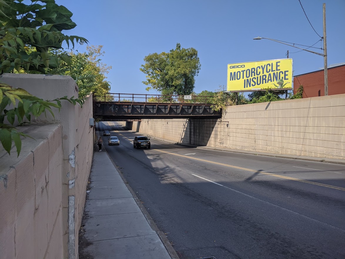
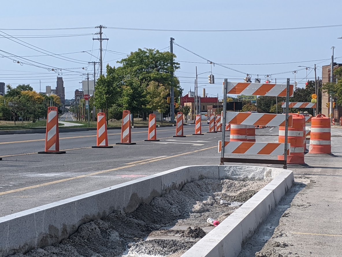
Take Geddes Street. It ranges between 40 and 55 feet wide. Certain sections could easily accommodate the highly protected infrastructure that would be necessary to make that street safe for biking, but other areas—particularly the wildly dangerous section that dips beneath the train tracks—could not. Good bike infrastructure won’t fit, and slim painted lanes would be insufficient, so City Hall should look for a parallel path for bike riders to use.
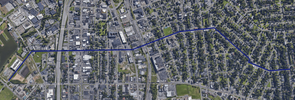
Right now, there is no one unbroken path that fits the bill, but there could be if City Hall negotiated for an easement between West Fayette and West Erie to connect Van Rensselaer and Oswego Streets. That would create a clear path along low-traffic streets from Strathmore all the way to the Inner Harbor. Add a few bits of bike infrastructure, and Syracuse would have a very good, very useful neighborhood greenway connecting several neighborhoods on the Westside.
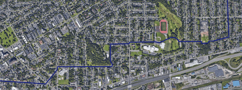
Or look at Eastwood. The three streets that lead to it—Grant, James, and Burnet—are too dangerous for comfortable biking, and there’s no other obvious way to get across Teall Avenue and into or out of the neighborhood.
Connect a couple of minor streets, and it’s easy. City Hall should ensure bike movement through the East Woods Skate Plaza to connect two stretches of Caleb Avenue, and they should do the same through Sunnycrest Park to connect Caleb to Robinson Street. Bike riders could then cross Teall Avenue at Robinson’s signalized intersection, and they would be able to take the tough climb into Eastwood on relatively low-traffic Hawley Avenue.
Syracuse relies on a few major streets to handle all crosstown traffic. That makes it hard to bike in this town, because most people don’t want to ride beside all those cars. Forge a few missing links, and City Hall could build a high-quality, low-stress, crosstown bike network that would allow people to bike around the City in peace and comfort.
