
NYSDOT’s new I81 project report lays out a good framework to undo the damage that car-only transportation planning has done to Syracuse. But although the overall vision of the Grid is good, NYSDOT needs to change some significant details of the Grid’s design in order for this project to be as effective as possible.
When you get into the nitty gritty of the design drawings, there are some troubling details. The National Association of City Transportation Officials (NACTO) says that travel lanes on city streets should be 10’ wide—maybe 11’ if it’s a major trucking or transit route — but NYSDOT plans to build Almond Street with four 12’ wide travel lanes. That’s the standard for highways, and it’s the same lane width that NYSDOT plans to use for the grade-separated portions of 81.
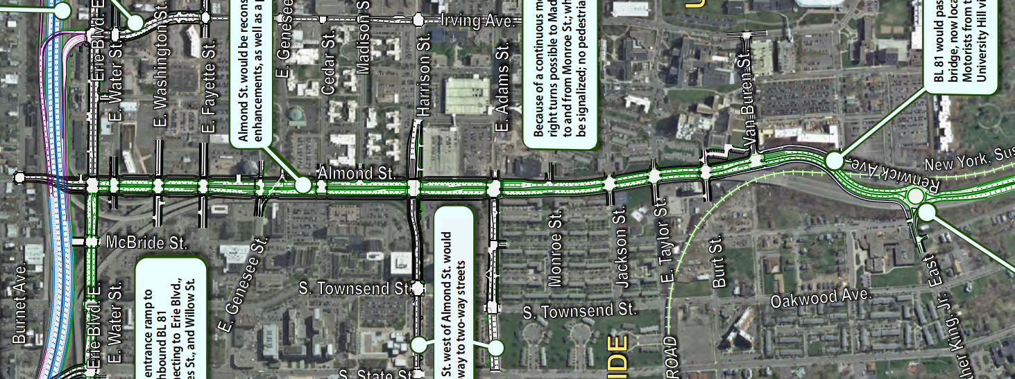
NACTO also says that curb radii—a measure of how sharply a car has to turn at an intersection and a key determinant of pedestrian safety—should be no more than 15’ in order to make crosswalks safe for people on foot. NYSDOT plans for 15’ curb radii on many local streets, but on Almond most intersections will have curb radii of between 20’ and 35’, and the intersection of Almond and Erie Boulevard will have a mammoth 65’ curb radius.
NYSDOT also intends to speed traffic on Almond by leaving out crosswalks for existing intersecting streets. People on foot and bike won’t be able to cross Almond Street at either Madison or Monroe Streets even though NYCLU specifically called for a crosswalk at Monroe, and even though Madison is a prime candidate for a neighborhood greenway connecting Downtown, University Hill, and Westcott.
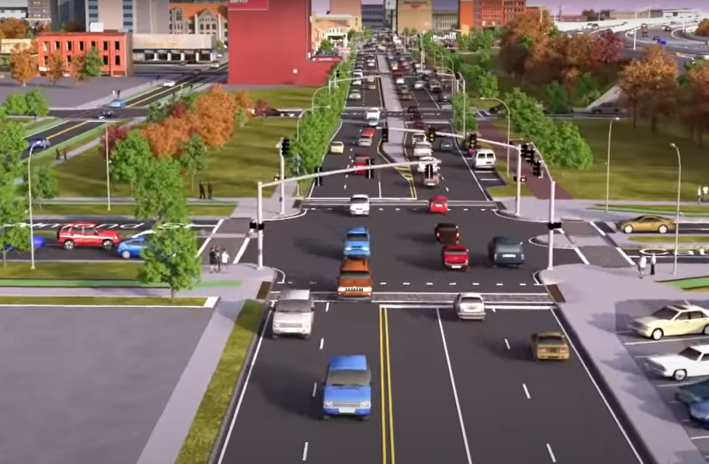
rendering 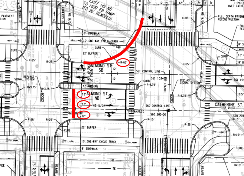
reality
These are design standards for moving cars at very high speeds with little consideration for people who might travel the street by foot or bike. In fact, NYSDOT predicts that Level of Service—“a qualitative measure used to describe the experience of a user on an urban street segment”—will be significantly worse for pedestrians and bicyclists than it will for car drivers. Levels of Service for cars on Almond Street range between grades of A, B, and C, while people using the sidewalks and bike lanes get service grades of C and D.
NYSDOT also predicts that their design could actually increase the number of cars on local streets by bringing more interstate through-traffic into Downtown:
“Businesses on BL 81 south of I-690 would experience an increase in pass-by potential customers, which could marginally benefit sales. Furthermore, the business loop designation may attract through travelers on I-81 looking for convenience retail and restaurant uses.”
NYSDOT helpfully lists the types of businesses that would likely benefit from this added traffic and might want to set up shop along Almond Street: “gas stations, convenience stores, and fast food.”

The design standards NYSDOT is proposing—12’ lanes, large curb radii, and limited access from local streets—are identical to those that define the West Street arterial between Fayette and Onondaga Streets. That hostile highway is a significant barrier between Downtown and the Near Westside, and we shouldn’t be replicating its failure along Almond Street.
It’s possible to make a very wide street that actually fits in a city and knits neighborhoods together, one that’s pleasant to walk or bike along, one that will support small-scale retail and attract quality housing.
Eastern Parkway in Brooklyn, for instance, is a really nice street even though it carries three lanes of traffic in each direction. It’s lined by apartment blocks and businesses that cater to the neighborhood—not interstate through traffic. Crucially, Eastern Parkway has narrow travel lanes (10’), many intersections, and sharp corners at those intersections to encourage drivers to slow down when they turn through the many crosswalks.
This is the kind of street we should be building in the center of Syracuse—not another grade-level high-speed arterial. NYSDOT is accepting comments on their most recent design. Let them know.
