
Central New York’s highways remade the geography of where people live in Onondaga County. A new dataset makes it possible to track change in the number of housing units in each of the County’s census tracks from 1940-2019. These numbers show heavy housing losses in the few highway-adjacent neighborhoods that had lots of housing in 1940, and they also show thinly spread housing construction in previously rural census tracts now served by the highways.
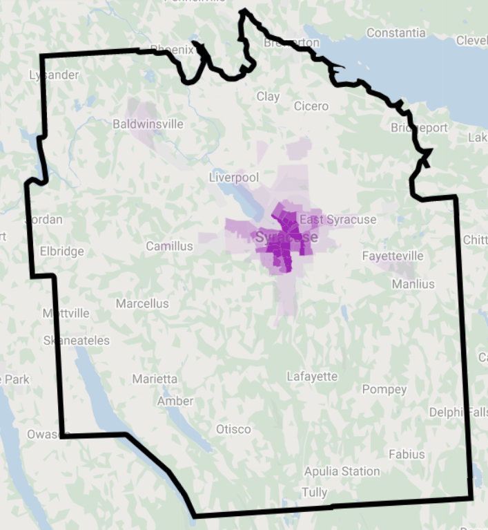


The maps above show housing units per square mile by census tract in Onondaga County and the City of Syracuse in 1940. Housing was highly concentrated in the center of the County. There were some suburban pockets of moderate density in villages like Baldwinsville, Fayetteville, and North Syracuse—and also in some early inner ring suburbs like Mattydale and Westvale—but the vast majority of the County’s land was rural, and most of its people lived in city neighborhoods at the County’s center.


By 2019 that sharp division between city and rural had blurred. Suburban subdivisions sprawled out from Syracuse and covered the northern half of Onondaga County with tract developments that are much denser than the countryside but nowhere near as tight-knit as traditional City neighborhoods. This new kind of in-between neighborhood now accounts for the vast majority of Onondaga County’s urbanized area.

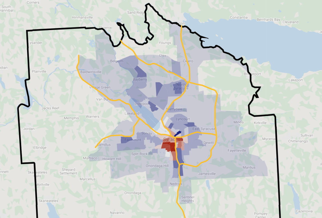

The highways caused these changes. These maps show the change in housing unit density between 1940 and 2019. Tracts shaded blue saw a net increase in the number of housing units, tracts shaded red lost housing. The yellow lines trace Onondaga County’s limited-access freeways.
Housing growth followed the freeways out of Syracuse and into the suburbs. In general, rural areas where highways were built transformed to sprawl while rural areas without highways remained rural. City neighborhoods immediately adjacent to the highways lost housing through urban renewal and targeted disinvestment, while neighborhoods away from highways gained housing.
For eighty years, the highways drove sprawl towards the County’s edges. Today, the northern and eastern suburbs have just about passed over into Oswego and Madison Counties. If this sprawl continues, it will leave Onondaga County with huge infrastructure maintenance bills, and little tax base to pay them. The County’s biggest challenge in the 21st century is figuring out how to grow without sprawling ever outward.
Removing the City’s highways is a good first step. They left a gaping hole in the County’s center and decimated neighborhoods that were built to accommodate growing communities through the 19th and early 20th centuries. Once the highways are gone, those same city center neighborhoods will provide better homes for our growing community today.
