Syracuse can be a hard place to navigate. The City is big, it’s streets intersect at weird angles, and it’s just very easy to get turned around and lost. In a place like this, it’s helpful to have a way of simplifying things—some mental tool that makes the City understandable and makes people feel comfortable and in control as they move around within it. BRT can provide Syracuse with just such a tool—the network diagram.
The highways already do this for car drivers. There are people who understand the City entirely in terms of highway exits. Name any spot, and they can tell you how to get there from the nearest exit. Ask for directions to any location, and they’ll tell you how to get from where you are to the nearest onramp, how to take the highway from there to the appropriate exit, and then how to get from that exit to wherever you’re going. It may not be the shortest or fastest route, but for someone who understands the City through the highways it will be the most intelligible route.
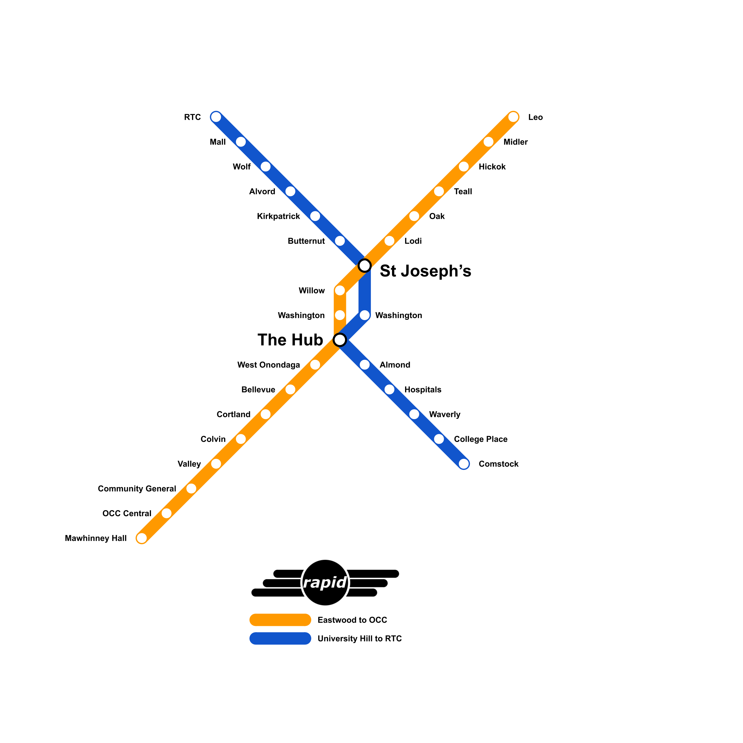
BRT could give us a similar simplifying diagram based on high frequency transit routes. Here’s an idea of how it could look:
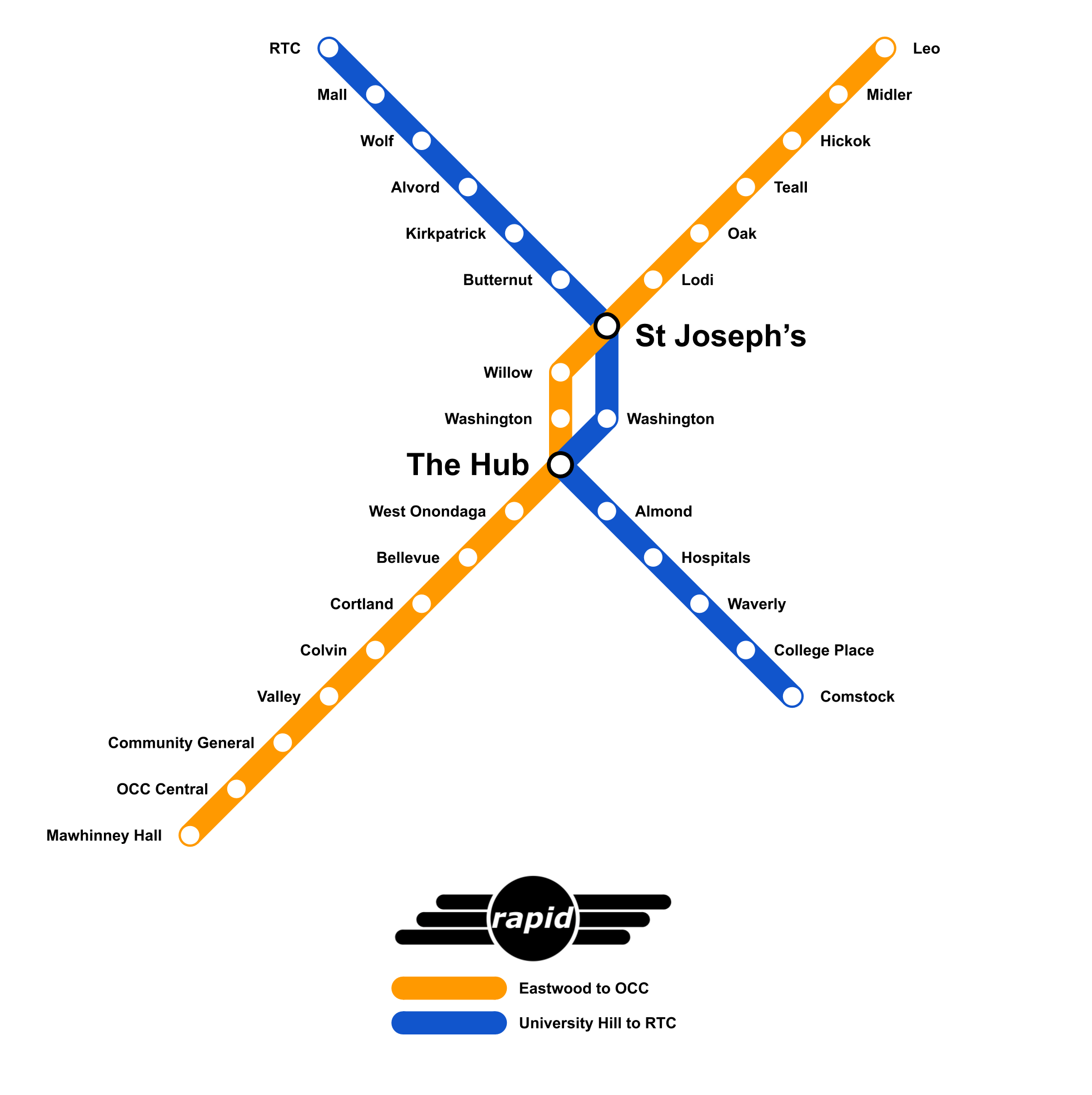
It’s not actually so simple to get from the RTC to SU as this diagram suggests—the bus operator is going to have to make more than three turns—but from the perspective of a passenger on the Blue Line, it’s as easy as boarding and exiting the bus at the correct station stops.
If these transit lines are useful enough that people can ride them as their primary mode of transportation in the City, then knowing your way around town is as easy as remembering the relationships between the network’s different station stops. How to get from Eastwood to Crouse Hospital? Just catch an OCC-bound Orange bus, transfer to an SU-bound Blue bus at either St. Joseph’s or the Hub, and get off at the Hospitals station stop. This simple diagram becomes a key to understanding the City as a whole.
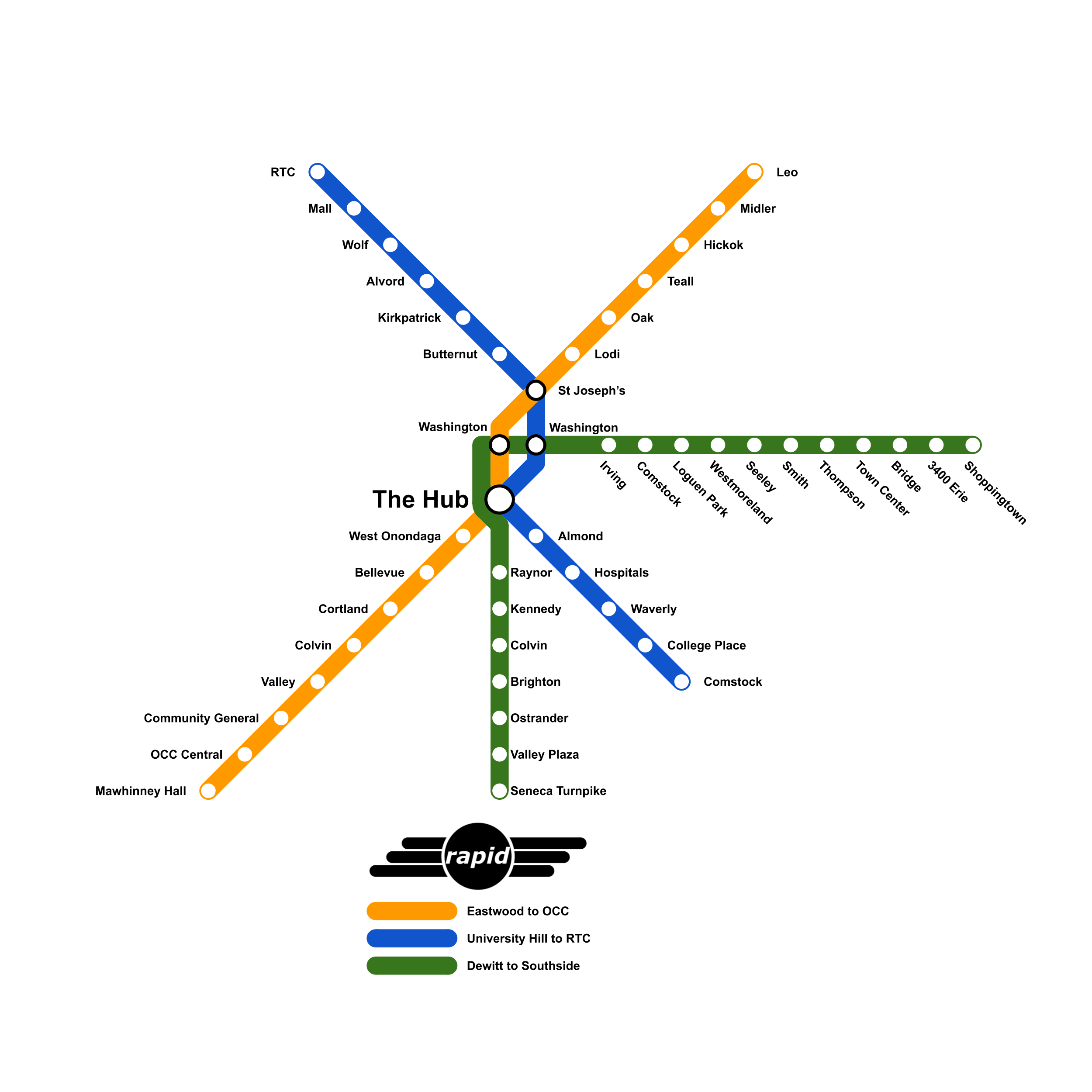
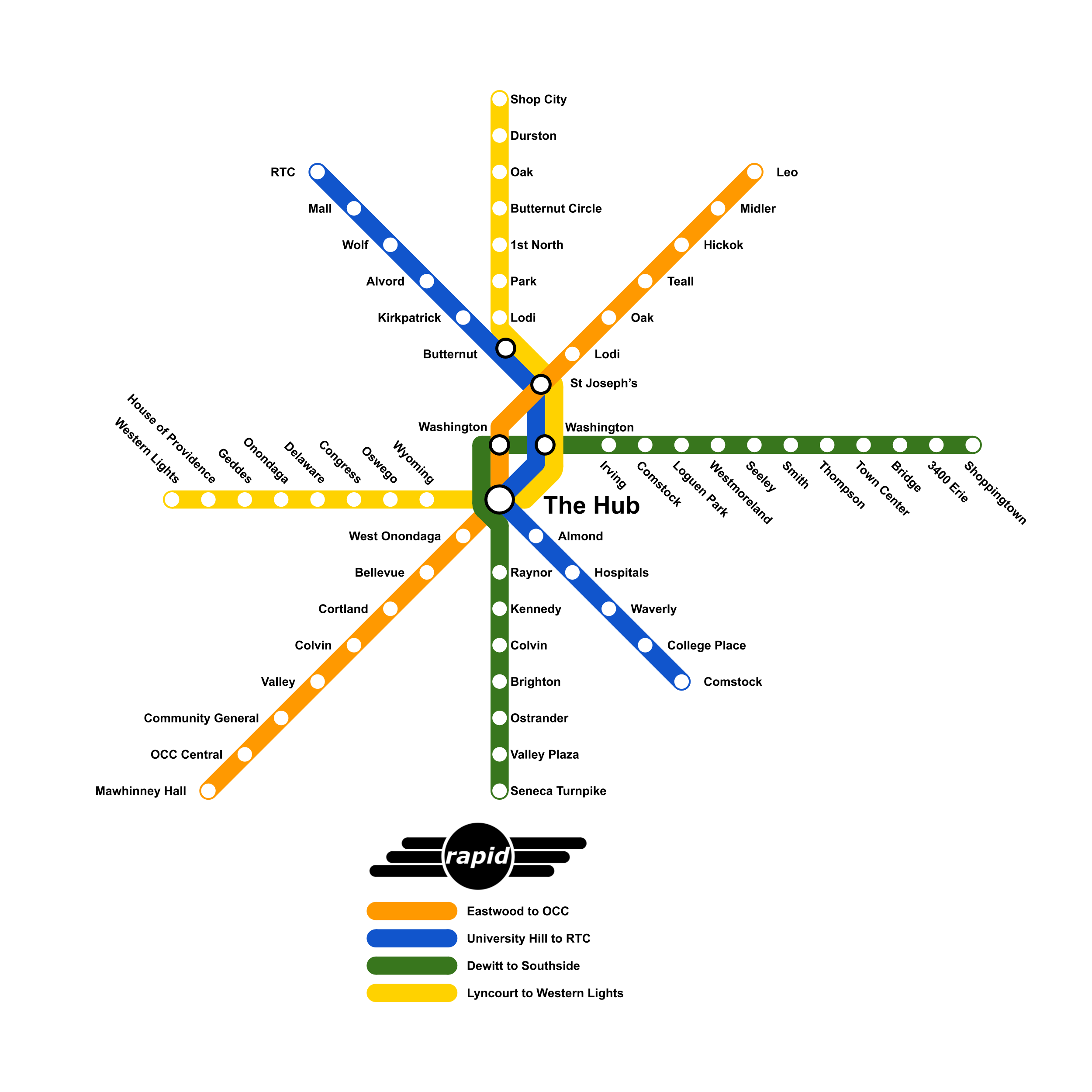
And after these two first lines prove their worth, Centro should extend BRT to more of the City, running new lines to different neighborhoods, making more of the City accessible and intelligible to people through public transit.