All posts by inthesaltcity

I81’s Environmental Impact

Last week, Onondaga’s Town Supervisors—a group of people without any governmental responsibility for the City—got together to again let everybody know that they would like for I81 to stay in the middle of Syracuse. They want that, in part, because they’re concerned about the ‘environmental impacts of removing the I81 viaduct.

On the face of it, that’s a stupid concern. The environment will be better off with one fewer piece of obsolete, overbuilt, car-only transportation infrastructure. Get rid of the viaduct, and there’s room for new housing within walking distance of major employers, making it more possible for more people to drive less.

But those supervisors were never really concerned about the environment. They’re concerned about upending the status quo where all of the County’s environmental problems get dumped in the City. Ed Michalenko doesn’t care that vehicular exhaust is giving kids asthma so long as those kids don’t live in DeWitt. Jim Lanning doesn’t care that trucks are driving through Onondaga County so long as they go through Syracuse instead of Skaneateles.

That’s the danger of shoving all of the County’s problems onto one communityit lets these suburban supervisors believe that if a problem doesn’t exist for them, then it doesn’t exist at all. It’s telling that their ‘compromise‘ for I81  is to bury it through the middle of Syracuse, as if putting those cars out of sight is the same thing as taking them off the road.

The only way that this project will do anything positive for the environment is if it makes Onondaga County into a place where fewer people have to drive to run every single errand. That’s the promise of the Grid—more walkable neighborhoods that can support better bus service, fewer miles of highway subsidizing and necessitating car ownership. That’s an environmental impact to be excited about, and by making car ownership less necessary in Onondaga County, it might just reduce the traffic in places like Skaneateles and DeWitt.

The Green New Deal, Housing, and Transportation in Onondaga County

Congress is full of new members talking about a Green New Deal—a “broad and ambitious package of new policies and investments in communities, infrastructure, and technology to help the United States achieve environmental sustainability and economic stability.” The ideas for those new policies include regulations on carbon emissions, subsidies for alternative energy, and wetland reclamation. Less has been said about the relationship between housing and transportation, but Onondaga County’s experience shows that the Green New Deal needs to focus on that link in order to grow environmentally sustainable communities.

For 70 years, almost all new settlement in Onondaga County has contributed to global climate change. New housing has been built on former farms, it has been built too far away from jobs and schools for people to meet their daily needs on foot, and it has been built with big yards and cul-de-sacs that make public transportation ineffective and inefficient.

At the same time, people have been leaving Onondaga County’s older settlements—its City and its villages—where it was possible to live without a car. Syracuse, Liverpool, Solvay, and East Syracuse have all lost about ⅓ of their population since the 1950s and 1960s. That depopulation has drawn jobs and schools out of those older communities, it has made it more difficult for the people who remain to meet their daily needs on foot, and it has made established bus and train routes less effective and less efficient.

The result has been that many families living in Onondaga County can’t live their daily lives without the help of cars, and they drive those cars to run every single errand, attend every single church service, and visit every single friend. This is a terrible result for the environment.

It’s also reversible. In fact, the City’s Land Use and Development Plan anticipates that Syracuse’s neighborhoods will see exactly the kind of population growth that would allow Onondaga County residents to drive less often and burn less carbon:

“Several of Syracuse’s neighborhoods have borne the brunt of population loss and economic decline as regional population has shifted dramatically toward the suburbs since the 1960s. Despite this, Syracuse is uniquely positioned within the Central New York region in light of increased national and statewide focus on Smart Growth and widely renewed interest in urban living. The City of Syracuse possesses a concentration of interesting historic architecture, which dates from periods of dense urban settlement and is arranged in walkable neighborhoods. Many neighborhoods which currently possess high vacancy rates are poised to accept population growth, particularly among young professionals and families who desire a traditional urban environment and who may take advantage of Syracuse’s affordable historic housing stock and walkable, urban neighborhoods. Commercial corridors with low levels of activity and density today are dispersed through Syracuse’s neighborhoods in a connective, multi-nodal network which, when better utilized, are suited to provide centers of activity within walking distance of homes and support efficient mass transit.”

The document refers to the City specifically, but what it says is true of Onondaga County’s villages too. They all have relatively affordable houses. They all have neighborhoods where people can meet their daily needs on foot. They all have better bus service than their surrounding suburbs. They are all places where people can live more environmentally sustainable lives free from cars.

Affordability and sustainability sometimes work against each other, though. If a house is too cheap, then it’s difficult to get ahold of the money necessary to make major repairs. Banks won’t lend out the money to replace the roof on a house that isn’t even worth enough to be collateral for the loan. That situation—which exists in so many of the neighborhoods where the houses need new roofs but the residents don’t need cars—makes it financially impossible for many people to move into the communities where they can live environmentally sustainably.

The Green New Deal can remove this financial barrier by awarding grants for the renovation and/or construction of housing in neighborhoods where people can live without a car.

There are challenges to writing that kind of a policy well. To be effective, it will have to actually determine which communities offer the chance to live without a car—a determination that Syracuse’s City Hall has struggled to make as it rewrites the City’s zoning ordinance. To be efficient, the policy should limit its grants to those projects that wouldn’t happen without government subsidy—a limitation that both SIDA and OCIDA routinely ignore.

The effort of overcoming those challenges is worth the reward of creating a climate policy that makes it possible for people to live in communities where daily life burns less carbon—communities where people can walk to meet their daily needs, where Centro can provide quality bus service—communities like Syracuse, Liverpool, Solvay, and East Syracuse. That’s a policy that recognizes the link between housing and sustainable transportation, that addresses the difficulties of creating more of both, and it is exactly the kind of thing that needs to be a part of the Green New Deal.

Flexibility is Adaptability is Resiliency

I used to rent a one-bedroom apartment on the back end of a building on the City’s Northside. The building had been a standard Syracuse double-decker—two identical three-bedroom apartments stacked one on top of the other—but at some point the owner split the second floor into two one-bedroom apartments. That was good for me because it meant there was a one-bedroom apartment that I could afford, and it was good for the landlord because the combined rent from those two second floor one-bedroom apartments was $980 a month—significantly more than the $750 a month that the three-bedroom apartment on the first floor brought in.

Small modifications like this one—putting up a wall and building a new kitchen and bathroom to convert a two-family building into a three-family building—make Syracuse resilient. The City is full of old buildings that have been modified over the years to better meet the needs of a changing population, and you’re most likely to find them in the neighborhoods that are most diverse and that provide people with the greatest variety of opportunity.

It’s a problem, then, that City Hall’s new zoning ordinance would make that kind of responsive modification largely illegal in so many of the neighborhoods where it’s most useful.

ReZone divides all residential buildings into 1 of 3 categories: one-family, two-family, or multi-family. That double-decker apartment I lived in would have originally been considered a two-family home, but now with its three apartments, City Hall will call it a multi-family home. ReZone allows two-family homes in all of Syracuse’s inner neighborhoods, but it bans multi-family housing from almost all of Tipperary Hill, the Southside, Westcott, Skunk City, and the Northside. That ban restricts people’s ability to modify their properties in the small ways that will make those neighborhoods able to cope with change.

City Hall needs to amend its draft zoning ordinance to accommodate a greater variety of housing types. The could mean adding more categories to its list of residential uses (three-family, four-family, five-family, etc.), it could mean expanding the two-family category to include other small-scale apartment buildings with more than two units (up to six, say), or it could mean getting rid of the two-family category entirely to allow all kinds of multi-family housing in every neighborhoods except those quasi-suburban spots like Meadowbrook and the Valley.

Syracuse’s strength is its flexibility. The City’s been around for about 200 years now, and the people who call it home have adapted to huge economic, demographic, and technological changes in that time. Left to their own devices, city residents will keep on doing the little things—like converting a two-family home into a 3-family home—that will keep the City responsive to the needs of the day, but those kinds of modifications will only be possible if City Hall relaxes its planned restrictions on multi-family housing. Do that, and Syracuse might just make it another 200 years.

Two Views of Syracuse’s Future

2019 will see two policy announcements that will shape Syracuse for decades to come. New York State plans to let us all know what it’ll do to replace I81’s downtown viaduct, and Syracuse City Hall plans to adopt its first new zoning ordinance since 1922. With each of these the community has the choice to make a big change or to keep things the same as they are now, and its decisions will reveal whether or not Syracuse believes in its own future.


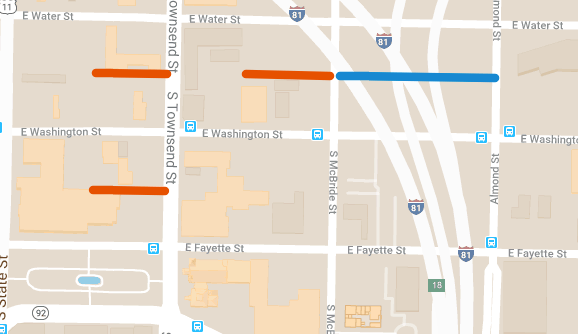
Take I81. NYSDOT is going to demolish the downtown viaduct and uncover a lot of land in the city center, and a lot of people see the potential for something transformational to fill in that space. Here’s just one possibility, described by the Gifford Foundation:

“[The Community Grid plan is] the best opportunity for reclaiming the geography presently occupied by I-81 as a transformational neighborhood with mixed-income housing, extraordinary schools, and facilities, programs, and services that honor the rich history of the community, reflect priorities of those who live there”

That’s a vision of a better future–for a Syracuse that’s an inclusive empowering city–and that vision drives the Gifford Foundations decision to endorse NYSDOT’s plan to move the highway out of Downtown.

Contrast that with State Senator Bob Antonacci’s argument that Syracuse has nothing to gain by removing all those off and on ramps from the middle of town:

“The theory goes that tearing down I-81 through downtown Syracuse will unlock a dormant potential and uniting downtown with the University Hill neighborhood. I personally am skeptical of this. A previous attempt, the Connective Corridor, at uniting those two areas was described as having brought crime into the university and surrounding neighborhoods.”

He doesn’t think any significant positive change can come from getting the highway out of Downtown and that unless we all realize this, then “the 81 debate will end in a zero-sum game where a significant portion of the community will feel they lost.” The best result that Antonacci can imagine is to maintain the status quo.


It’s the same with the new zoning ordinance. At the beginning of the ReZone project, City Hall published the Land Use and Development Plan. That document sees Syracuse as the region’s future:

“Syracuse is uniquely positioned within the Central New York region in light of increased national and statewide focus on Smart Growth and widely renewed interest in urban living…. Many neighborhoods which currently possess high vacancy rates are poised to accept population growth, particularly among young professionals and families who desire a traditional urban environment and who may take advantage of Syracuse’s affordable historic housing stock and walkable, urban neighborhoods… over the long-term the City may market its ability to cost-effectively absorb regional population growth—based on existing infrastructure and an urban land-use pattern that lends itself to walkable neighborhoods, local commercial and business services, and efficient transit service.”

This Syracuse is a place where people want to live, a place that can welcome those people, and a place that will be better off for having done so. That vision informs the Land Use and Development Plan’s prescriptions for more housing, more housing options, better bus service, more opportunities for small businesses, and neighborhoods where people can meet all of their needs easily.

Contrast that with how Owen Kearney, a city planner, described the project to Grant Reeher on WAER:

“We’re really a city of residential neighborhoods with neighborhood business districts and Downtown. And kind of thinking of those three elements: that Downtown core, our neighborhood business districts, and essentially the neighborhoods surround them, and continuing to protect all three of them and enhance all three of them through our land-use regulations, which is what zoning are, but to allow new uses in those neighborhood business districts, at the same time protecting those residential areas”

His focus is on protection and stasis. This explains all of the changes that City Hall has made to the draft zoning ordinance since the first draft–rolling back housing opportunity, restoring old parking regulations that penalize bus-riders, keeping it difficult for new people to move into stable neighborhoods. Those changes all ‘protect’ the status quo by limiting the City’s ability to welcome new people.


Where the Gifford Foundation sees the potential for connected neighborhoods that empower their residents, Antonacci can only see traffic and crime. Where City Hall once saw the possibility of new housing mixed with new businesses so that lots of people could walk to the grocery store, the current administration can now only see problem corner stores and absentee landlords.

With I81 and with ReZone, that reflexive urge to keep things the way they are–to ‘protect’ them–comes from a fear of the future. When you can only imagine change for the worse, it makes sense to hold onto the present. In that case, Syracuse’s best hope is to slow its inevitable and irreversible decline.

The City deserves better than that. A better future is possible, Syracuse can be a better place to live, big changes can leave us better off. It’s only possible, though, if the people with the power to effect those changes can imagine that better future. Let them know. Call City Hall, call your state reps, call the Governor, and tell them that you know Syracuse can make a better future, and you want their help to make it happen.

Cooperation over Competition

When Syracuse takes notice of its neighboring upstate urban communities, it’s usually to see how we measure up. That’s the impulse behind City Hall’s decision to compare Syracuse to Albany, Buffalo, and Rochester in its recent report on poverty, and it’s the impulse that drove the CNY Business Journal to run a story about State economic development grants under this headline: “CNY Wins $88 Million Award in State REDC Competition, The Most of Any Region.”

Too often those comparisons about trying to outdo each other. That preening Business Journal headline is about the money that Governor Andrew Cuomo is giving to CNY instead of WNY. We’re on top now so we’re happy with the process, but things were different in 2014 when Syracuse luminaries like David Rubin were harumphing about how the Governor had lavished attention on Albany and Buffalo while ignoring Syracuse.

It’s no mistake that State economic development causes this kind of backbiting. The Governor knows that so long as his ersatz competitions are the easiest way to get some of the State’s largesse, Upstate’s cash-strapped cities will focus more on beating each other out to win those competitions than they will on working together to change the structural causes of their dependency.

It’s time to try something different. The reason that Syracuse’s City Hall can easily compare itself to Albany, Rochester, and Buffalo is that all four cities have the same problems. They’re all post-industrial and shrinking, they’re all trying to run their governments on insufficient property taxes, they’re patching holes in their antiquated sewer systems. It’s time to recognize that these are problems best solved through cooperation rather than competition.

That cooperation can take many forms. First, upstate mayors should all meet together with the State and Federal politicians who represent their constituents and agree to advocate for policies that will meet all their cities’ specific needs. That’s how New York State’s Land Bank legislation came about. There are plenty of other policies that would benefit all upstate cities, from better funding for transit Upstate, to amendments to the New York’s home-rule legislation. Coordinated lobbying will help Upstate’s cities push those policies through the legislature.

Second, upstate cities can also work together on regional projects that better integrate their economies. The State’s Regional Economic Development Councils encourage that kind of integration within a metropolitan region, but upstate cities should look beyond their immediate suburbs to partner with each other. Better transportation links between cities–whether that’s lower Thruway tolls or better train service–would make Upstate more attractive to big businesses looking to employ lots of people, and they would make it easier for small businesses to expand into new markets.

Third, upstate cities can share ideas to deal with their common problems and to act on their common opportunities. Syracuse studied Rochester before coming up with a plan to remove snow from its sidewalks. Buffalo’s Canalside is a good example for any city that regrets having paved over the Erie Canal. Utica is showing how upstate cities can take advantage of Amtrak. Syracuse, Rochester, and Ithaca can all look to each other when trying to figure out how to make a huge private university an asset to everyone who lives in the city.

Cooperating like this isn’t easy. It takes commitment, vision, and solidarity–rare qualities in New York’s political class. But people living in Upstate’s cities–from Troy to Tonawanda–can lay the foundation by visiting each other, recognizing our common interests, and learning to see ourselves as a community.

ReZone’s Rules for Rowhouses

Rowhouses combine many of the benefits of both single-family and multi-family housing. They all have first floors at ground level, so everybody gets a front stoop and a backyard, and the houses don’t take up much space, so many families can live within walking distance of schools, shops, and bus stops.

But not all rowhouses are created equal. These, on the corner of Lodi and Gertrude, are all on their own individual lots. Even though they’re connected, each house is a separate building, meaning that each one is an opportunity for someone to become a homeowner. That’s the opportunity to build equity, accrue wealth, achieve stability.

Screen Shot 2018-12-17 at 6.58.51 AM

There are more rowhouses the next block down on Lodi. These are really just one big apartment building on a single lot. It’s owned by just one person, so fewer people have the opportunity to secure the many benefits of homeownership.

Screen Shot 2018-12-17 at 7.00.39 AM

That’s a big difference, but it’s one that City Hall’s new draft zoning ordinance doesn’t recognize. Here’s all that the draft has to say about rowhouses:

“[Dwelling, Multi-Family] includes both stacked and side-by-side units. The current Syracuse ordinance includes some references to “townhouses” in some districts as distinct from “apartments.” In some communities, we include a use type called “single-family attached”; however, staff prefers not to introduce that term in Syracuse and to use instead a broad definition of “dwelling, multi-family.”
pg 233

So are rowhouses single-family or multi-family? Can somebody buy a single rowhouse, or do they have to buy a whole set at once? Is this different from building multiple single-family houses with party walls on narrow lots as is allowable in zoning district MX-5, but nowhere else? Do the ordinance’s minimum lot dimensions for multi-family housing apply to a single house in the row, or the row in its entirety? Are rowhouses allowed in zoning district R-2 where the ordinance bans ‘multi-family housing’ but allows ‘2-family housing’? There aren’t obvious answers to any of those questions in the ordinance as it’s currently written.

Rowhouses can have an important place in Syracuse’s future. They create more opportunities for people to own a home that’s within easy walking distance of daily needs. Building more of them would bring more of those opportunities into the City’s existing neighborhoods, and they’re a good option for building entirely new neighborhoods at the Inner Harbor and the Almond Street area.

Before that can happen, though, City Hall needs to amend its new zoning ordinance to clarify its rules for rowhouses. It should make it clear that rowhouses are a type of single-family housing, that they’re allowed in all zoning districts, and that they can be bought and sold individually. Simple changes that will make for a better Syracuse.

Redlining by Another Name

Syracuse doesn’t have hurricanes, tornadoes, or wildfires, but FEMA still exerts a lot of influence over city residents’ lives. That agency maps the City’s floodplains, determining which people need to buy flood insurance under certain circumstances. Whenever FEMA amends the map–putting that financial burden on new people–it always makes the news.

But those marginal adjustments aren’t the real story. The real story is that FEMA’s flood maps are one of a set of ‘color-blind’ government policies that work in concert to recreate the 20th century’s racist housing practices, all on the pretense that it’s required by Syracuse’s geography.


GEOGRAPHY

There are two major streams in Syracuse: Onondaga Creek and Meadowbrook. Onondaga Creek’s floodplain gets a lot more attention because it’s bigger and covers many more houses than Meadowbrook’s does.


It’s tempting to say that this is just natural–the unplanned result of the different topography around each stream–but neither stream is in its ‘natural’ state. Both have been channelized in order to make their banks easier to build on and in order to keep them from flooding. It’s just that the engineers did a better job on one of those streams than they did on the other.


MORTGAGES

FEMA doesn’t require flood insurance for every house in its floodplains. That requirement only comes into effect if someone has, or applies for, a loan. Buy the flood insurance, and there’s no problem getting a loan, but, as Chris Baker reported, many people can’t afford monthly payments for both flood insurance and a loan.

This means that people living in a FEMA floodplain have limited access to credit. On the one hand that makes it difficult for someone who already owns a home to leverage that asset–one of the chief benefits of home-ownership. On the other, it keeps a lot of people from buying a home in the first place.


ZONING

On some level, the extra cost of flood insurance should discourage people from trying to buy a home in a floodplain. Houses that flood aren’t a good investment anyway. Better for people to move somewhere, like Meadowbrook, that’s safe from flooding.

City Hall’s zoning maps restrict that kind of movement, though. The land around Meadowbrook has very large lots–often 4 times the size of the lots around Onondaga Creek–but it’s zoned so that there can only be one unit of housing on each lot. This restricts housing supply and inflates housing prices.


If ever there were a place to restrict housing supply, it’s on Onondaga Creek’s floodplain. That area, though, has very loose zoning restrictions, allowing for some of the densest residential development in the City. All that abundant housing ends up being pretty cheap.

The net effect is to push people away from the safe area around Meadowbrook and onto Onondaga Creek’s floodplain.


RACE

It just so happens that the neighborhood that floods, where it’s expensive to get a loan but cheap to live, where people can’t accumulate wealth, is a neighborhood that’s overwhelming populated by African-Americans (green on the map). The neighborhood with good flood control, where credit’s easy, and where people enjoy all the benefits that accrue to American homeowners is populated by Caucasians (blue on the map).


Who would have guessed?


REDLINING REDUX

When redlining was federal policy, nobody cared to disguise its racism. One factor in drawing red lines on the FHA’s Security Maps was the presence of “Negroes.” People were open, then, about making access to home ownership dependent on race.

That kind of honesty doesn’t fly today. Race can’t be an explicit reason for giving someone a loan or letting someone move into a neighborhood. Now FHA-backed loans are dependent on ‘color-blind’ criteria like whether or not the loan in question will be used for a house near a stream that floods.

But the streams that flood–in Syracuse anyway–seem to be the ones in Black neighborhoods. White neighborhoods, even the ones with streams, stay dry, and they stay homogenous because the zoning ordinance inflates their housing prices and makes it difficult for new people to move in.

It’s in City Hall’s power to unmake this racist housing policy. First, it can reduce flooding along Onondaga Creek by building a levy. That will shrink the floodplain on FEMA’s maps and expand access to credit for the people living in that part of the City. City Hall can do this as part of Phase II of the Creekwalk–the long-promised extension of the City’s best new public space into the Southside.

Second, City Hall can redraw the zoning maps to allow more housing in the neighborhoods where banks are already willing to make loans. That will allow more people to move into a good neighborhood where they’ll have access to the benefits that come from owning a home.

A Parkway not a Freeway

Last week another truck crashed into the train bridge over Onondaga Lake Parkway. It wasn’t the first time, and it won’t be the last. No matter how many flashing warning signs they put up about that being a low bridge, drivers keep using that road, and all those crashes are symptoms of a bigger problem: the Parkway is a freeway where a freeway shouldn’t be.

The part of Onondaga Lake Park that runs along either side of the Parkway is a place where people want to be. There are weddings at the Butterfly Garden, people fishing off the stone bridge, and our history is on display at the Gale Salt Spring, the LeMoyne Well, and the Skä•noñh Center.

Those places are all worse for being right next to a freeway. What’s a wedding like with cars screaming by at 55 mph in the background? It’s amazing that people go to any of those spots the with the Parkway how it is now.

It’s also an issue of access. Syracuse is on Onondaga Lake, but somehow there’s no sane way for a person to get from the City to Onondaga Lake Park without a vehicle. That’s because the one connection between the two places is taken up entirely by a freeway. People should be able to walk or bike from the City to that park, and calling the shoulder of a freeway a ‘bike lane’ isn’t good enough.

There have been plans to fix this problem for a long time. People have talked about eliminating tolls on the Thruway to try and get commuters to use I81 instead, and they’ve talked about moving the Liverpool Post Office to sit in the middle of the Parkway so people don’t think to use the road. Both of those ideas required multiple levels of government to cooperate on a complex solution, and neither of them ever came about.

Why not try something simpler? There are only 2 miles of Parkway where cars are allowed to go 55 mph.

ononlakepkwy

Those are the only 2 miles of road where drivers go so fast that they need extra wide lanes and a rumble strip to keep them safe from themselves. Reduce the speed limit on those 2 miles of road the 30 mph, and it’d be simple to narrow the lanes (or remove them) and use the extra space for a biking/walking path from the City to the rest of the park.

.   .   .

Onondaga Lake Park is Onondaga County’s “Central Park.” It’s a symbol of the switch from the destructive economy and mindset of the past to a new appreciation for the environment and a new focus on people’s quality of life. The Parkway is a vestige of that destructive past and mindset–a 4-lane freeway running through the middle of the park, cutting off access for the County’s poorest. A simple change–reducing the speed limit for 2 miles and repainting the lanes–would fix those problems. As an added bonus, it’d keep tractor trailers from running into the train bridge too.

Alleys for Neighborhoods

Bank Alley is different from a lot of the other streets Downtown. It’s not like Salina or Fayette–wide streets that are good for getting across town–and it’s not like Clinton or Adams–one-way racetracks for cars getting to or from the elevated highways. It’s short and narrow and a lot calmer than the rest of the neighborhood.

That difference makes it possible for different people to make different uses of all the buildings with entrances on both Salina and Bank Alley. Retailers on the first floor of those buildings face Salina because that’s where so many potential customers are walking by, but renters living on the top floors enter those buildings from Bank Alley because it’s more private.

A good mix of different kinds of streets and buildings makes for a neighborhood where different kinds of people can make a life. That’s a neighborhood where grocery stores can sit near houses, churches near shops, and community centers near schools. That’s a neighborhood where the variety of people and activities mean that any single person can meet their daily needs easily.

That’s the kind of neighborhood that the Gifford Foundation was talking about when it wrote that the I81 project will be:

“the best opportunity for reclaiming the geography presently occupied by I-81 as a transformational neighborhood with mixed-income housing, extraordinary schools, and facilities, programs, and services that honor the rich history of the community, reflect priorities of those who live there”

So it’s a good thing that the area around the viaduct already has so many alleys. Landmark, Block, and Grape Alleys (shown in orange) cut through the blocks just west of the viaduct.

Screen Shot 2018-11-26 at 6.16.35 AM

Right now those alleys aren’t doing much for anyone because they’re surrounded by empty lots, but that will change once the viaduct comes down. Earlier in November, the AIA predicted that this part of town will see a lot of new construction in the next few years. When that happens, the buildings that go up and the people who use them will benefit from the alleys that are already there.

The I81 project also provides the opportunity to reopen an alley that hasn’t existed since the viaduct went up. People have talked about reconnecting major streets that the viaduct divided, and this smaller street (shown in blue) should be part of that conversation too.

Screen Shot 2018-11-26 at 6.16.10 AM

City Hall is already laying the groundwork for the right kind of neighborhood with its new zoning ordinance. It’s zoning these blocks MX-5 which means no minimum parking requirements and very few restrictions on how people can use the land. That will make these alleys more useful to the neighborhood.

Screen Shot 2018-11-26 at 7.41.40 AM

It’s going to take a lot of work to make these blocks into neighborhood. Alleys can help. They add variety to the kinds of streets in a place, and they make buildings useful in different ways for different people. They can make this part of Syracuse a good place to live, and that’s a good thing for the City.

What’s a Winning Season Require of the City?

On November 18, the Post-Standard published an opinion piece about the economic impact of NCAA football. It argued that Syracuse University’s successful season could add $91 million to the local economy, and that “SU and the region can leverage” that success “and reinvest it back into the economy and the team for years to come.”

That $91 million figure came from from National Asset Services, a real estate company. In what the Post-Standard is generously calling a “study” (read all 802 words for yourself), National Asset Services compared the effects of six college football teams on their respective hometowns. That study is bad for many reasons–it confuses some programs’ value to their universities with others’ regional economic impact, for example–but it’s worst offense is its bad data. All of the numbers that it cites came from other studies performed by the very universities in question.

It’s no secret why universities would lie about the economic benefit that they bring to their cities. It gets gullible newspaper columnists to write stuff like this:

“Other college towns have embraced the seven-game home season, with both the universities and host communities investing millions for the purpose of a bigger return. A return to its winning ways for the SU program, if it can be sustained, may be providing us the same opportunity.”

As if it’s an opportunity for a City staring down bankruptcy to pour money into a tax-exempt university’s athletic facilities. Syracuse had that opportunity four years ago, turned it down, and now the team’s winning anyway.

Bad evidence doesn’t really matter, though, when your mind’s already made up. A lot of people take it as an article of faith that Syracuse University is the City’s best opportunity to turn itself around. When you believe that, there’s no reason to question big numbers like $91 million in regional economic benefits–they’re just obviously true.

But it’s narrow-minded to think that Syracuse–9th poorest city in the nation–would be better off if the local college football team could just win a few more games–to understand the City as an accessory to the University, as a place that’s worthwhile on the 7 days a year when SU football plays a home game.

There’s more to Syracuse than that. The City’s biggest challenges, strengths, and opportunities have nothing to do with Syracuse University’s football team. There’s lead paint in the City’s houses, the I81 viaduct is about to come down, the public schools are in the middle of a transformation. What does SU football’s record mean for any of that?

It’s exciting that SU football is finally winning again, and it probably does fill a few hotel rooms and sell a few more beers. But that’s no reason for the community to invest “millions for the purpose of a bigger return.” Syracuse has better uses for its money and bigger claims on its attention. Enjoy the success, but keep the focus on what’s really important.