All posts by inthesaltcity

The roundabout’s new spot

NYSDOT’s new proposal to place a highway offramp at Van Buren Street shows how their desire to maintain a high-speed highway through the City is incompatible with residents’ desire for safe, connected neighborhoods free of noise and air pollution.

The offramp—designed as a large roundabout—was originally planned for MLK Boulevard on the Southside. When NYSDOT unveiled those plans last summer, people immediately and rightly pointed out that it was too dangerous to funnel all of the highway’s traffic down to street level directly next to an elementary school. Connecting the highway to the street grid there would put kids at serious risk of injury, and the roundabout widened the entire roadway meaning that all of its noise and air pollution would be even closer to the school than I81 is now. Of the 7,000 comments NYSDOT received about the entire I81 plan, more than 1,000 were about the roundabout.

So NYSDOT has adjusted the I81 plan by moving the offramp 1000’ north to Van Buren Street. They’d dead end MLK Boulevard to keep highway traffic away from Dr. King Elementary’s students. That’d make the street safer, but it would also ‘cut off’ the Southside from the Grid. Moving the roundabout will allow NYSDOT to shift the highway lanes a couple dozen feet to the East. That will mitigate noise and air pollution at the school, but the new design may actually increase noise and air pollution at that point because cars will be driving a lot faster—and they’re more likely to be accelerating—than if they were passing through a roundabout.

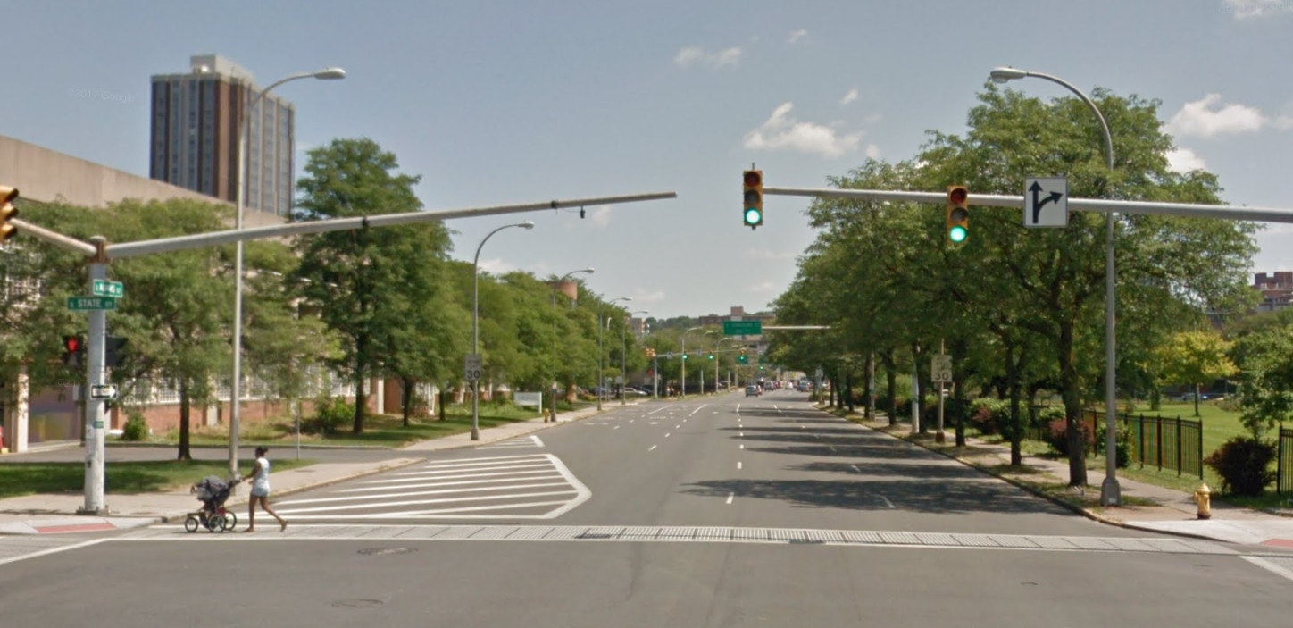
At the offramp’s new location on Van Buren, it will cause many of the same problems that people feared at MLK Boulevard. Residential buildings flank Van Buren Street right where the roundabout will be, and the new offramp will be just as close to them as it would have been to Dr. King elementary. NYSDOT also intends to install a biking/walking path from Raynor to Van Buren to connect the Almond Street shared use path with University Hill, but it will be impossible to cross the roundabout there, so the offramp will sever that connection.

A better option would be to move the highway’s offramp further south to a place like the current Exit 17 just south of Brighton Avenue. End the limited-access highway there with a roundabout connecting to Salina St—as the current exit already does—and run a narrower 30 mph Almond Street from that point all the way through the Southside to Downtown. Almond Street would intersect with Brighton, Colvin, Oakwood, and Kennedy Street before reaching MLK Boulevard, so car traffic would have a lot of options to disperse through the City. Many fewer cars would pass by Dr. King Elementary, and any that did would travel past the school at much safer speeds. This would maintain connections between the Southside, Downtown, and University Hill, and it would allow people to walk from the Southside to Oakwood Cemetery—Syracuse’s largest green space.

But NYSDOT didn’t even consider this option. They dismissed the idea of moving the roundabout south by claiming that “traffic would speed up again by the time drivers reached Downtown.” But drivers would only speed up again if there were no signalized intersections and if the road was designed with highway-sized lanes that encourage fast driving all the way to Downtown—NYSDOT considered moving the roundabout south without ending the highway at the roundabout.

This is a bad sign for the project as a whole. The Grid has to prioritize movement within the City over high-speed car traffic traveling through the City. NYSDOT, incorrectly, seems to think they don’t have to choose between these two priorities. Asked to place more value on the health and safety of the students at Dr. King Elementary, they ignored the best option for those kids because it would slow down cars. You can see similarly misplaced priorities in the details of their design for Almond Street through Downtown which would encourage speeding and make it difficult to bike or walk between Downtown and the Eastside.

There are a thousand little details of the I-81 project that NYSDOT can tweak to either make Syracuse a safer, healthier, happier place or a place that’s easy to drive through. When public feedback forced them to move the highway’s southern offramp, they chose a new location that will make driving easier at the expense of local connectivity. We can’t let them keep making that same choice.
New payment options will remove a barrier to bus ridership

updated February 10, 2021 in light of information shared during Centro’s public hearings on fare restructuring. New payment technology will allow riders to pay the fare with their phones but not, initially, with a credit card.

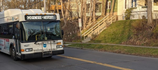
There are different kinds of barriers that keep people from riding the bus, and Centro’s about to remove one of the big ones: finding exact change. Centro is upgrading its fare boxes to give riders the option of paying the fare with a smart phone, and that will make a lot more people a lot more comfortable stepping onto the bus.

Right now, paying the bus fare requires some advanced planning. The regular fare is $2, and you have to pay in exact change. That means finding four dollar bills or sixteen quarters or forty dimes or some combination of those before you leave the house in order to make a round trip. People just don’t carry cash as commonly as they used to, and it’s not unusual to not have the right combination of bills and coins to pay the bus fare. (you can also pay with a multi-ride pass, but that requires even more advanced planning since you’ll have to have purchased it well ahead of time).

This is a hassle, and it depresses ridership. Plenty of people really do pass up public transportation because they’re too worried about stepping onto the bus and not being able to pay because the only cash they’re got is a $20 bill and the operator can’t break it.

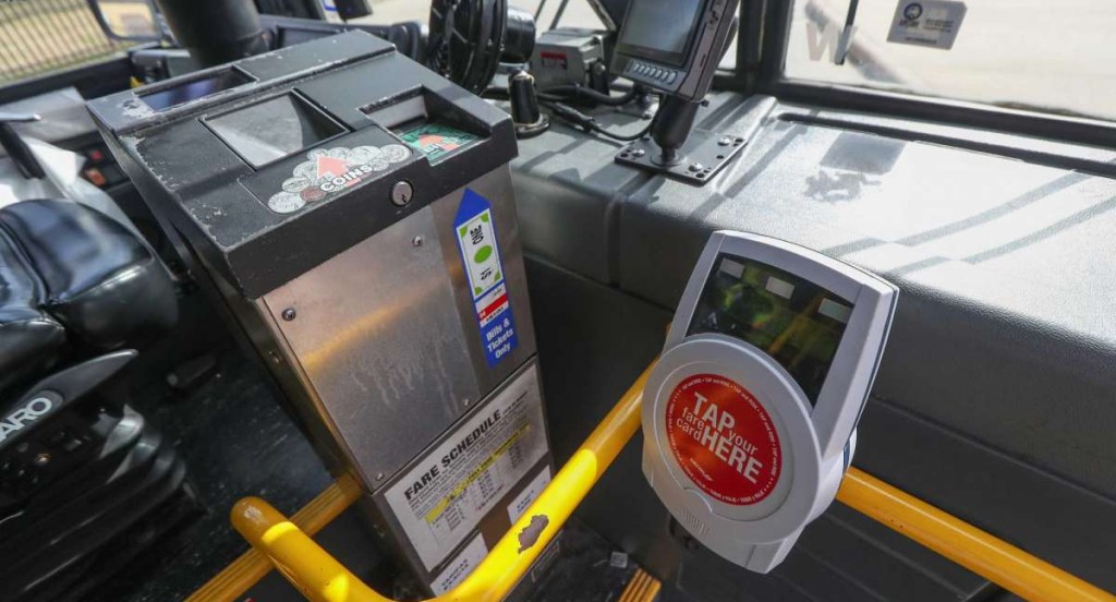
mobile fare technology in Houston

So it’s a very good thing that Centro is upgrading its fare boxes to accept mobile payment. You might have already noticed the new hardware that started showing up on the sides of fareboxes months ago. This new technology will give people the option of paying the fare (which Centro is lowering to $1) with their phone. And because plenty of people have their phone every time they leave the house, paying the bus fare will require no more planning than paying for a cup of coffee.

Clearly, there are other barriers to ridership. People also need to be able to understand where their bus is going, and the bus needs to actually go the places people need to get when they need to get there. Centro has the plans and funding to address those problems too, and they should roll out Bus Rapid Transit service before Ben Walsh leaves office.

But in the meantime, it is very exciting to see Centro making this simple, common-sense improvement to the rider experience. Mobile fare payment has succeeded in making transit more convenient in plenty of other cities, and it will remove an important barrier to ridership in Syracuse.
Restoring the Community’s Street Grid

The Near Eastside needs more small streets. A fine-grained street grid with many small streets and many small blocks yields many different benefits to a neighborhood. The Near Eastside used to have one of the most finely grained grids in Syracuse, but urban renewal removed many streets and consolidated many blocks, and the result is bad for the neighborhood. When NYSDOT builds the community grid, and as City Hall extends NYSDOT’s work through the rest of the City’s center, they should focus on restoring the neighborhood’s traditional street grid to make a better neighborhood.
Small streets are good for all kinds of reasons. For one, they can increase the number of people who can live in a neighborhood. To see how, look at the block bounded by Washington, Water, McBride, and Almond Streets. That block has enough room to fit about 80 new rowhomes, but it only has enough street frontage to fit about 40 rowhomes. Reopening the little street that used to cut through that block—Orange Alley, just 20′ wide—would almost double the amount of usable street frontage and allow the block to hold twice as many people.

Small blocks also improve mobility. When a neighborhood has many small streets, people have lots of different options for getting between any two points. All of those options allow people to disperse through the neighborhood, and that discourages traffic from all bunching up on one congested street. Car drivers coming from DeWitt can keep to high-capacity streets like Genesee while people on foot and on bike can follow safer, slower parallel streets like Water or Jefferson to reach the same destination.

a fine-grained street grid offered many options to move through the Near Eastside before urban renewal

Small streets are also good for small businesses. Jane Jacobs showed how a street network with many streets and small blocks creates allows more retail businesses to succeed with foot traffic. The Near Eastside used to have some of the smallest blocks in Syracuse, and the neighborhood also supported a high density of small-scale retail.

On the whole, Syracuse has a good street grid that brings these benefits to most of the City’s neighborhoods, but urban renewal degraded the street grid on the Near Eastside. City Hall and NYSDOT removed miles of local streets and consolidated dozens of blocks. Now in that neighborhood, the scrambled street grid limits housing options, harms small businesses, and makes it harder to get around.

The Community Grid is about more than just removing the viaduct, it also has to be about restoring the City’s traditional street grid destroyed by urban renewal to secure all of its many benefits for the neighborhood.

But—as of the 2021 DEIS—NYSDOT plans to do almost none of that on the Near Eastside. NYSDOT only intends to restore two of the many streets that urban renewal removed—Pearl and Irving—and those would function less like local streets than as extensions of new highway off-ramps.

City Hall and NYSDOT should do more to restore the neighborhood’s traditional street grid. Along Almond Street, NYSDOT should install pedestrian crossings at Madison and Monroe Streets in order to connect already existing streets that have been broken by the highway. City Hall should reopen through streets removed by urban renewal, like Washington and Cedar, in order to give people more options for travelling through the neighborhood. And City Hall should establish new small streets just a single block long, like Orange Alley, in order to create more room for people to live in the neighborhood.

Rowhomes for the Near Eastside

City Hall should build new housing on the Near Eastside, and a lot of that new housing should be rowhomes. Rowhomes combine the benefits of both single-family and multi-family housing and they are a perfect housing solution for the growing Near Eastside.

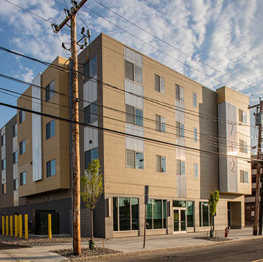
Over the past few years, private for-profit developers operating on the Near Eastside have been building one basic kind of housing: the midrise apartment block. These buildings can fit a lot of homes in a neighborhood, and all those people help support more local businesses and better public services.

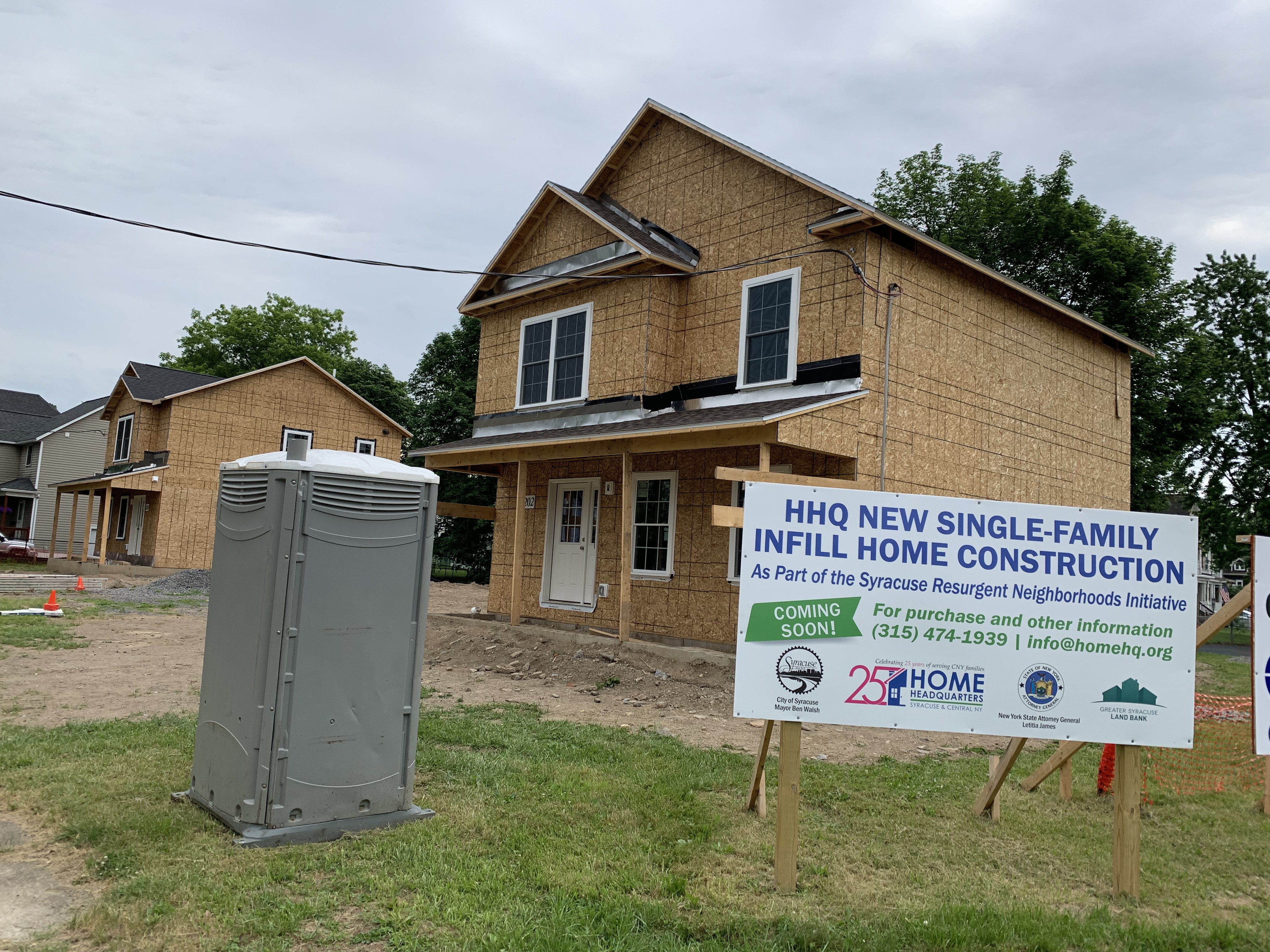
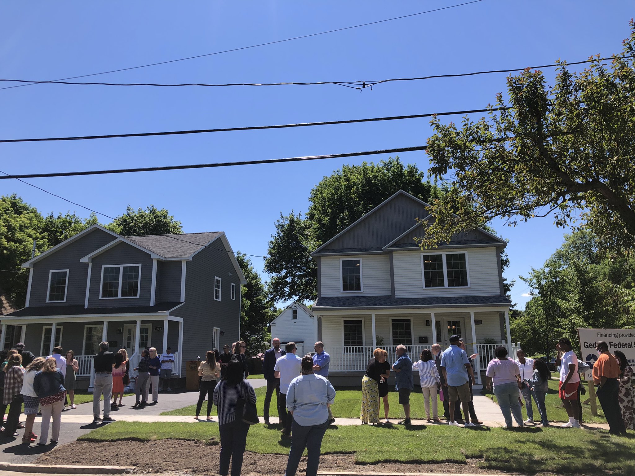
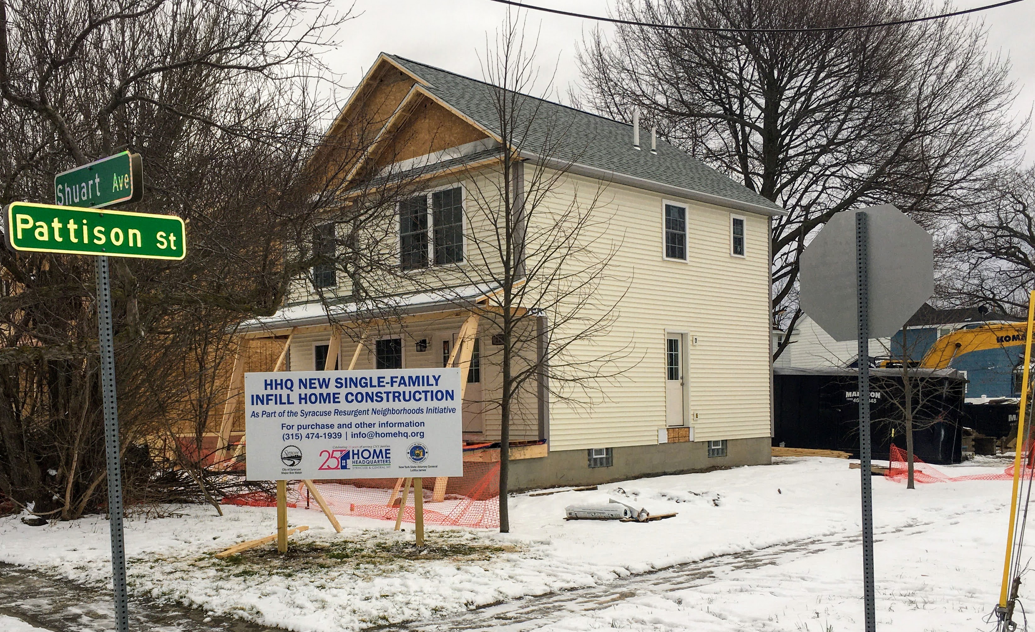
In the past couple of years, City Hall’s Resurgent Neighborhoods Initiative has built a very different kind of housing in other City neighborhoods: single-family houses with large front, side, and backyards. These buildings give people a little bit of private outdoor space, they encourage a sense of ownership of the block, and they provide people with the opportunity to own their own home.

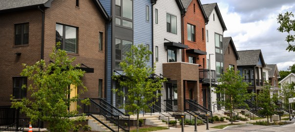
Rowhomes—houses on narrow lots that share sidewalls with neighboring houses—combine all these benefits. Like large apartment buildings, they can house lots of people and support vibrant growing neighborhoods. Like detached single-family homes, they provide small yards and opportunities for home ownership.

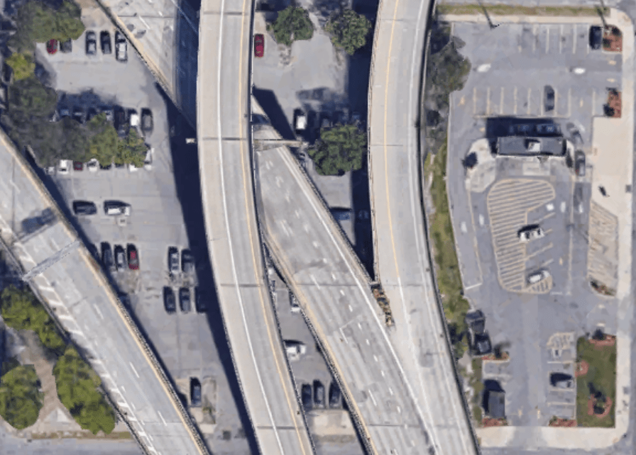
To see how rowhomes would help bring these benefits to the Near Eastside, just look at the block bounded by Water, Washington, Almond, and McBride Streets. It’s currently almost completely covered by a tangle of two elevated highways, but the I81 project will remove that interchange and transfer the land back to the community. That block could easily fit 80 rowhomes, so there would be room for 80 families to own a home on a single block of this high-opportunity neighborhood.

Of course, it’s not currently legal to build rowhomes in Syracuse. The City’s antiquated zoning code prohibits them, and ReZone would still maintain that ban by requiring what it calls “attached single-family” houses to sit on overly large lots that rob rowhomes of some of their chief benefits. Before City Hall adopts the new zoning ordinance, it should amend ReZone to allow rowhomes to be built on lots as narrow as 15’ wide and as small as 750 square feet. These standards would simply allow City Hall to build rowhomes similar to those that already exist in other Syracuse neighborhoods.

Rowhomes hit a housing sweet spot: they make room for lots of people to live in a neighborhood, and they also provide families with private yards and the opportunity to own a home. Syracuse could use more rowhomes, and City Hall should build them on the Near Eastside.

The Public’s Interest in Housing on the Near Eastside

The Near Eastside needs more new housing, and it needs that new housing to be affordable for families with a range of incomes. Recent private for-profit development is providing housing for households at the top of that range, but it will take public and not-profit development to meet the needs of the rest of the community. City Hall should actively guide new housing construction in order to serve the public’s interest by making the neighborhood’s restoration equitable and sustainable.

In the private for-profit housing market, rents in new buildings are higher than those in older buildings. New buildings have to cover costs—to buy land and materials, to pay construction workers—that older buildings paid off a long time ago, and private for-profit developers cover those costs with relatively high rents. New construction on the Near Eastside is being driven almost entirely by private for-profit developers, and so it is much more expensive than older housing across the City.

In a different world where City Hall hadn’t destroyed almost all of the neighborhood’s preexisting housing, this would be less of a problem. New, private, for-profit buildings would still be expensive, but they would be surrounded by thousands of older homes whose mortgages were already paid off and whose owners could compete for tenants by lowering rents. In such a neighborhood, the construction of new housing—with newer appliances, better HVAC, and more amenities—could even help to reduce rents in older buildings by luring the richest tenants away.

But we don’t live in that world—City Hall did destroy almost all preexisting housing between Montgomery and Beech Streets—so there aren’t many cheap homes just east of Downtown, and no amount of private, for-profit, new construction will change that in your lifetime or mine. This is a problem City Hall will have to fix by directing the construction of not-for-profit housing on behalf of the public.

When the public builds housing, it doesn’t need to cover upfront costs solely with income from rents and sales. Instead, it can draw on the municipal budget to meet those costs with the understanding that—once you account for the full range of public benefits that flow from restoring a neighborhood in the City’s center—the public will come out better in the end. Those benefits include increased sales taxes from new businesses, increased property taxes in surrounding neighborhoods, savings on social and emergency services, savings on asphalt maintenance, better outcomes for SCSD students, expanded transportation options, and—most importantly—more people who need homes in Syracuse will have them.

A lot of land on the Near Eastside is already controlled by some public entity—be it City Hall, Syracuse City Schools, SUNY Upstate, or NYSDOT. The I81 project should include an agreement between those public entities to build new housing on that land on behalf of the public, NYSDOT should provide funding to build that new housing in the I81 budget, and that new housing should be made available at prices affordable to households making a wide range of incomes. This is the only realistic way to serve the public’s interest by restoring the Near Eastside sustainably and equitably.

The Community Grid and Neighborhood Restoration

Before urban renewal, tight-knit neighborhoods right next to Downtown provided housing and opportunity for tens of thousands of people. Now, most of those neighborhoods are mostly parking lots and home to very few people. In order for the Community Grid to succeed, Syracuse must restore those neighborhoods. 

Urban renewal hit the 15th Ward/Near Eastside worse than any other neighborhood. That’s a product of City Hall’s racism (the 15th Ward was home to 8 of every 9 Black people living in Syracuse at midcentury), and it’s important to note that Urban Renewal wasn’t a one-time event. City Hall began mass demolition of Black families’ homes in the 1930’s, and it’s continued into the 21st century with the willful neglect and destruction of Kennedy Square.

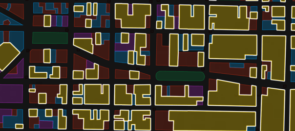
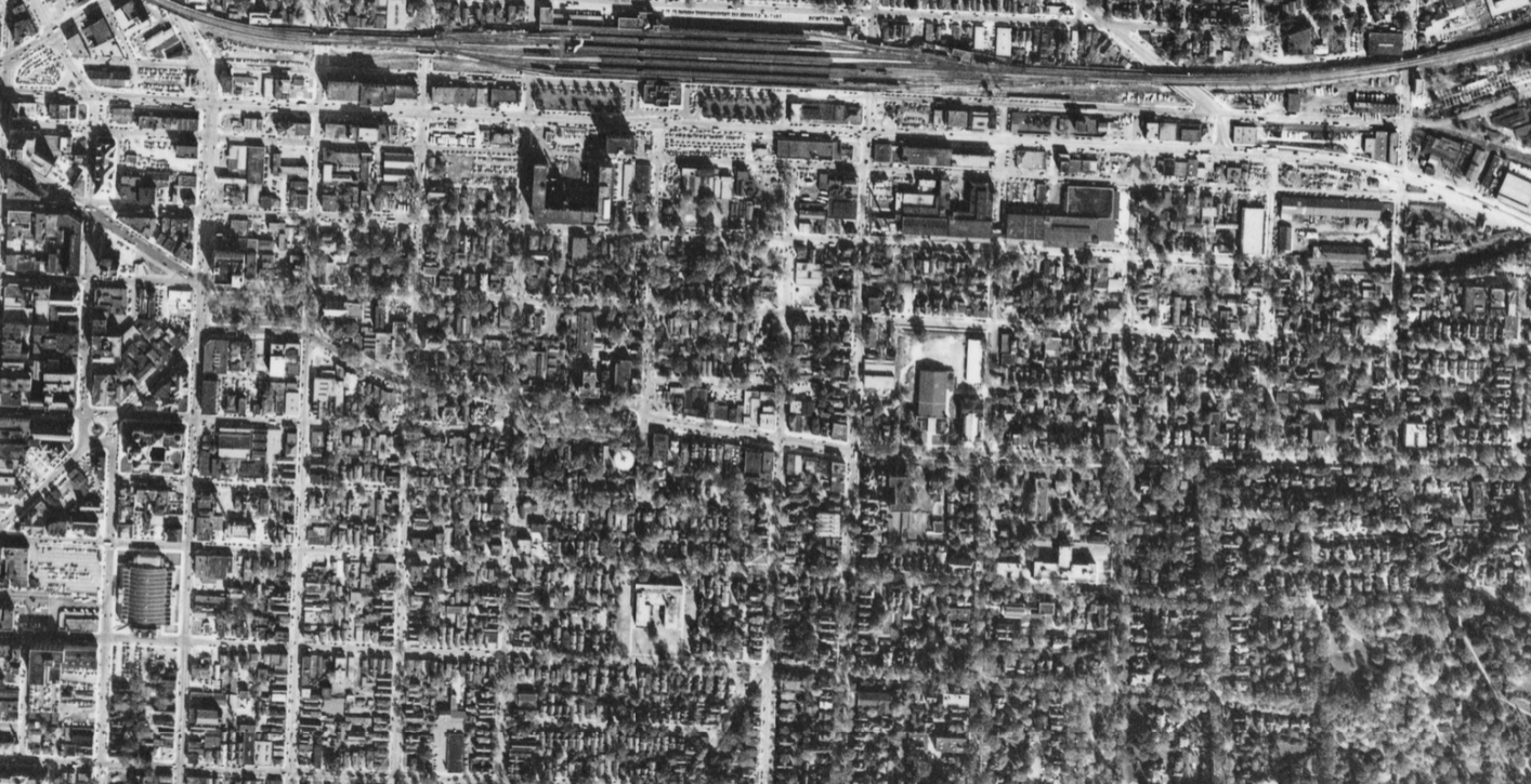
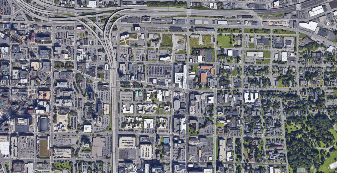
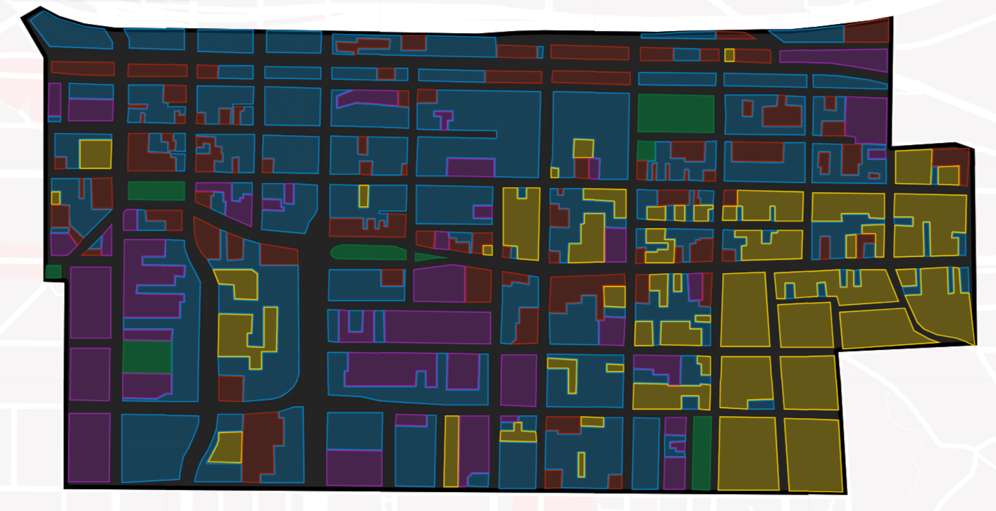
These maps show how land uses changed just east of Downtown between 1953 and 2021. Areas shaded yellow are housing (including mixed-use buildings), red are commercial, purple are institutional (churches, schools, hospitals, etc), blue are parking and vacant land, and green are parkland.

In 1953, the vast majority of this neighborhood was covered in housing, but it was also served by many small businesses, schools, churches, and synagogues. Small streets laid out before the Civil War cut the land up into small blocks, making the neighborhood easier to get around on foot.

By 2021 the neighborhood was dominated by vacant land and parking lots. Entire blocks of housing have been demolished, and many small streets have been either eliminated (Renwick, Washington, Irving, Cedar, McBride, Jefferson, Madison) or widened (Harrison, Adams, Almond, Townsend) in order to make the area easier to drive around at the expense of people on foot.

As a result of all these changes, the population of the Near Eastside fell from 14,646 in 1950 to 5,656 in 2020—a drop of 61%. With that huge loss of people, the neighborhoods has lost most of its character as well. Few children mean there are no more schools, most houses of worship have either closed or followed their congregants to some other neighborhood, and the local businesses that sustained the neighborhood’s permanent residents have been replaced (if at all) by office buildings staffed by commuters.

This neighborhood has transformed from a place where people can make a good life into a space that serves residents of other neighborhoods who come and go in cars.

The Community Grid is Syracuse’s opportunity to unmake these mistakes. We’re removing the highway, and the new street grid can be designed in a way that supports walking, biking, and transit, small businesses, new housing, and repopulation. It’ll take more than transportation planning to right urban renewal’s wrongs, but if Syracuse pursues that goal intentionally, we can restore these neighborhoods and create good places for people to make their lives in the City.

Public involvement in the design, funding, and construction of Syracuse’s Columbus Monument

In a recent letter to the editor, James Albanese—a member of the Columbus Monument Corporation—described Syracuse’s Columbus Monument as a ‘privately’ funded statue. Writing of the importance of the monument as a physical object located in a prime public space, Mr. Albanese says:

“being there connects us with our immigrant ancestors, who after a 15-year effort to privately fund and erect this work of art felt that they were finally being integrated into the local community as equals.”
[emphasis added]

Mr. Albanese chose these words carefully to corroborate the Columbus Monument Corporation’s argument that City Hall cannot remove the statue because the monument properly belongs to the ‘people of Syracuse.’ In his telling, the monument was paid for with private money, so no public body—like City Hall—can decide to remove it.

But that’s not true. Although the original Columbus Monument Association attempted to privately fund and erect the monument in the 1920’s and 30’s, that effort came up short. In the end, the purchase, shipment, and construction of Syracuse’s Columbus Monument relied on public money supplied by the City of Syracuse, New York State, and Italy’s national government, and Benito Mussolini even had a hand in designing the monument itself.

The problems started with the Depression when the dollar’s value fell relative to the Italian lira. Despite raising an impressive sum to hire Italian sculptor Renzo Baldi, the worsening exchange rate meant the Columbus Monument Corporation didn’t have enough money to actually ship the monument from Italy to Syracuse.

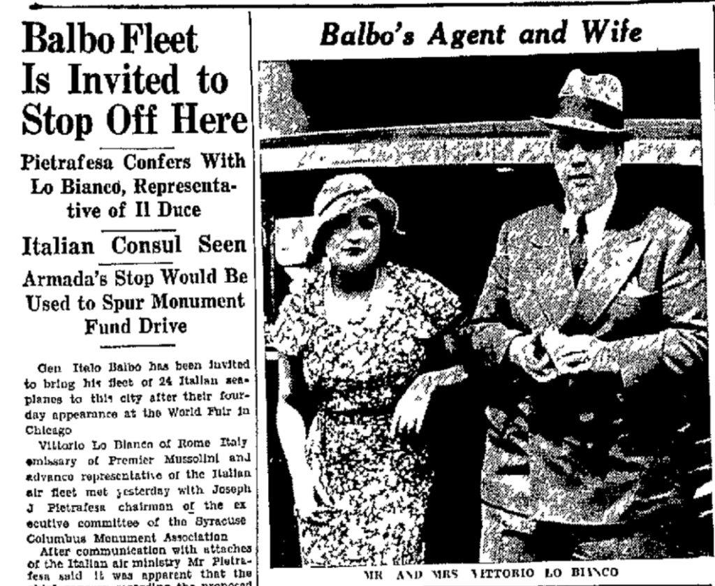
The Corporation appealed to the Italian government to help provide the necessary money. In 1933, they asked the Italian air force to come to Syracuse for a fund raiser.

“The occasion of the proposed visit of the transatlantic squadron here would tie in with a campaign of the monument association to raise additional funds for the Columbus monument”

The air squadron did not come to Syracuse, but the Italian national government did agree to help ship the monument. It paid half the cost of shipping the granite blocks of the pedestal. The Syracuse Herald article announcing the shipment and the Italian government’s generosity also revealed that “the inscription will be composed by Premier Mussolini and forwarded to Syracuse to be placed on the monument.”

during the 1930’s Italy’s fascist government cultivated support among the Italian diaspora, particularly in America.

When the stone reached New York, the Columbus Monument Association still could not afford to ship it from there to Syracuse. They asked Herbert Lehman—New York’s governor—to provide free passage on the Erie Canal. New York State shipped the granite over the canal on two barges pulled by a state-owned tug.

Once the pieces of the monument were all actually in Syracuse, a private firm—the Mondo Construction Company—was supposed to put them together. However, City Hall took over the job of actually erecting the monument in 1934 in order to “help defray expenses.”

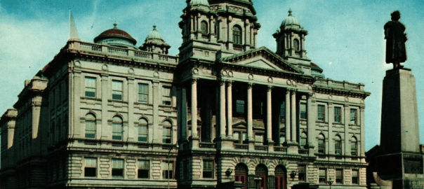
Syracuse’s Columbus monument was not a purely private venture. Local, state, and national governments helped design, fund, and construct the monument, it sits in a public right of way, and it was ritually presented to the City of Syracuse at its dedication in 1934. The public put the monument up, and the public has every right to decide to take it down.

The case for bus lanes

Syracuse should build bus lanes on specific high-traffic streets as part of the I-81 project. Giving buses dedicated space on city streets makes public transit faster, cheaper, and more reliable, and it’s an important step towards building a transportation system that works for everybody.

But bus lanes weren’t included in NYSDOT’s draft plans for I-81, and they weren’t even part of SMTC’s design of Centro’s planned BRT lines. Even though bus lanes (and preferably, separated bus lanes) are considered necessary for any project to call itself BRT, Centro isn’t asking for any dedicated street space for its buses.

There’s some sense to that. Syracuse doesn’t have the same level of traffic congestion that makes dedicated bus lanes so essential and successful in cities like New York and Boston, and it’s better to focus on other infrastructure improvements—like signal priority and level boarding platforms—that will have a greater impact in Syracuse.

But even though dedicated bus lanes shouldn’t be Centro’s top priority, there are at least three good reasons they should still be part of the I-81 project.

Centro buses are often held up by congested car traffic

FIrst, Centro buses do get stuck in traffic. It doesn’t happen on every bus route, and it doesn’t happen all hours of the day, but there are plenty of times that buses moving through the middle of town get stuck behind a bunch of cars, and that sucks.

Centro should make it a priority to build bus lanes in the specific places where excessive car traffic slows buses down.

Adams Street has ample room for bus lanes

Second, there’s plenty of room for bus lanes already. The places where Centro most needs its own dedicated running lanes just so happen to be overly-wide traffic sewers leading to and from 81’s off and onramps. Parts of James, State, and Adams Streets are 5 lanes and more than 60’ wide. That’s crazy!

These streets have enough room to build dedicated bus lanes without needing to do the costly work of moving a single curb. Just repurpose some of that ample existing street space by painting it bright red with a sign that says “bus only” and call it a day.

These bus lanes would be useful even before BRT is fully implemented, and they should be included in the I81 project.

Third, it’s important to claim that space for public transportation now before doing so becomes politically difficult. Removing the 81 viaduct will temporarily reduce car traffic on these overbuilt streets, but the project will also open up new space for new homes and businesses in the City’s center. When new people move into the center of town, they’ll build their lives around whatever transportation system Syracuse provides. If there’s still mediocre bus service and lots of room for cars, they’ll drive everywhere and create all kinds of new traffic congestion that’ll slow the buses down and make public transportation even less appealing to new residents.

And if Syracuse waits until the buses really are bogged down in terrible traffic, it will be too late to build bus lanes because the drivers bogging down the buses will scream bloody murder at the idea of giving any of ‘their’ space to public transportation. Better to get ahead of that problem now by laying the groundwork for a transportation system that can handle population growth—a transportation system built on high-capacity modes like walking, biking, and public transportation.

This is an opportune moment. Downtown is riven by a few overly wide streets clogged with traffic shunting to and from the highways. When 81 comes down, the excess space on those streets will be immediately—but only temporarily—up for grabs. Syracuse should turn that space into bus lanes as part of the I81 project in order to secure fast reliable public transportation now so that the City’s center can handle population growth in the years ahead.

More and better bike racks

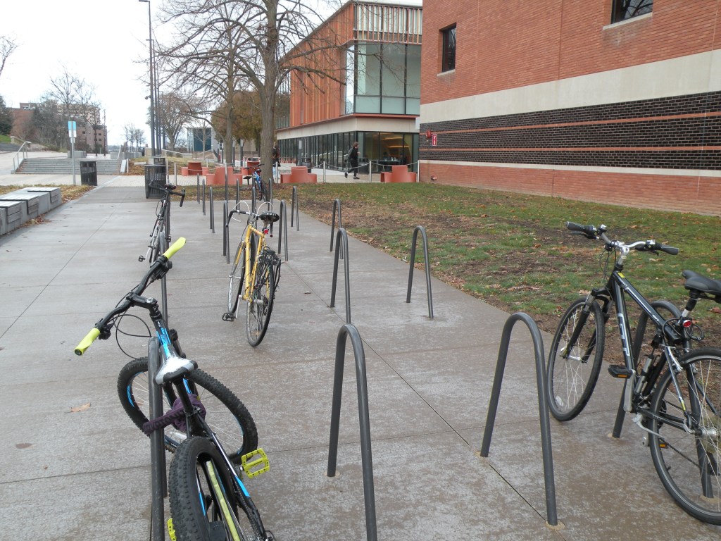
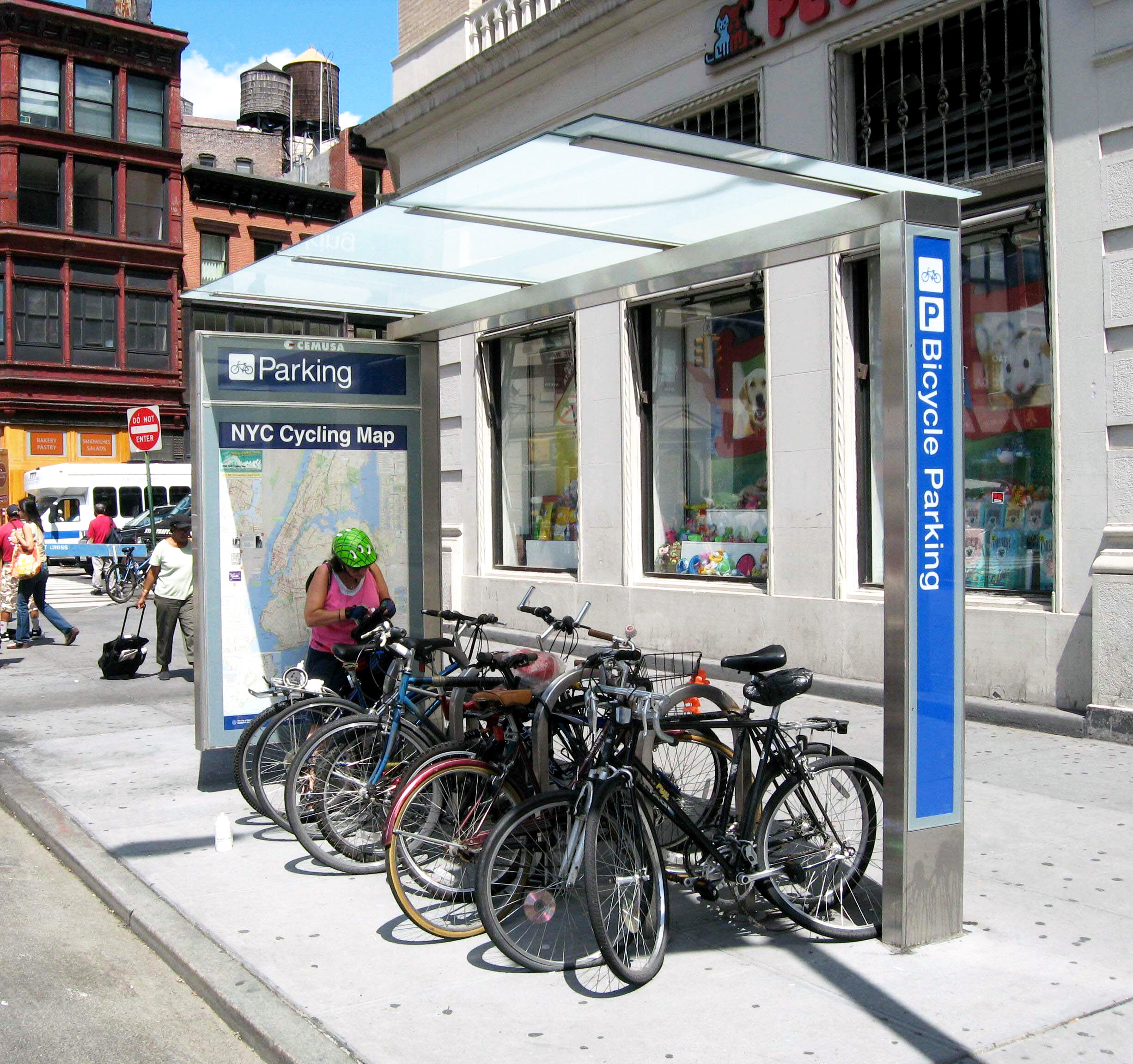
Syracuse needs better bike storage. It’s no good biking somewhere if there’s nowhere to put the bike once you get there. Right now, there’s almost no place in Syracuse with dedicated bike storage for more than one or two people at a time. Bike riders make it work by locking to street signs, fences, benches, etc., but this isn’t a scalable solution. If Syracuse is going to see a meaningful shift to biking, we need better places to store all the bikes.

This concrete pad has enough racks to store 48 bikes. The same space could fit 3 parked cars

University Hill shows how impactful this can be. There’s simply not enough room for every student, professor, and staff member to bring a car onto Syracuse University’s and ESF’s campuses without demolishing half the academic buildings (compare University Hill to Downtown, which did demolish half its buildings to make space for car storage). Bikes (along with quality transit to campus and abundant housing within walking distance of campus) let people get to work or class without needing to bring along a 2-ton steel box that they need to stash somewhere.

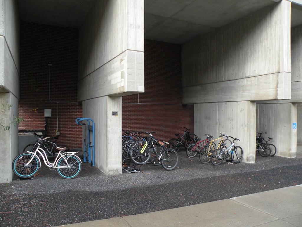
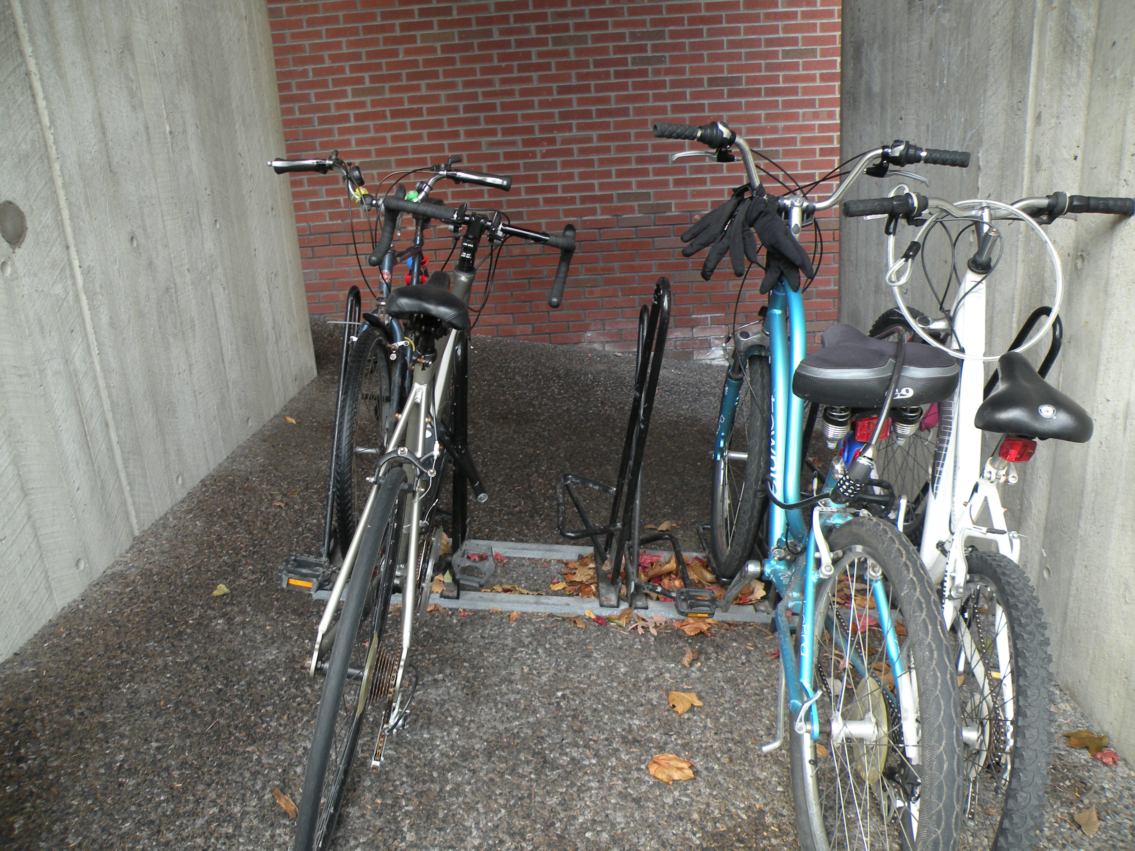
ESF handles bike storage better than SU. To see how, look at the north side of Illick Hall. It’s ‘shark fin’ bike racks are more secure than the traditional racks that SU uses, and they pack more bikes into a smaller space. ESF also placed these racks beneath the building’s overhang to keep bikes out of the elements, and there is a publicly available bike pump and tool set to handle minor repairs.

Here are three lessons from ESF and SU’s bike storage facilities. First, they are abundant. Although many people bike to campus, there’s almost always enough space for another person to lock up their bike.

Second, they are secure. The bike racks on University Hill are sturdy and designed to be locked to a bike’s frame (rather than just the wheel, like the sorry schoolyard-style bike rack outside of City Hall). ESF’s ‘shark fin’ racks are particularly well-designed in that they make it easy to use a single lock to secure both the frame and the front wheel while fitting more bikes into less space.

Third, they are out of the way. These bike racks have their own dedicated space where they don’t get in the way of pedestrians. That’s a much better situation than you find Downtown, where a bike locked to a street sign can easily fall over and block the sidewalk.

this otherwise unusable space is room enough for 7 bikes

City Hall can learn these lessons and implement similar bike storage strategies in other parts of Syracuse where a shift to bike transportation would yield similar benefits.

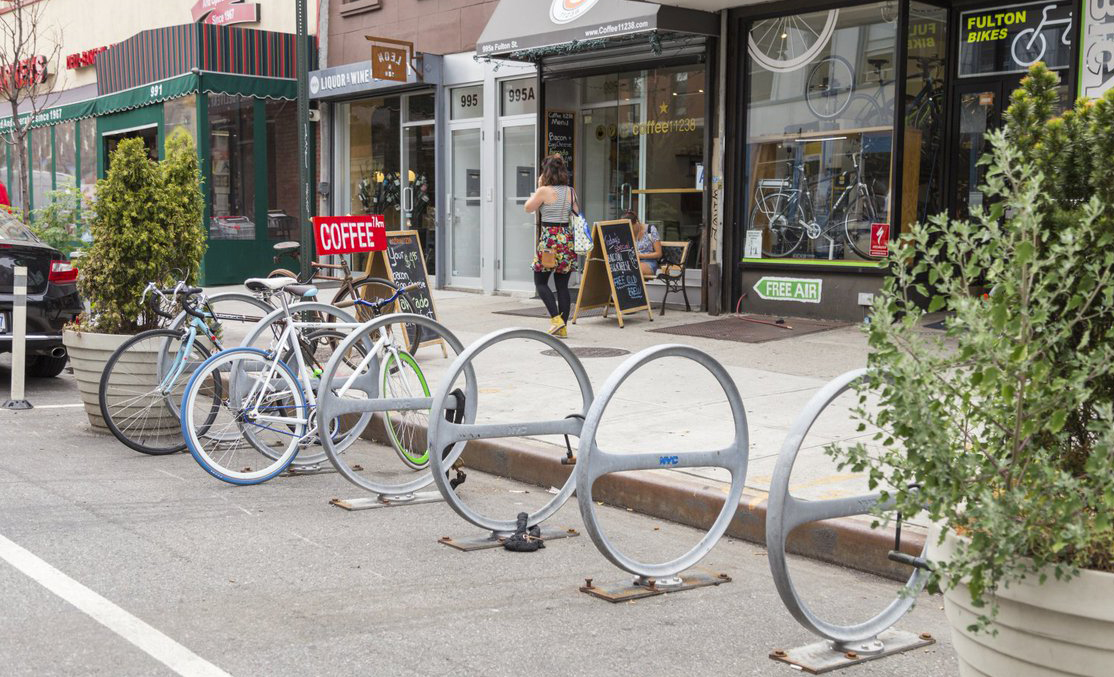
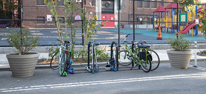
A simple, easily implemented, scalable solution is to build bike corrals below the curb at crosswalks. Bike corrals are just a set of closely-spaced bike racks (enough for 4-8 bikes) protected by bollards or planters. By placing them along the curb at crosswalks, City Hall would improve street safety by reducing the effective length of the crosswalk and by ‘daylighting’ these intersections so that pedestrians and car drivers can see each other. In this way, bike corrals work like curb extensions, but they’re significantly less expensive to construct and they bring the added benefit of quality bike storage.

This simple intervention could make a big impact in places like Downtown and neighborhood centers where lots of people tend to congregate and excessive car storage wastes valuable space that could be put to better use.

Monuments to genocide

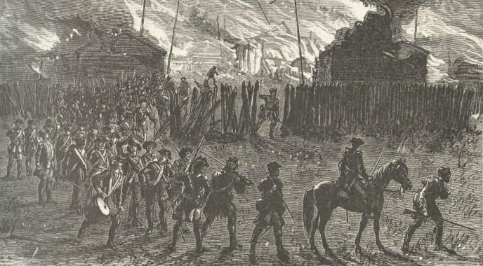
There are monuments in Syracuse City Parks that commemorate an act of genocide carried out by the United States Government against the Onondaga Nation in April of 1779. These monuments memorialize the Van Schaick Expedition—a part of the infamous Sullivan-Clinton campaign—which passed from Fort Stanwix, through the present-day City of Syracuse, on its way to destroy Onondaga settlements to the south. Colonial soldiers killed or captured Onondaga men, women, and children and destroyed their crops and homes.

The Van Schaick Expedition was despicable, it does not deserve our veneration, and City Hall should remove these monuments from its parks.

The Sullivan-Clinton campaign was a series of military expeditions in which professional soldiers from the Continental Army destroyed Haudenosaunee settlements across the state. In George Washington’s words, the purpose of the campaign was to “chastise and intimidate” the Haudenosaunee. In the words of another officer involved with the campaign, the purpose was “to extirpate those hell hounds from off the face of the earth.” Because of its scorched-earth tactics designed to eliminate entire communities, experts consider the Sullivan-Clinton campaign an act of genocide.

Colonel Goose Van Schaick led the campaign’s raid against the Onondaga. Here is a first person account of that raid, written by Lieutenant E. Beatty of the Fourth Pennsylvania Regiment and quoted from Onondaga’s Centennial by Dwight H. Bruce:

“21st, this morning set of about Day Break, on the same line of march and west about 6 Miles when we halted, Capt. Graham with his Compy. Was sent forward as an advance party, then proceeded on to the Onandaga lake, about 8 Miles in length and 4 in Breadth, waded an arm of it, about 4 foot deep, and 200 yards wide, and came to Onandaga creek, small but deep, had to cross it on a log.

Capt. Graham’s Co., Just as he had crossed the creek, caught an Indian who was shooting Pidgeons, and made him prisoner. And we got some Information from him, then proceeded on till we come within about one Mile of the Town, when we Rec’d. word from Capt. Graham that he had caught on Squaw and killed one, and he taken two or three children and one White man, and one or two made their escape and alarmed the town.

The Col. Immediately sent me forward to order him on as quick as possible, and make as many prisoners as he could, and he would support him with the main body. I overtook him at the first town, and delivered my orders, and he Immediately pushed on about two miles to the Next town, where he made a small halt and took a great many prisoners, soon after Major Cochran with Capt. Gray’s Compy. came up and ordered me to stay with the prisoners and their two Compys. to push on to the next town, about one mile forward, which they did, and made more prisoners and killed some, particularly a Negro who was their Dr. they then plundered the middle town where I was.

Capt. Bleekers Compy. had come up by this time, and left the main body at their first town; we then collected all our prisoners, plundered this town and set fire to it, then marched of to the main body, which lay at the first town; we stayed there about 8 hours and killed some five horses and a Number of Hogs, & plundered their houses, and set fire to them, and Marched of about 4 o’clock, in the same line of march as we came, only the front changed. and a Compy. to guard the prisrs. Who was to march between they two colums;

marched on about 2 Miles from the town down the Onand’ga creek, when about 20 Indians who Lay concealed on the opposite side of the Creek fird upon us, but the Rifle Men soon Dispersed them, killing one of them, we then marched on and crossed the Onandaga Creek in two places, for fear the enemy should attack us, but we met with no interruption, crossed the arm of the lake, and encamped by the side of the lake about 8 Miles from the town. We killed about 15, took 34 Prisoners, Burned about 30 or 40 houses, took 2 stand of Coulors, and we had not one man killed or wounded—”

This account of events comes from one of the perpetrators of genocide. Other accounts contain more graphic details of the soldiers’ violence. By the 1800’s, white settlers in Syracuse telling the story of the raid would specify that the soldiers killed “large numbers” of Onondagas in the creek as they tried to swim to safety, and that the soldiers “hung and quartered” the Black man they found living with the Onondaga. According to the Peace Council, Onondaga oral histories tell that the soldiers also raped Onondaga women.

Van Schaick’s raid destroyed a ten-mile long swath of “longhouses, fields, orchards, [and] food stores,” leaving the Onondaga with little food to survive the particularly brutal winter. A brood of cicadas “provided a much need food source to help the Onondaga survive that first year of rebuilding.” The Onondaga still celebrate the return of the cicadas (most recently in 2018) in memory of this history and as “a way to acknowledge the benevolence of the natural world, offering sustenance as they struggled to survive.”

Clark’s Onondaga reports when the white settlers came to this part of the County for the first time in 1789, they took over the remnants of an “extensive Indian orchard” that was still abandoned 10 years after Van Schaick had burned part of it. The settlers learned this history from the Onondaga still living in the area who provided them with shelter when they first arrived.

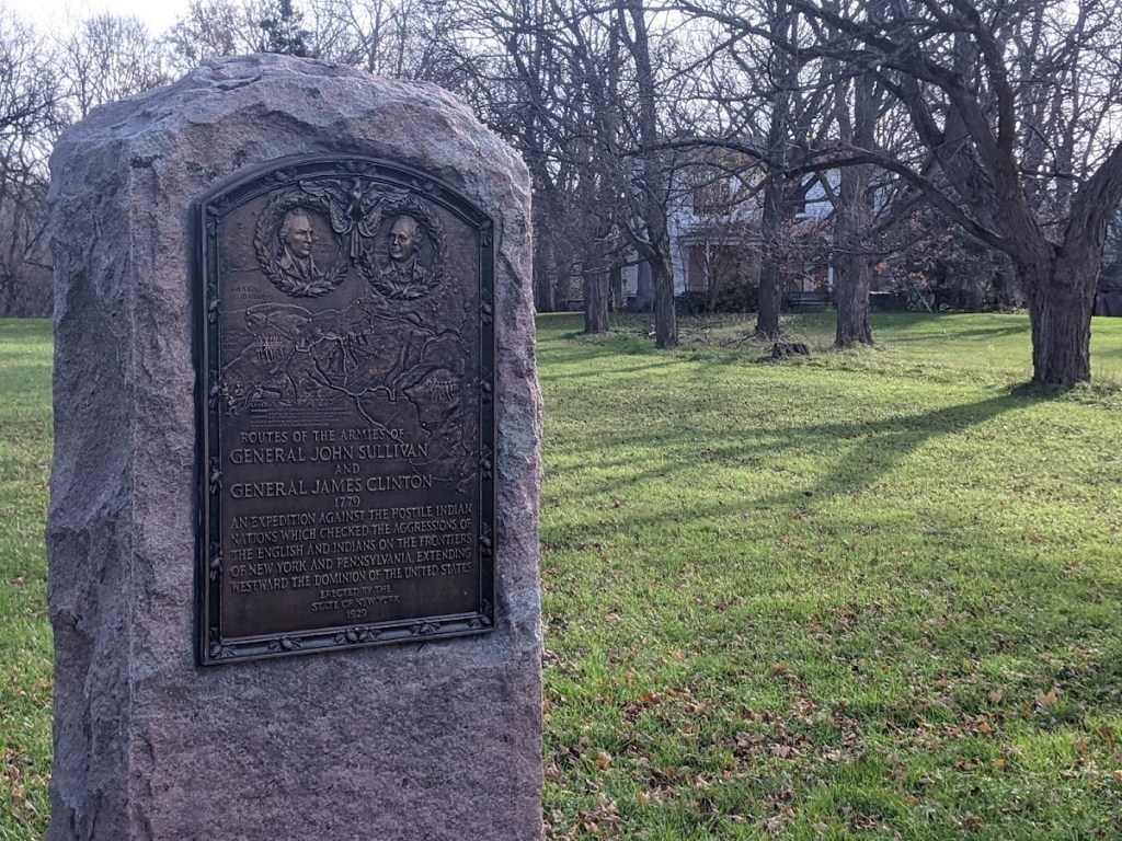
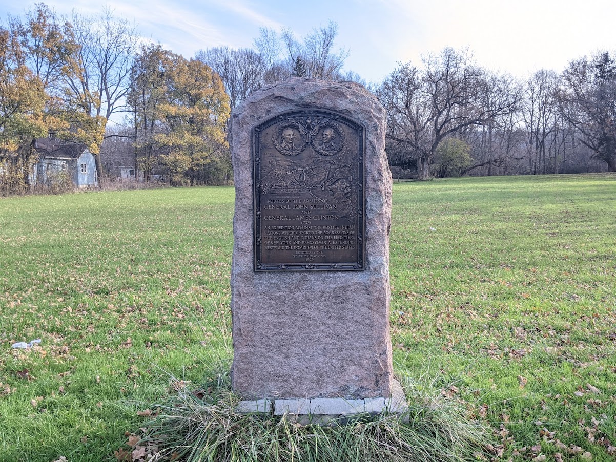
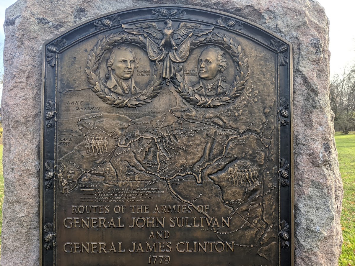
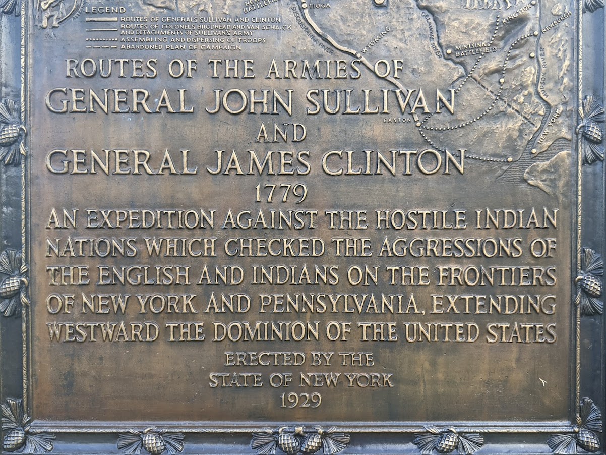
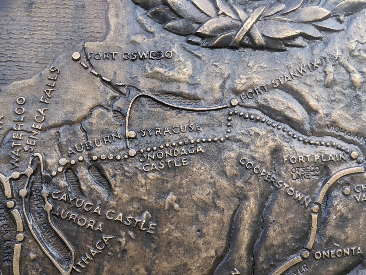
New York State erected Syracuse’s first monument to the Sullivan-Clinton Campaign in 1929. That was the 150th anniversary of the campaign, and identical monuments were placed across the state. The monument depicts the Campaign’s multiple expeditions on a map of New York State. The Van Schaick Expedition is clearly marked and is shown passing through present-day Syracuse to “Onondaga Castle.”

This monument sits on a large privately owned piece of land on Valley Drive across from Onondaga Valley Cemetery.

When New York State built its monument, people in Syracuse understood that this was not an event worth commemorating. There had been some preparations for a celebration of the “Raid” on Sunday April 21, 1929, but the Syracuse Herald reported “lack of interest and delay in attempting to bring about the celebration are given as reasons for its postponement.” The Herald also noted that:

“The celebration has never been encouraged by the Onondaga Historical Association. Officers of that organization contend that the attack on the Onondagans was unjust. The Indians who are now part of the Onondaga community have had traditions handed down to them telling of the barbarity of the American troops. Officers of the historical association urge that there is nothing to celebrate and that the anniversary might better be forgotten.”

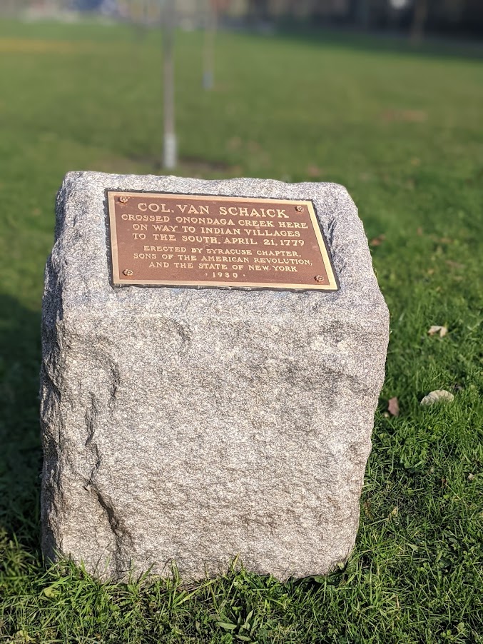
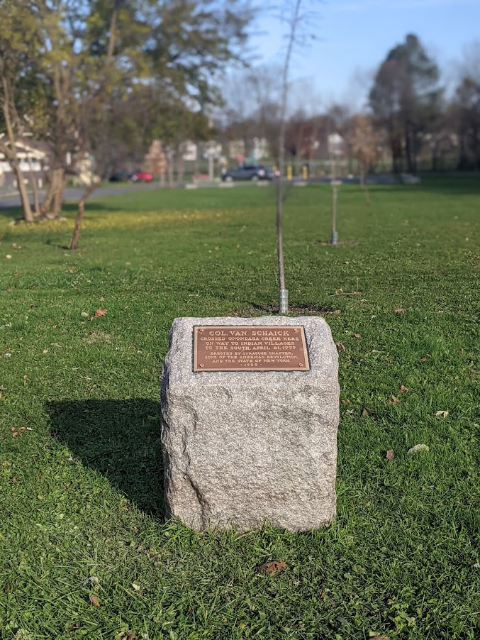
Unfortunately, the Sons and Daughters of the American Revolution did not take this advice, and the very next year they erected two monuments to Van Schaick’s raid on City-owned parkland. One is on West Colvin Street between Onondaga Creek Parkway and Hunt Avenue. It reads:

Col. Van Schaick
crossed Onondaga Creek here

on way to Indian villages
to the south, April 21, 1779

The metal plaque has recently been replaced, so someone (likely unaware of the history) is actually maintaining this monument to genocide.

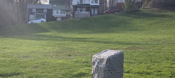
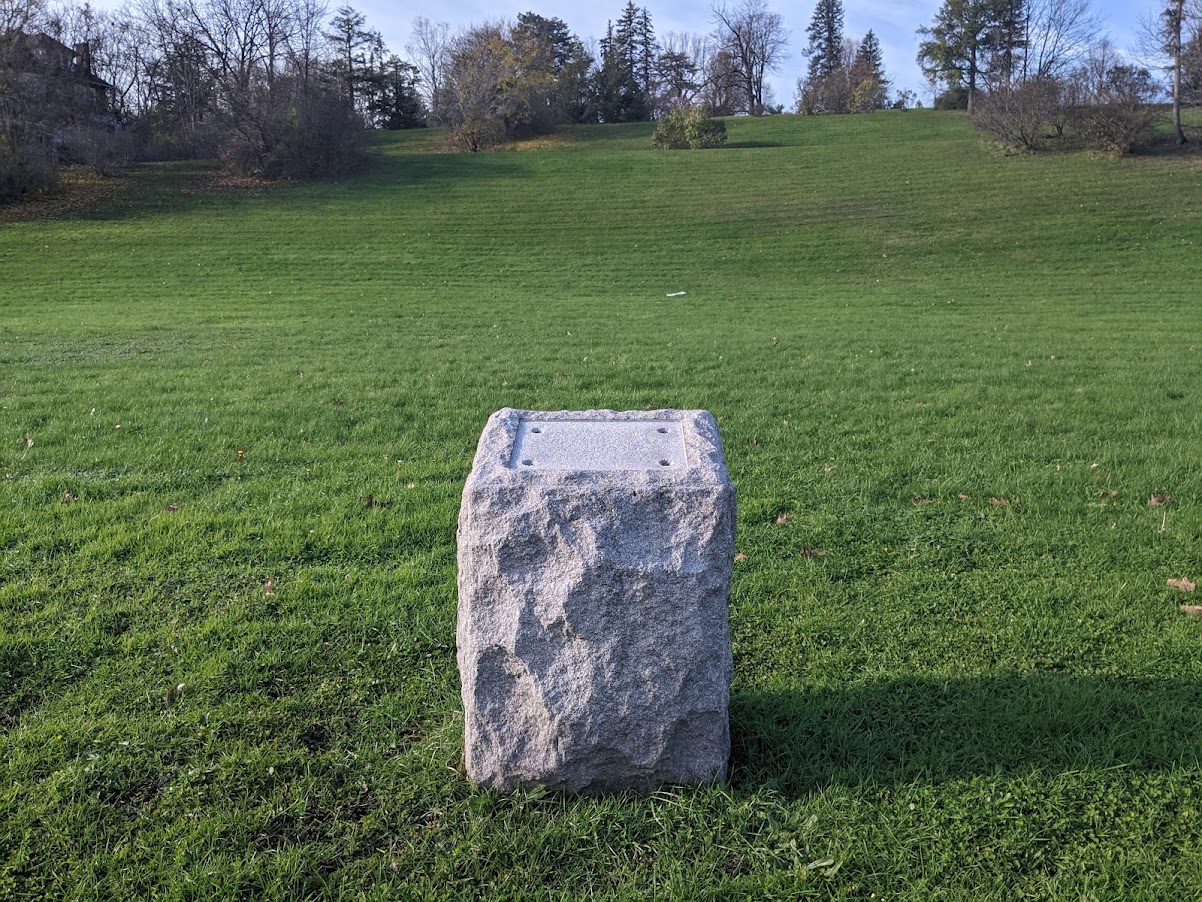
The second monument is nearby in Onondaga Park along the east side of Onondaga Avenue across from the City’s greenhouses. The plaque on this monument used to read:

Site of
Indian Attack
on Col. Van Schaick’s Expedition
against the Onondagas
April 21, 1779

Thankfully, someone stole the plaque many years ago. All that’s left now is a bare stone.

These two monuments tell an incredibly misleading story. The one on Colvin makes no mention at all of Van Schaick’s violent purpose, and the one that used to be on Onondaga makes it seem as if the ‘expedition’ only fought back after they were initially attacked. So in addition to being a grave insult to the Onondaga Nation, these monuments are also bring us out of right relation with our community’s true history.

It is inexplicable that these monuments still stand in City-owned parkland, and they should be removed. This isn’t applying modern sensibilities to past events—the Onondaga Historical Association thought this was a bad idea when the monuments were put up in 1929. It’s remained a bad idea for 92 years, and leaving them up one day longer is also a bad idea. Take these monuments down.