All posts by inthesaltcity

Neighborhood-Level Population Change

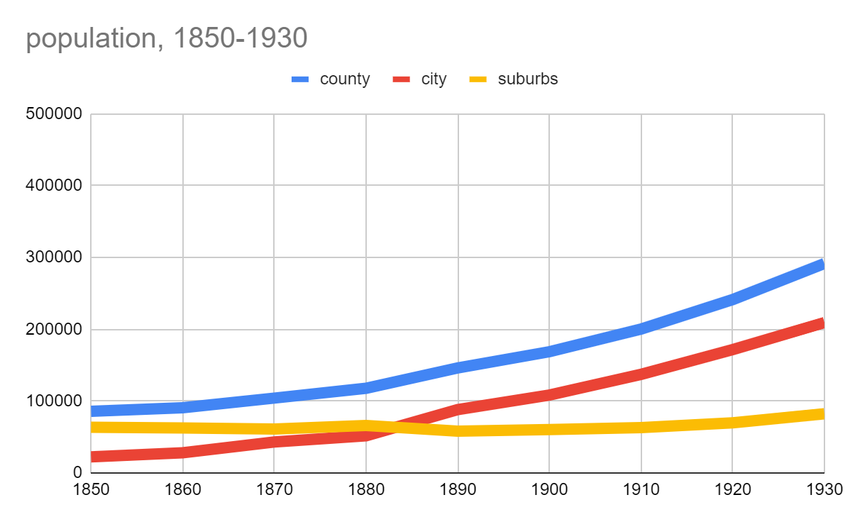
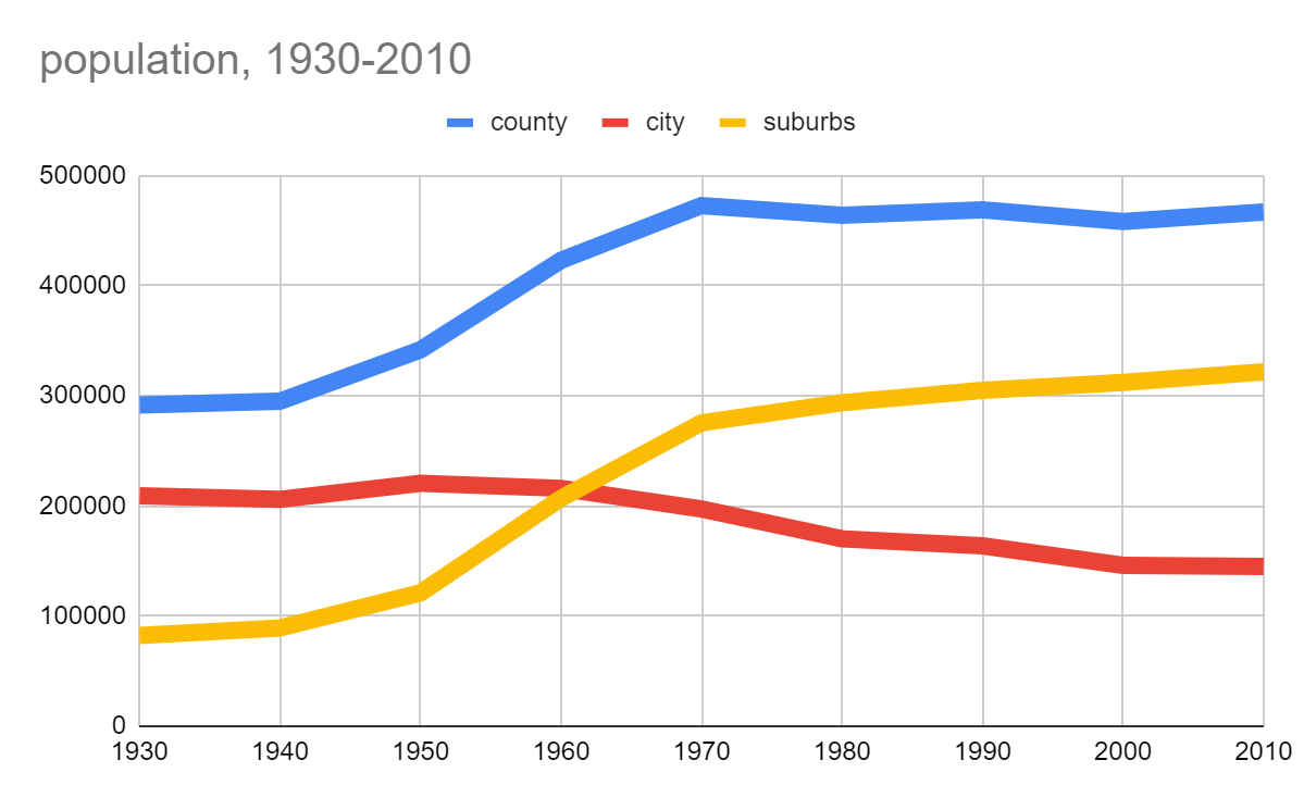
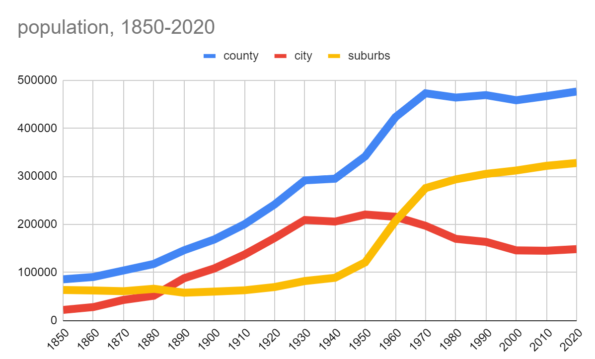
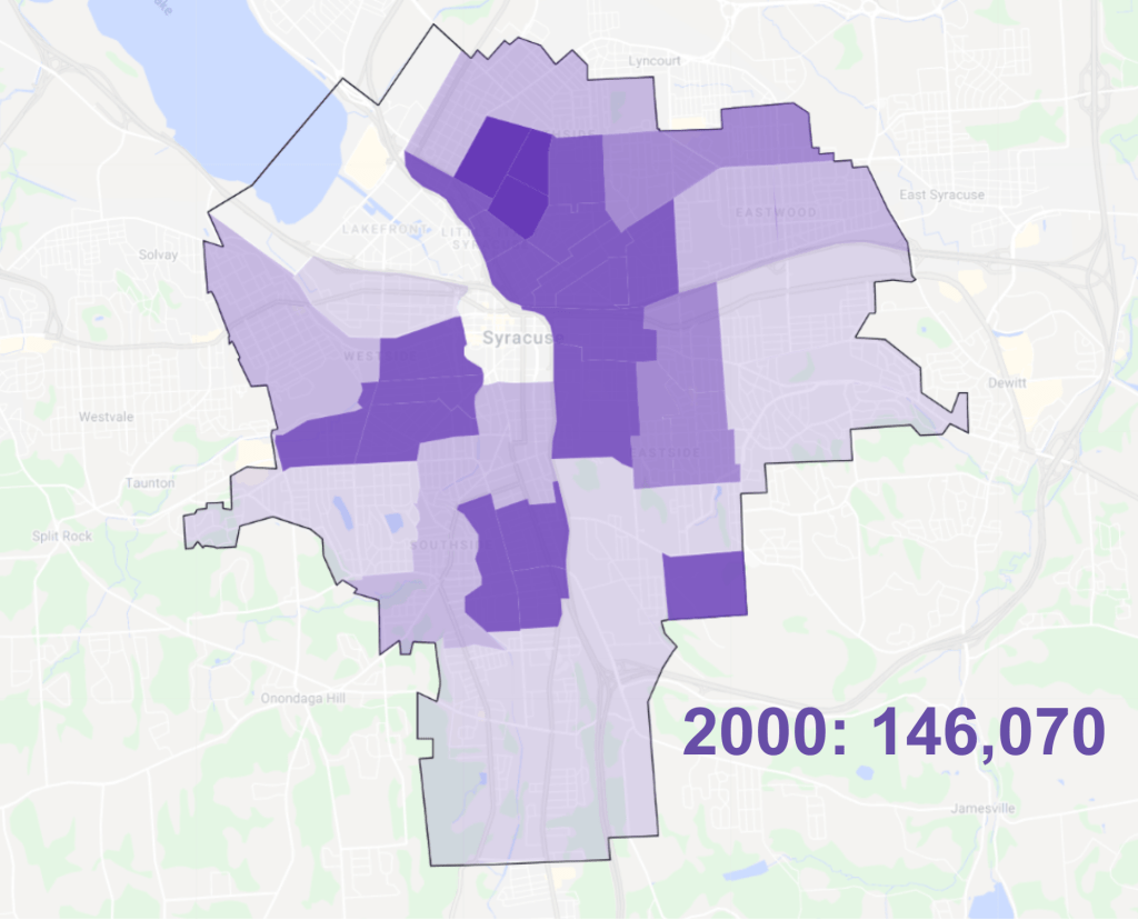
Since the 2000 census, the total number of people living in Syracuse has remained remarkably stable. From 146,070 people in 2000 to 145,170 in 2010 to 146,620 in 2020, the City’s topline population figure has never moved more than 2.4% between censuses, and the most recent count is within 1.7% of the 2000 count.

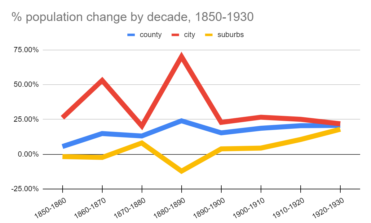
But that remarkably stable population figure obscures Syracuse’s massive demographic churn at the neighborhood level. Between 2000 and 2020 while the City’s overall population showed just a 1.7% increase, individual neighborhoods saw population shifts ranging from a drop of 21.7% to an increase of 59.1%.

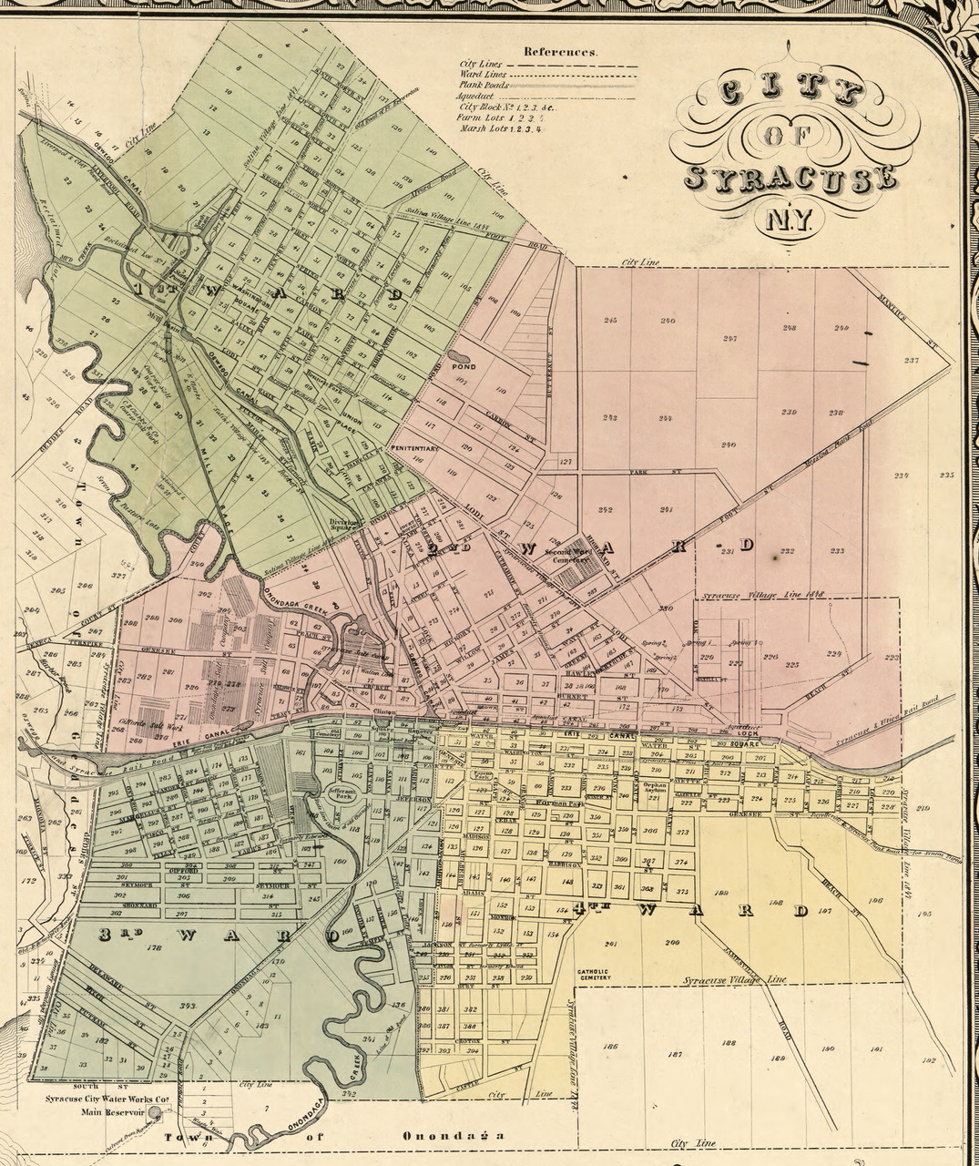
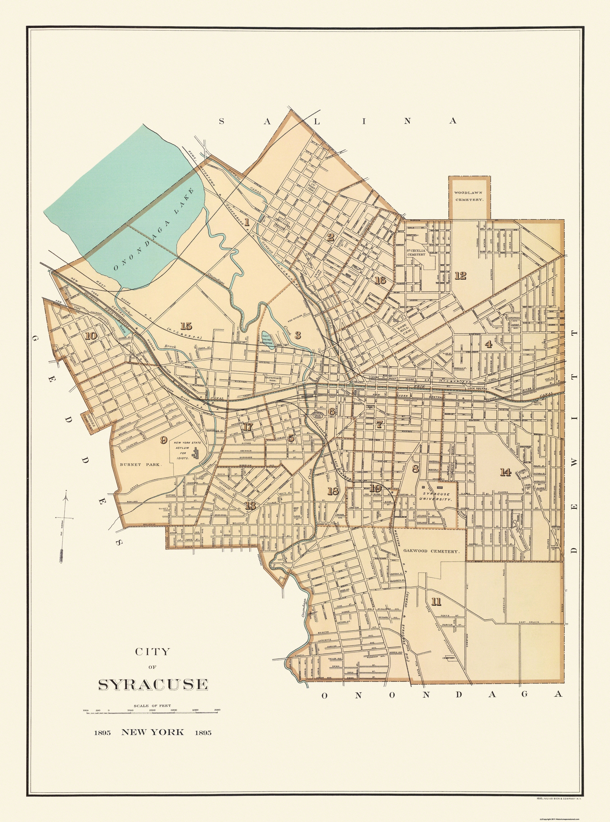
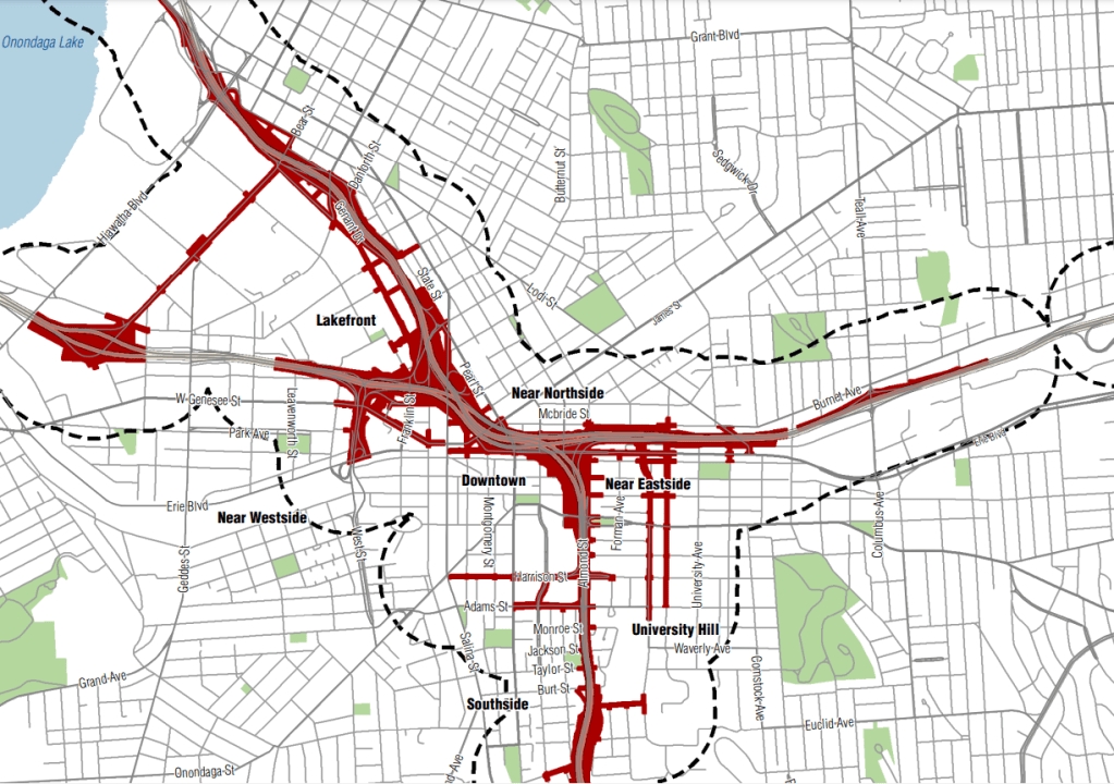
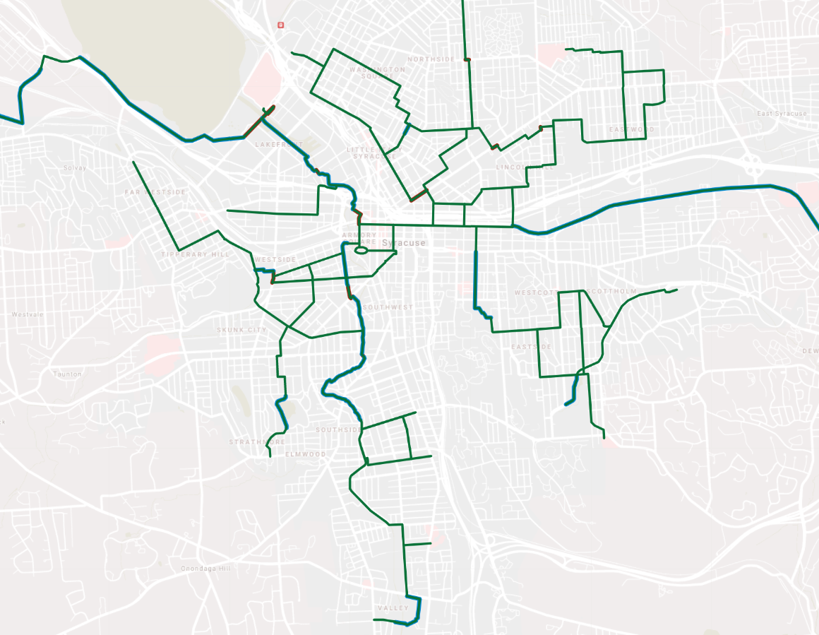
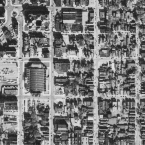
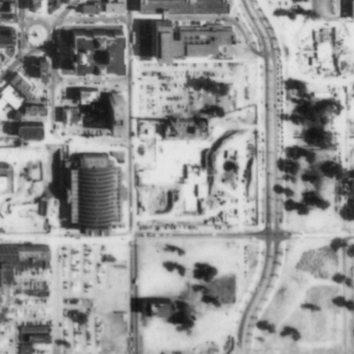
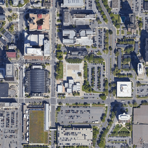
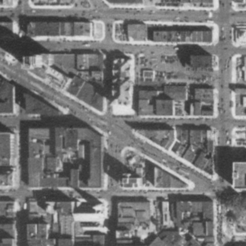
To see these neighborhood-level changes, we need to look at the census tract level. However, because the Census Bureau adjusts tract borders every 10 years, we have to group multiple tracts in order to compare similar areas over the 2000, 2010, and 2020 censuses. The map above shows the groupings (between 1 and 4 census tracts) used in this analysis.

These population change maps show the population shifts that have characterized Syracuse’s neighborhoods during the first two decades of the 21st century. The maps show areas that lost population in red, and areas that gained population in blue. The intensity of each color corresponds to the magnitude of the percentage change in population.

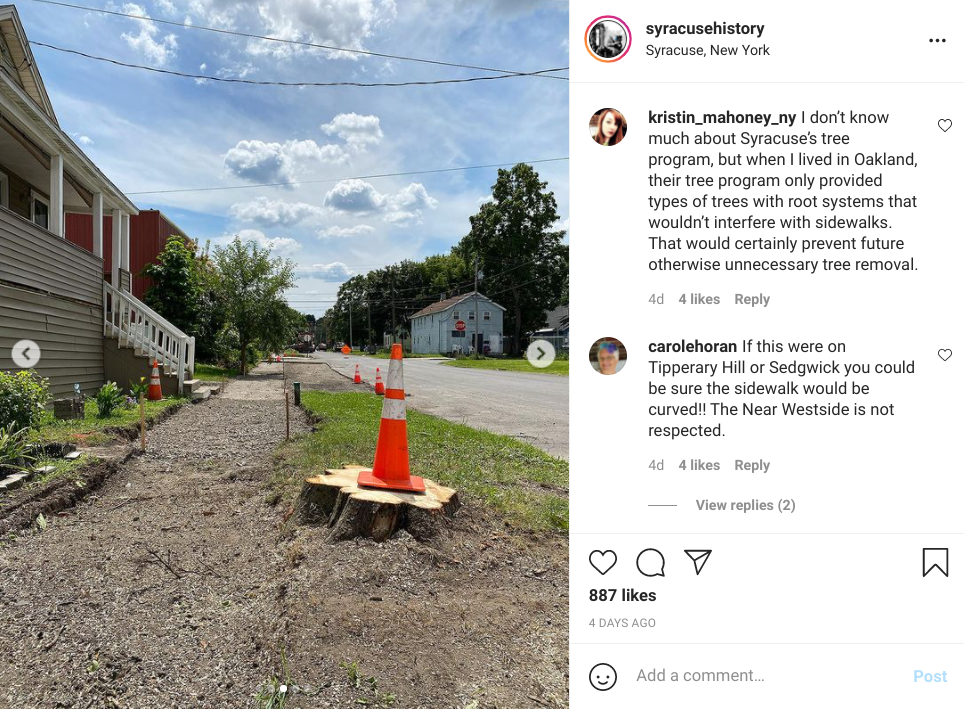
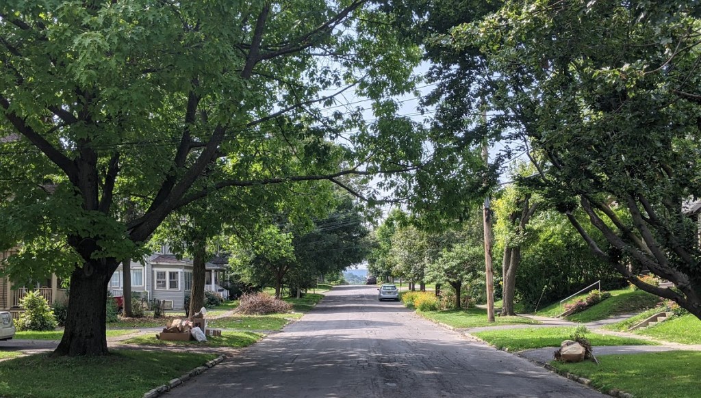
The Northside, the Valley, and University Hill all gained population during each of the last two decades. Salt Springs, the Southside, the Westside, Tipperary Hill, and Strathmore all lost population both from 2000 to 2010 and from 2010 to 2020.

These broad trends held constant over the last twenty years even though Syracuse as a whole shrank between 2000 and 2010 and the city grew between 2010 and 2020. The City gained population between 2010 and 2020 because Downtown and Franklin Square grew by an enormous amount (65.7%) after shrinking modestly the previous decade, and because outer neighborhoods like Eastwood and Outer Comstock grew rather than shrank during the last decade.

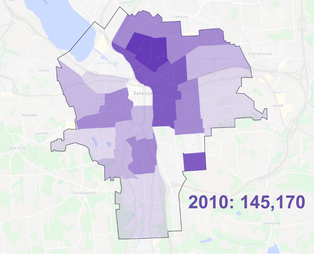
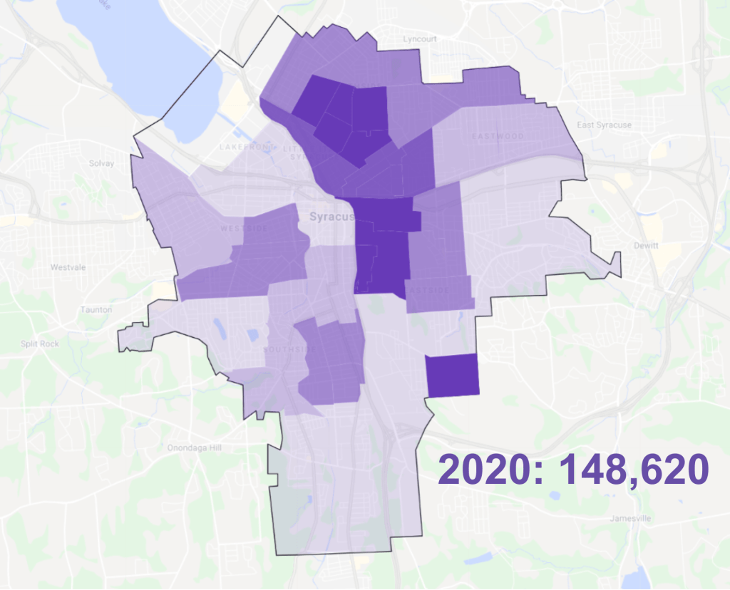
This series of density maps shows how those population trends have changed the concentration of people in different Syracuse neighborhoods has changed over the last 20 years. The South and West Sides lost a lot of density while the Northside and University Hill became much more densely populated and Downtown/Franklin Square gained some density (although this area is still nowhere near as densely populated as the surrounding inner city neighborhoods).

Overall, though, Syracuse’s patterns of density remained relatively stable between 2000 and 2020: outer neighborhoods remained sparsely populated while inner neighborhoods house lots of people in a relatively small area.


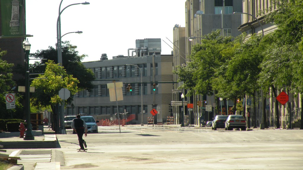
The total number of people living in Syracuse has remained essentially stable for the last 20 years, but the populations of the City’s neighborhoods have varied widely. The South and West Sides have lost a huge percentage of their total population while the Northside and the City’s center have grown dramatically. Looking forward, Syracuse will need to reverse these downward trends in its shrinking neighborhoods while also accommodating continued growth in its booming neighborhoods.

A New Kind of Population Growth

The 2020 census is a big deal for Central New York. Not only did the City of Syracuse post its first decade of population growth since 1950, but—more importantly—the City’s rate of growth exceeded the rest of the county’s. Between 2010 and 2020, Syracuse’s population grew by 2.38% while the towns’ collective population grew by just 1.88%.

To understand just how crazy this is, we need to back up to 1850: the first census taken after Syracuse became a city. From this point until 1930, Onondaga County grew from a population of 85,890 to 291,606—a 240% increase. Over the same period, Syracuse grew by 840% while the towns that make up the rest of the County grew by just 29%. Syracuse accounted for 91% of the County’s overall population growth during this time.

This was a period of rapid urbanization. Syracuse was a major city at the front of economic, technological, and social change, and people flocked to the city—both from the surrounding countryside, from elsewhere in the United States, and from overseas—to get a better life.

But what these raw numbers don’t show is how Syracuse grew. New housing for all these new people was often built at the edge of town, and the city would annex it in order to provide municipal services. New transportation technologies like electric streetcars facilitated day trips between the growing city and existing villages like Geddes (now known as Tipperary Hill), and the two municipalities agreed to join. Developers built brand new communities like Eastwood—designed from the beginning to function as a suburb of Syracuse—and the City eventually annexed them too.

So this period of rapid urbanization was also a period of suburbanization. Syracuse grew by growing outward—as cities like Houston still do today—and the towns appeared not to grow much at all because the City’s boundaries ate into theirs in order to encompass all of these new people.

All that changed after the 1930 census. The 1920s saw a huge increase in car ownership that made it easier for people to move far beyond the City’s municipal boundaries, and new laws made it harder for Syracuse to annex land from surrounding towns. Syracuse annexed Eastwood, Meadowbrook, and parts of Salt Springs, Strathmore, and Winkworth between 1920 and 1930—a huge increase in both land area and population—but it was the last time the City was able to annex any significant amount of land.

After 1930, the County’s population continued to grow, but that growth occurred in the towns. Between 1930 and 2010 they grew by 291% while the County’s overall population increased by just 60%, and the City lost 31% of its population.

This was a big change with huge implications for life in Onondaga County, but the demographic trends after 1930 weren’t so different from those before: the County as a whole continued to grow both in population and in extent of urbanized land as prosperity attracted new people, and new transportation technology made it possible for people to live further and further away from each other. The only difference is that Syracuse’s city line used to expand to capture all that sprawl, but since 1930 municipal boundaries have remained essentially static.

So the 2020 census is a big deal because it might signal that Onondaga County has moved into a new phase of population growth. For the first time since Syracuse stopped growing in land area, its rate of population increase outpaced the County as a whole. The city’s population rose by 2.38% while the County gained just 2.03% and the towns only added 1.88%. For the second time since 1850, the lines on the graph on the right have intersected, and Syracuse is again adding people more quickly than the towns.

But what’s different this time is that the City is gaining population without spreading out. All of this past decade’s population increase occurred within a set boundary line. For the first time in its history, Syracuse has managed to house more people without subdividing farmland or forest, without lengthening anyone’s commute, without extending the sewer mains.

This is a new kind of population growth for Onondaga County. It’s fiscally sound because it fosters growth without overextending municipal infrastructure. It’s environmentally sustainable because it accommodates new people without using up new land and without requiring people to spend an hour of everyday behind the wheel of a car. It’s exactly what our community needs in order to meet the challenges of the 21st century.

Lay new sidewalks, keep old trees

This should have gone without saying, but the municipal sidewalk program should preserve as many existing street trees as possible. Tall trees with full foliage shade the sidewalk and make walking around the City more bearable in Syracuse’s steamy summers. A sidewalk—even a brand new perfectly level one—will not be a good place to walk if it’s fully exposed to the elements.

So it’s really very bad that City Hall is trying to fix the sidewalks by cutting down a bunch of decades-old trees. There may be cases where a tree is so close to the sidewalk and its roots are so disruptive that it’s truly necessary to remove the tree in order to build a new ADA-compliant sidewalk. In those rare instances, fine, cut down the tree, but make sure to replace it immediately to avoid the same problem in the future.

But, as Syracuse History has pointed out, City Hall is choosing to cut down trees even when it’s not really necessary. It was probably easier, cheaper, and faster to just cut down this fully grown tree, but it wasn’t necessary. The sidewalk could have curved around the tree, it could have been raised over the roots, they could have removed just a single root. There are plenty of ways to build a decent sidewalk and preserve the mature trees that make walking safer, healthier, and more pleasant.

The Mayor has been making the case that Syracuse needs more trees. He’s using covid relief money to plant a bunch and wants to increase the City’s canopy by about 25%. That’s a good goal, but he will never reach it if he starts by removing the trees we already have.

Cutting down fully-grown street trees in order to lay new sidewalks is penny-wise and pound-foolish. Street trees take decades to grow tall enough to provide all of their benefits. The trees we have now are gifts from previous generations that we can’t quickly replace. City Hall needs to figure out how to lay new sidewalks and preserve these treasures.

The Grid and Bus Rapid Transit

The I-81 project can and should help build a Bus Rapid Transit system in Syracuse. BRT will make public transportation much more useful for current riders, it will attract many new riders, and it will reduce traffic congestion and improve traffic safety for everybody who uses Syracuse’s streets.

In the DEIS, NYSDOT lists “maintain[ing] access to existing local bus service and enhanc[ing] transit amenities within the project limits in and near Downtown Syracuse,” as one of the I-81 project’s five objectives. These transit amenities “could include bus stops and shelters, bus turnouts, and layover and turnaround places.”

NYSDOT elaborates:

“Apart from the Downtown transit hub, Centro has few amenities for its customers. Most stops have a sign, but no seating, lighting, or shelters. Syracuse has a temperate climate with cold winters and hot summers, and the city sees substantial snowfall each year. Lacking any amenities, customers must wait for buses outdoors without the protection of shelters. Where practical, enhanced amenities for riders could provide a better experience for transit customers and facilitate their use of existing transit services.”

This is good. It is ridiculous that the snowiest big city in the nation asks its bus riders to stand in the street to catch the bus in the winter. It is ridiculous that a town where the sun sets as early as 4:30 pm doesn’t provide adequate lighting at its bus stops.

But even though better amenities are good, what we really need is better service. Even the most comfortable bus shelter won’t do much if riders have to wait an hour for the bus to show up.

Luckily, Uplift Syracuse just released a new report—“Better Bus Service”—that shows how investing in infrastructure like better bus stops can make more frequent service more possible by speeding up buses and reducing the annual operating cost of providing improved service.

Basically, faster buses cost less to run than slower buses because they allow a single operator to complete more runs in a single shift. Uplift Syracuse estimates that if bus speeds on Centro’s best performing corridors could be increased from roughly 10 mph to 15 mph, then Syracuse could have an 8-line, 28-mile, citywide network of fast and frequent rapid transit service for roughly $8 million per year—that’s significantly cheaper than Syracuse Metropolitan Transportation Council’s estimate that running a network of just half this size would cost $8.3 million annually.

NYSDOT is willing to build new transit infrastructure anywhere in the I-81 project area shaded red on the map above. This area overlaps with much of the central portion of Uplift’s proposed BRT system. Here are the specific projects NYSDOT should build in order to advance Bus Rapid Transit in Syracuse:

New Stations

potential BRT stations located in the I-81 project area

BRT stations are significantly different from the bus stops Syracuse knows now. They are more than just a place to wait—BRT stations actually increase average bus speeds by minimizing the amount of time that it takes for riders to board and alight from the bus.

BRT stations do this in two ways. First, they are raised up above the sidewalk to sit even with the bus floor. That makes it easier for everybody to get on and off the bus, and it’s especially important for people who use mobility devices. Second, they allow riders to pre-pay their fare while waiting for the bus to arrive. This makes boarding much faster because it eliminates the line at the farebox.

And BRT stations do also have the amenities that every bus station really should have: shelter from the snow, rain, and sun, a nice place to sit, lighting, and real-time information about when the next bus will arrive.

the park at the intersection of Butternut, North Salina, and North State Streets will host a major BRT transfer station

Several potential BRT stations are located within the I-81 project area. One of the most important is the small park at the intersection of Butternut, North Salina, and North State Streets. That’s where two BRT lines will converge, and a station on that park would allow riders to transfer between those lines without the need to cross the street.

Other potential BRT stations are on Fayette near Crouse and Irving, on State Street at Willow, on Adams at McBride, and at the corner of Adams and Irving. Centro needs to finalize its plans for where to locate new stations, and then NYSDOT needs to build the ones that will be in the I-81 project area.

Transit Lanes

potential Transit Lanes located within the I-81 project area

Transit Lanes speed service by letting buses bypass traffic congestion. Syracuse doesn’t have much traffic congestion so transit lanes probably won’t be necessary across most of the City, but Downtown streets do sometimes back up during rush hour. Happily, these same streets are significantly wider than they really need to be, so there’s plenty of room to give BRT buses their own space.

Major streets in the I-81 project area that might also have BRT service are Adams, State, James, Willow, and Salina. In all cases, the I-81 project area does not extend far enough to cover the entire portion of these streets that would need transit lanes, so it will be up to City Hall to complete the work of extending those lanes along State from Erie Boulevard to Harrison Street, say, or along Adams from the Hub to Irving.

These transit lanes will ensure that buses keep their schedules no matter the traffic Downtown, and that will make for faster, cheaper BRT service.

potential Transit Lanes located within the I-81 project area in dark blue with those located outside the project area in light blue

All of these minor transit infrastructure proposals are within the I-81 project area, all would meet one of the five objectives that NYSDOT has set for this project, and all would move Syracuse closer to getting the public transit system that we need and deserve. Let’s make them part of the final I-81 project.

You can let NYSDOT hear about it at this link: I-81 comment form

The Grid and the Northside

The I-81 Draft Environmental Impact Statement showed how NYSDOT’s plans to tear down the viaduct will change Downtown and the Southside, but that document also contained some very good plans for the Northside. By improving access to one highway onramp and removing several others, NYSDOT will make the Northside’s streets safer.

Pearl Street is a major onramp to 81 northbound, and it will become even more important once the Grid gets built. But right now, it’s not very easy to get to Pearl Street. A lot of traffic from Downtown comes up State Streets, crosses James, takes a left onto Willow, and then a quick right onto Pearl and the highway.

To accommodate all those highway-bound cars, traffic engineers turned State Street into a 5-lane 60-foot-wide racetrack between Fayette and Willow. It’s an unpleasant place to walk, a deadly place to bike, and a terrible place to run any kind of street-facing business besides a gas station (there are two on this short ⅓ mile stretch of de facto highway).

When NYSDOT tears down 81, they’re also going to extend Pearl Street two blocks south to Erie Boulevard. Then, car traffic from Downtown to 81 northbound will take Erie to Pearl to the highway, significantly reducing the number of cars on North State Street.

NYSDOT is also putting a fully protected bike lane on State Street from Water Street to James. This will provide a direct connection between the Empire State Trail and one of the flattest routes across the Northside.

The intersection of State, Salina, and Butternut Streets is a major gateway to the Northside, but it’s seen better days. There are some good local businesses hanging on, but many storefronts are vacant and so are a lot of the upper floors of the buildings surrounding the triangular intersection.

Again, a major problem is a nearby highway onramp that attracts too much car traffic. Actually, there are two: the onramp that comes off the Butternut Street bridge and the State Street onramp a block north of that. These two getaway points for suburban commuters draw thousands of cars from Downtown through this square, and they fill what should be a pleasant public space with noise and exhaust.

NYSDOT’s Grid plan will eliminate those two highway onramps. There’s just no need for them with an improved onramp at Pearl Street. NYSDOT also plans to reconstruct the Butternut Street bridge to make it narrower and safer, and they want to give away the land at the northwest corner of State and Butternut that’s currently being wasted with parking and an onramp.

With all those cars gone, new space for a new building that can house people and help ‘enclose’ the square, and a planned future BRT station, this intersection should become a major focal point linking the Northside to Downtown.

NYSDOT will do similar good work further north by removing highway exits at Spencer and Basin Streets. These ramps bring high-speed traffic to neighborhood streets, and they are a barrier between neighborhoods.

Take the Spencer/Catawba exit. There are three brand new Franklin Square apartment buildings within a walking distance of the North Salina Street business district, but the only way to get between the two neighborhoods is the Spencer Street bridge. Because a highway offramp dumps cars travelling 60 mph off right at that bridge, it’s not a very nice place to walk, and very few people do. Removing the Spencer Street offramp will make it much easier for people to walk the short distance between the Northside and Franklin Square, and that will be better for both neighborhoods.

NYSDOT’s plan for the Community Grid will remove 9 of I81’s off and onramps between Hiawatha Boulevard and I690. That will significantly reduce high-speed traffic on the Northside’s local streets, it will make the neighborhood safer and more pleasant, and it will better connect neighborhoods currently divided by the highway.

Getting the Grid’s details right

NYSDOT’s new I81 project report lays out a good framework to undo the damage that car-only transportation planning has done to Syracuse. But although the overall vision of the Grid is good, NYSDOT needs to change some significant details of the Grid’s design in order for this project to be as effective as possible.

When you get into the nitty gritty of the design drawings, there are some troubling details. The National Association of City Transportation Officials (NACTO) says that travel lanes on city streets should be 10’ wide—maybe 11’ if it’s a major trucking or transit route — but NYSDOT plans to build Almond Street with four 12’ wide travel lanes. That’s the standard for highways, and it’s the same lane width that NYSDOT plans to use for the grade-separated portions of 81.

NACTO also says that curb radii—a measure of how sharply a car has to turn at an intersection and a key determinant of pedestrian safety—should be no more than 15’ in order to make crosswalks safe for people on foot. NYSDOT plans for 15’ curb radii on many local streets, but on Almond most intersections will have curb radii of between 20’ and 35’, and the intersection of Almond and Erie Boulevard will have a mammoth 65’ curb radius.

NYSDOT also intends to speed traffic on Almond by leaving out crosswalks for existing intersecting streets. People on foot and bike won’t be able to cross Almond Street at either Madison or Monroe Streets even though NYCLU specifically called for a crosswalk at Monroe, and even though Madison is a prime candidate for a neighborhood greenway connecting Downtown, University Hill, and Westcott.

These are design standards for moving cars at very high speeds with little consideration for people who might travel the street by foot or bike. In fact, NYSDOT predicts that Level of Service—“a qualitative measure used to describe the experience of a user on an urban street segment”—will be significantly worse for pedestrians and bicyclists than it will for car drivers. Levels of Service for cars on Almond Street range between grades of A, B, and C, while people using the sidewalks and bike lanes get service grades of C and D.

NYSDOT also predicts that their design could actually increase the number of cars on local streets by bringing more interstate through-traffic into Downtown:

“Businesses on BL 81 south of I-690 would experience an increase in pass-by potential customers, which could marginally benefit sales. Furthermore, the business loop designation may attract through travelers on I-81 looking for convenience retail and restaurant uses.”

NYSDOT helpfully lists the types of businesses that would likely benefit from this added traffic and might want to set up shop along Almond Street: “gas stations, convenience stores, and fast food.”

The design standards NYSDOT is proposing—12’ lanes, large curb radii, and limited access from local streets—are identical to those that define the West Street arterial between Fayette and Onondaga Streets. That hostile highway is a significant barrier between Downtown and the Near Westside, and we shouldn’t be replicating its failure along Almond Street.

It’s possible to make a very wide street that actually fits in a city and knits neighborhoods together, one that’s pleasant to walk or bike along, one that will support small-scale retail and attract quality housing.

Eastern Parkway in Brooklyn, for instance, is a really nice street even though it carries three lanes of traffic in each direction. It’s lined by apartment blocks and businesses that cater to the neighborhood—not interstate through traffic. Crucially, Eastern Parkway has narrow travel lanes (10’), many intersections, and sharp corners at those intersections to encourage drivers to slow down when they turn through the many crosswalks.

This is the kind of street we should be building in the center of Syracuse—not another grade-level high-speed arterial. NYSDOT is accepting comments on their most recent design. Let them know.

Sidewalk maintenance and street trees

Sidewalks and street trees both make it easier, safer, and more comfortable to get around town on foot, so Syracuse’s new municipal sidewalk program and Urban Forestry Master Plan should make life better for pedestrians. But these two programs might work against each other if they’re not coordinated.

One side of the problem is that the sidewalks need fixing—in many cases—because tree roots have messed them up. Trees planted too shallow send their roots out near the surface, and they lift individual pavers to make the sidewalks impassable for people with wheelchairs, a headache for parents with strollers, and a hazard for anyone on foot. In many cases, fixing the sidewalk will mean removing a poorly planted tree.

The other side of the problem is that planting a new tree the right way often requires tearing up the sidewalk. Trees wont send their roots through the sidewalk if they’re given enough room, and on streets where there’s only a little space between the sidewalk and the curb that means planting the root ball deeply and partially underneath the sidewalk. Of course, that’s only possible if you tear the sidewalk up to plant the tree.

It’s not hard to imagine where this could lead: a tree gets cut down to fix the sidewalk, then a little while later, the sidewalk gets torn up to plant a new tree. The end result is less tree cover and a newly-busted sidewalk, and City Hall’s spent a lot of money to make the street worse.

Luckily, we have a model for doing this right. The Dig Once program coordinates pavement reconstruction with utility maintenance on Syracuse’s streets to minimize construction disruptions, save money, and to preserve the new smooth street surface for as long as possible. Basically, whenever DPW rips an entire street up in order to repave it, they fix everything underneath the street before laying new asphalt back over top. This is the kind of common sense coordination that delivers better municipal services without any extra cost to the public.

City Hall should take the same ‘Dig Once’ approach with its municipal sidewalk program. Tearing up a sidewalk in order to lay down a brand new one? Check with the City Arborist to see if that block is in line to get new trees, and let them get planted nice and deep before pouring the new concrete surface. It’s that simple.

Syracuse is used to hearing that it can’t have nice things because we can’t afford them, but a lot of times it’s less a matter of money and more a problem of just doing things efficiently. That’s the case with rebuilding our pedestrian infrastructure. We have the money for sidewalks, and we have the money for new trees—we just need to spend that money intelligently in order to buy a better City for people who get around on foot.

Safe flat bike routes across town

The hardest part about riding a bike in Syracuse is figuring out the best route to get somewhere new. The City’s hilly topography and terrible post-war city planning have combined to create very few safe flat routes across town, and so an unplanned bike trip is likely as not to put you in danger or wear you out.

City Hall, the County, and the State have done some good work to fix this problem on certain routes, and it’s not too hard to imagine how they could easily do more, but too many pieces of “bike infrastructure” in this town fail to actually improve safety, and what’s left isn’t enough to get you everywhere you need to go.

The Syracuse Metropolitan Transportation Council’s Bike Suitability Map tries to help with route planning by rating a large number of streets according to their “suitability” for biking, but the map has its own problems. First, the ratings do not match the lived experience of riding a bike. For example, Westcott Street gets a higher rating between Broad and Beech than it does between Beech and Dell. This may be due to the lower overall traffic volumes on Westcott’s southern end, but anybody who has ever biked the street knows that cars crawl safely through the business district but speed like maniacs south of it.

Second, the map doesn’t really account for hills. It shows where streets go up extremely steep hills, but it doesn’t account for that slope in its ratings and it ignores most of the hills in the City. The 50’ hill on Willow Street between Lodi and Highland, for instance, doesn’t show up. Neither does the 40’ hill on Bellevue Avenue between Summit and Clairmonte.

Third, the map limits itself to public streets and therefore misses many of the cut-throughs that connect many of the best biking paths across Syracuse. There’s nothing about how to get across SU’s campus, through Clary Middle School’s parking lot, or over the gravel path that connects Carbon Street to the Farmers Market.

So here’s a map of the bike routes that people would really use to get across the City. The green lines show the shortest, flattest, safest routes between many points in Syracuse. These routes avoid streets with dangerous traffic, and where they cross those streets, there is often a 4-way stop or a traffic light. They are good routes for someone who is trying to get around town on a bike for the first time.

In places, these routes jump onto the sidewalk to avoid heavy traffic—like on James Street between Catherine and Townsend. Where that happens, the path is outlined in red.

The blue highlights indicate where a route is fully separated from regular traffic. This includes both intentional bike infrastructure like the Canalway Trail on Erie Boulevard and also unintentional infrastructure like Fowler’s parking lot connecting Marcellus and Magnolia Streets.

I’m more familiar with some areas of the City than others, and the map definitely reflects those gaps in my knowledge. If you know of a really nice easy route that’s not on the map, please tell me about it! The map is on google drive and I will keep updating it.

safe flat bike routes across town

Plant more trees in Clinton Square

Clinton Square is Syracuse’s premier civic space. Bob Haley calls it “the center of the center of the center.” It’s the spot where the City of Syracuse started. It’s the site of our biggest city festivals. It’s where we gather as a community.

City Hall has always taken special care of the space. It’s been rebuilt several times since the Erie Canal defined the square 200 years ago, and the most recent renovation from 2001 added a beautiful fountain that recalls the canal’s original path through Downtown and provides a great place for kids to cool off in Syracuse’s increasingly hot summers.

But spend much time in Clinton Square, and it’s obvious how much better the space could be. While people gather in the fountain and the paved area along Water Street, they shun the northern part of the square along Genesee. It’s not hard to see why: sitting at one of the picnic tables near the Soldiers and Sailors monument is basically unpleasant. You’re stuck in the hot sun, and it’s hard to maintain a conversation over the noise of nearby car traffic. The too-open space feels more like a parking lot than a park, so people stay away.

Like so many unpleasant things Downtown, this is the result of car-first 20th century urban renewal. West Genesee Street is designed for much faster traffic than it used to handle, and the Post-Standard building sits much farther back from the street than the buildings it replaced. So instead of a quiet, comfortable space like you can find along Water Street, the north side of Clinton Square feels noisy and exposed.

But fixing those problems is a pretty heavy lift. City Hall plans to completely reconstruct Genesee Street without making any meaningful changes to its design, and the Post-Standard building’s new owners just announced that they intend to redevelop it without making any significant changes to the exterior.

Fortunately, there’s a much simpler short-term solution for Clinton Square: plant trees—lots of them—on the grassy lawns on either side of the Soldiers and Sailors Monument. Trees would solve most of the problems with that side of the square. They’d provide shade, they’d slow cars, they’d deaden traffic noise, and they’d make the space cooler in summer.

Trees would also make the rest of the square feel more comfortable by ‘enclosing’ the space. Right now, there’s so much empty space north of Clinton Square that you can see clear to St. Joseph’s hospital. Lots of trees along the fountain’s northern edge would block that view of parking lots, highways, and potholes, and they would make the entire square feel much more protected and intimate.

City Hall’s recently released Urban Forestry Master Plan calls for planting 3,500 new trees in the City every year in order to increase quality of life and decrease urban heat islands. That’s exactly what Clinton Square needs, and when City Hall starts planting those new trees they should make the community’s premier civic space a top priority.

How cars killed Syracuse

81’s construction was a cataclysmic event in Syracuse’s history. Building the highway—and 690 soon after—meant tearing down dozens of city blocks and demolishing hundreds of homes. But although that event stands out for the scale of its destruction, it was neither the beginning nor the end of Syracuse’s campaign to demolish itself. Aerial images from 1938, 1951, 1966, and 2021 show how the area now known as Downtown has been gradually turned to asphalt in order to make room for cars over the course of decades. As NYSDOT prepares to remove the I81 viaduct from Downtown, they must account for the broader damage done to Syracuse by all of these cars.

To see some of the highways’ most direct devastation, look at the corners of Pearl and Canal Streets. That intersection used to be the northern edge of Downtown—now it doesn’t even exist. The three city blocks that surrounded it are completely covered by the 81/690 interchange.

But even through the interchange wouldn’t destroy these blocks until the 1960’s, the car had already started degrading the area by 1951. Compare the image from that year (second in the series) to the one from 1938 (first in the series). A handful of buildings and some green space from the 1938 image are gone just 13 years later, all replaced by surface parking lots.

The highways accelerated this degradation elsewhere in the City. 81 did less direct damage around Forman Park, but it preceded a similar scale of destruction by creating an enormous need for car storage that Syracuse supplied by demolishing dozens families’ homes.

Two church buildings survived this demolition derby, but their congregations didn’t. According to the logic of the day, I-81 should have made AME Zion and First Christian Scientist more accessible (by car) than ever, but destroying their neighborhood meant emptying the church buildings. Both congregations are still active in 2021, but they have had to build new houses of worship closer to their congregants’ new neighborhoods.

A little further south, Syracuse has tried to create institutions that can withstand the destruction of the surrounding neighborhood. The War Memorial, the Everson Museum, and the OnCenter are all supposed to capitalize on the highways by drawing people from the entire region. No one needs to live near these attractions because the car makes them accessible from any home in the County. There just needs to be enough space to store everybody’s car once they get Downtown, and Syracuse found that space by demolishing people’s homes (specifically, Black people’s homes).

City Hall cleared much of this land at the same time NYSDOT was building 81, but the War Memorial (and its parking lot) came before any of that wholesale destruction, and the OnCenter (and its parking garage) came much later.

Even places not directly affected by the highway construction program have seen this same pattern of car-driven demolition. The area around City Hall has been losing buildings—and even whole streets—to car storage since the 1920’s. The small park in front of City Hall is now car storage. So is the Yates Hotel and most of what used to be Genesee Street between Montgomery and State. All of this happened between 1961 and 2021, after the construction of the highways.


The highways aided, abetted, and accelerated Syracuse’s destruction, but they did not cause it. The City has been destroying itself ever since the first people bought cars, moved out of town, and demanded that Syracuse remain completely accessible to them.

So it’s been alarming to watch NYSDOT justify the Grid by pointing out how little it will affect driving conditions for suburban commuters, or to see their plans for replacing the West Street interchange with parking lots. Just removing the highway (or 1.1 miles of it) won’t fix the basic problem. We also have to make it so that people don’t feel the need to bring (and store) their cars Downtown.

That means deconstructing the system of arterial streets that feed the highways. It means building the grid so that it can’t carry the same amount of traffic that runs over the viaduct today. It means making it safe, easy, and pleasant to bike or bus across the City. It means building new housing on all of those parking lots so that more people can live in the City Center and get around it on foot.

Syracuse is a city, and cities are for people. For 90 years, our City’s leaders have been trying to replace people with cars, and they’ve done a pretty thorough job of it. The 81 project is a real chance to change course, but we have to make sure that NYSDOT understands that opportunity and acts on it. When they release their final Environmental Impact Statement this summer, watch to make sure that it goes beyond just removing the viaduct and puts Syracuse on a path to rebuild itself.