Category Archives: Transportation

Transit to Suburban Jobs

There’s not much doubt that Centro will run a bus line to the new computer chip factory on Route 31 when it opens. What’s not so clear is how good the service will be, or if it will meaningfully improve anybody’s life.

Centro designs its service—particularly suburban service—as a kind of social safety net. It’s designed for people to have to ride because they are too poor to afford a car, and because they have no other option they’ll put up with the bare minimum of service—a handful of buses a day in each direction.

This model is fatally flawed. Nobody has to ride the bus. Everybody—even people who don’t own cars—has other mobility options like catching a ride with a friend or family member, taxi services like Blue Star or Uber, and ad hoc jitney services. Centro can’t rely on ridership from everybody who can’t afford a car, because there are many other low-cost options for getting around. It has to outcompete all of them too.

And bare-bones, safety-net service simply can’t outcompete a taxi or a jitney or a ride from a friend when it comes to commuting. This kind of service offers riders one bus—one single chance—to get to work on time. If you miss it because your kid needs extra help one morning, because the bus never came, or because sometimes everybody just runs a few minutes late, you’re at least out of a day’s pay and at most out of a job. That’s simply too big a risk for anybody to take every single day, and so even people who can’t afford a car will spend a lot of money on cab fare to avoid it. The stakes are just too high.

For Centro to run a successful service that people will actually use, they have to eliminate, or at least mitigate, that risk by running more buses. Frequent service—a bus every 10 to 15 minutes—gives people multiple options to make it to work so every single morning isn’t weighed down by the possibility of economic ruin. You try to catch the bus that gets you to the job with 15 minutes to spare, but if you miss that one then the next bus still gets you to work 5 minutes before you clock in. You can keep your job even if your morning doesn’t go exactly to plan.

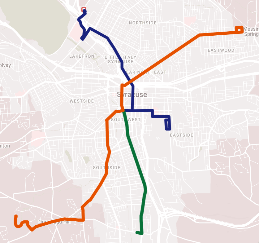
Frequent, practical, competitive transit service costs money. Centro has to pay their operators, they have to pay for gas, they have to maintain a bigger fleet of buses. Uplift Syracuse estimated that upgrading Centro’s 8 best-performing lines to truly frequent service would cost about $8 million per year, and that was before Covid made it so much harder to hire new bus operators.

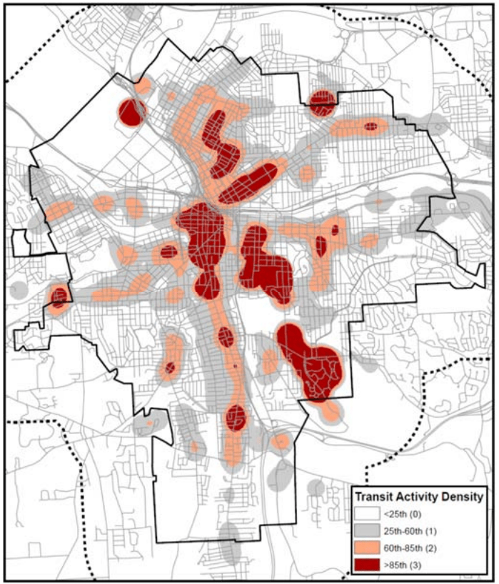
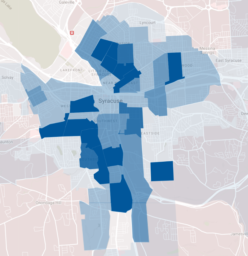
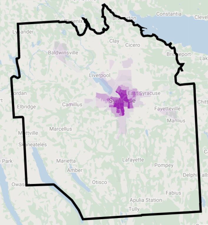
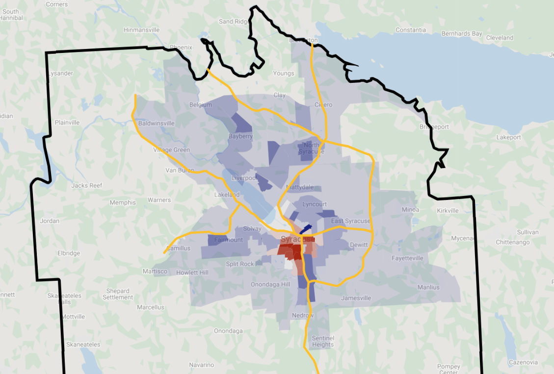
And since Centro doesn’t have nearly enough money, they rightly direct their funding to frequent service where it will do the most good: corridors where lots of people live, work, shop, worship, etc. That means James Street, Salina Street, Genesee Street, Butternut Street, Erie Boulevard, South Avenue. Centro’s best-performing lines are in the City where traditional development patterns are well suited to frequent transit service. There are currently no corridors outside the City that come anywhere near Syracuse’s levels of population and job density, and that’s why there is no decent bus service to the suburbs that anybody can rely on to get to work.

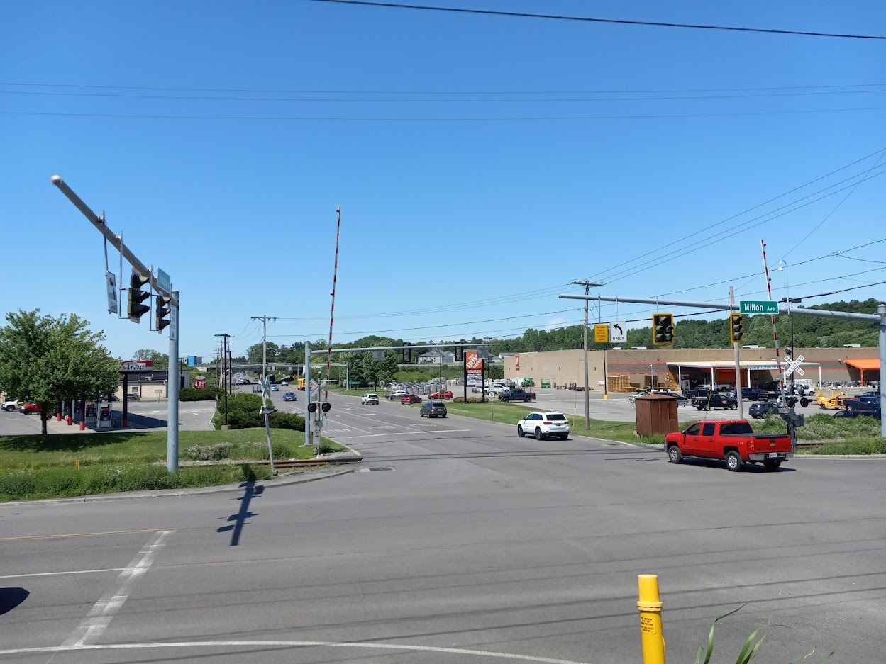
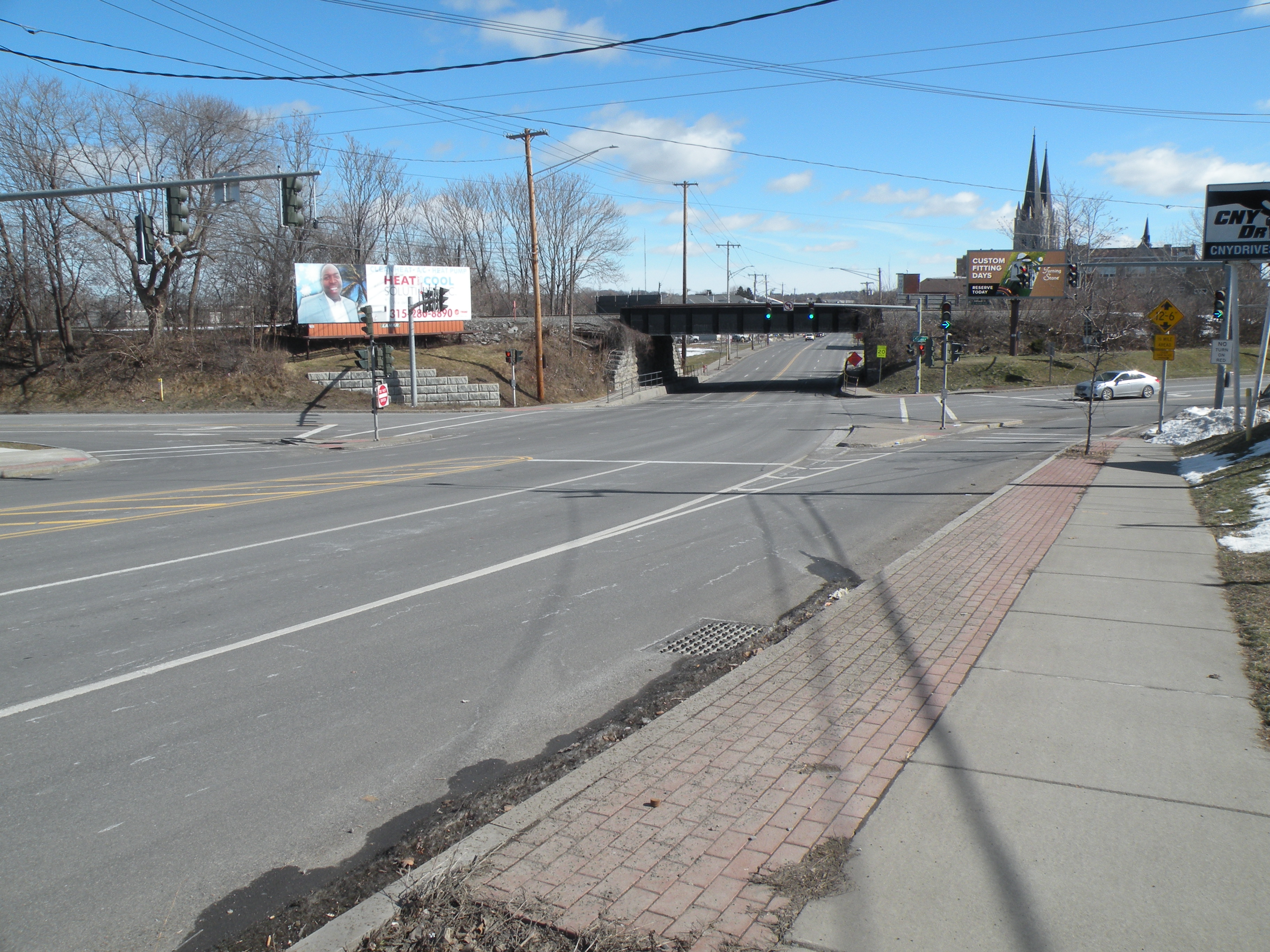
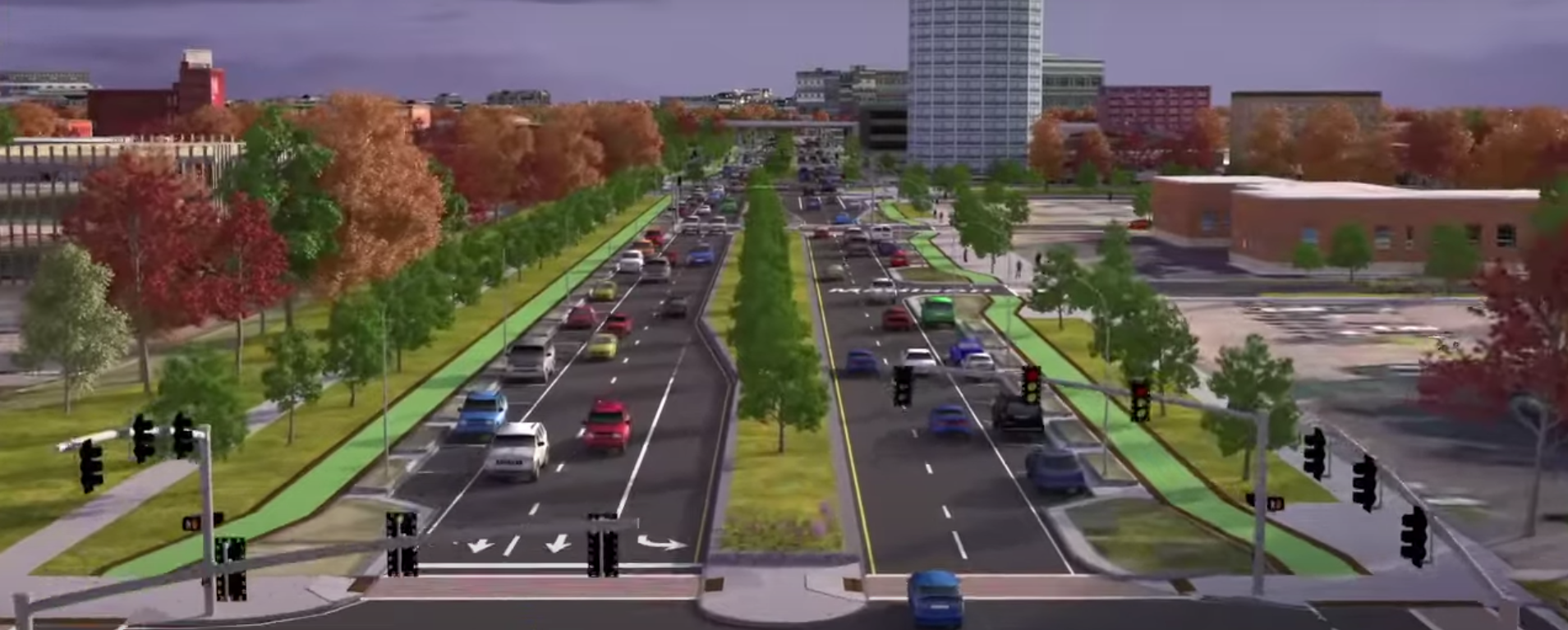
It might be possible to change that. Onondaga County just posted its first decade of meaningful population growth since 1970, and all indications are that our community will continue to grow. Those new people need somewhere to live, and there’s plenty of room for them in the urbanized area at the center of the County. More housing and mixed-use development along major suburban corridors like Old Liverpool Road, Milton Avenue, and Route 5 would create the conditions to necessary to support frequent transit service—lots of people and lots of places for them to go—and that same frequent transit service could be a reliable option for people trying to get to suburban jobs.

So here’s what it will take for Centro to run truly useful transit service to suburban employers like Amazon or Micron: lots more money, lots more housing, and much better planning. The entire County needs better bus service. Everybody needs access to all of the opportunities in this community, and this is how we can make it happen.

BRT on South Salina

Centro’s recent announcement that they are planning Bus Rapid Transit service along South Salina Street is great news for public transportation in Syracuse.

Since 2017, pretty much all discussion of BRT in Syracuse has been confined to the two lines  described in SMTC’s SMART1 report, but SMART1 itself assumed the eventual BRT system would include more lines. South Salina is a perfect place to run Centro’s next BRT line, and it will make the system more useful to three groups of people.

First, better bus service on South Salina will serve more people who rely on the bus. South Salina has always been one of Centro’s top performing bus lines—both in terms of overall ridership and ridership per service hour. That’s because lots of people who live along South Salina ride the bus. Look at a heat map of bus boardings, or a population map showing where people who commute by bus live, and it’s clear that the South Salina corridor is one of Syracuse’s strongest transit corridors. Adding frequency there will allow lots of current bus riders to take more trips immediately.

Second, transit’s network effect means this additional BRT line will benefit people who live along the original SMART1 lines too by increasing the system’s service area. BRT uses high service frequencies to facilitate connections between multiple lines, so no matter where you board a BRT bus, you can easily get anywhere else in the system. That means every new line increases the number of places existing riders can go, and that will make the two original SMART1 lines (shown in blue and orange below) more useful for more people.

note: Centro has not officially stated where the South Salina line will terminate. These maps are guesses.

Third, this network effect also benefits neighborhoods as a whole along each line. Shops, businesses, libraries, and church’s sitting on either of the two SMART1 lines will have a larger pool of customers, workers, patrons, and congregants with the addition of the South Salina line. That network effect puts existing businesses and institutions in a better place to succeed, and it will strengthen neighborhoods by attracting even more businesses and institutions and making more opportunity accessible within the City.

For all these reasons, it’s a very good thing that Centro is looking for ways to expand its plans for BRT service beyond the two lines described in the SMART1 study. We need to upgrade every high-performing Centro bus line—including South Salina but also those serving high-ridership corridors like Butternut, Genesee, and Onondaga—to BRT service in order to create a citywide network. That’s the transit system Syracuse needs and deserves, and Centro is committed to building it.

How to build rail transit in Onondaga County

Onondaga County’s extensive freight rail network—and particularly the elevated viaduct running through Downtown—has long inspired dreams of rail-based rapid transit in Syracuse. It seems like we’re this close to having big-city transit without the hassle of having to lay any new track or building much infrastructure. Just run passenger trains on the rails that are already there, and Syracuse would have its own version of Chicago’s El.

OnTrack showed that the reality is more complicated. You can’t just put a passenger train on any preexisting tracks and expect quality transit. The service—when, where, and how fast it runs—actually has to be useful if people are going to use it. OnTrack’s service was very bad and few people used it, in part, because of insufficient infrastructure. Any serious proposal for rail transit in Syracuse has to fix the infrastructure problems that doomed OnTrack.

To see what it would take to make rail work, look at the western corridor from Camillus through Solvay to Syracuse. The 2014 Syracuse Transit System Analysis identified this as a ‘transit improvement corridor’ because of existing transit ridership, population and employment density, and potential for new development. The 36 and 74 buses already serve the corridor—on West Genesee Street and Milton Avenue, respectively—and are among Centro’s best-performing suburban bus lines. In fact, these buses trace the same lines as two of Syracuse’s streetcar routes. The Near Westside, Tipp Hill, Solvay, Fairmount, and Old Camillus are all original transit-oriented development.

And luckily, an existing freight rail line stretches the entire length of this corridor. The Finger Lakes Railway operates from the Village of Camillus to Solvay, and the New York, Susquehanna & Western runs from Solvay through Downtown to University Hill.

But if we just replaced buses on Milton Ave with passenger trains on this rail line as it exists right now, it would be a huge downgrade in transit service. The right-of-way needs major improvements to offer truly transformational transit service.

DOUBLE TRACK

The existing rail line is only single tracked for most of its length. That means trains can’t run in opposite directions, and it presents two serious problems.

First, it limits service frequency to what a single train can provide running nonstop. For this 11 mile-long corridor, that means the train would serve each stop about once every 40 minutes—not the kind of service that would allow a person living in Camillus to get by without a car.

Second, a single-track would make it impossible for trains operating on other corridors (north to Baldwinsville or Liverpool, maybe) to share the City Center tracks with this line. Limiting the network to just a single line makes it much less useful because it limits who can access the system and where they can go. The most useful rail network would allow riders to connect with multiple lines so they can travel all across the county.

So in order to improve service frequency and expand the rail network, the right-of-way needs an additional second track.

SHIFT THE RIGHT-OF-WAY

Although the rail line follows Milton Avenue’s general path, it misses several important destinations currently served by bus.

Take the western terminus at the Village of Camillus. The bus stops right in the middle of town, but the old train station is about half a mile from the village’s center. That puts too many people and destinations out of easy walking distance of the train, so the tracks need to come to them. Quality passenger service needs new tracks running down Genesee Street so the terminal station can be in the center of the village.

In Solvay, one of the main areas of activity and residential density is at the intersection of Milton and Lamont Avenues. This is a great place for a station stop, and the existing right-of-way passes within a quarter mile, but it’s impossible to walk from the tracks to this spot because there are multiple factories in the way. Routing new tracks along Milton from Bridge Street to Erie Boulevard would bring service right where it needs to be.

At the Syracuse end of the line, the tracks run up against University Hill, but not anywhere worth getting off. The old OnTrack station is surrounded by parking lots, and it is more than half a mile walk (uphill) to the hospitals and most of SU’s academic buildings and dorms. The tracks should run up into the hill right past the hospitals and into Syracuse University’s Campus. This would allow for additional station stops where there’s lots of demand for transit, and it would facilitate connections between the rail line and the University Hill bus network.

In order to run the service where it needs to go, the right-of-way needs to shift in a few key places.

PEDESTRIAN INFRASTRUCTURE

Even when the tracks run right where they need to, a lack of pedestrian infrastructure can make the stations practically inaccessible.

Hinsdale Road is within walking distance of lots of housing, jobs, and things to do, but there are no sidewalks along any of the nearby streets and no crosswalks at any of the major intersections. People would be putting their lives at risk just walking from the train to their final destinations. Milton Ave and Hinsdale Road need sidewalks and crosswalks if anybody is going use a train station there.

In Syracuse, the rail line runs between the populous Park Ave and Near Westside neighborhoods, but there’s no way for people to walk from both neighborhoods to a single station because there is no pedestrian connection between Erie Boulevard West and West Fayette Street. This halves the area within walking distance of any Near Westside station and limits the number of people who can catch the train. A bike/pedestrian path connecting Erie Boulevard West to West Fayette Street would allow many more people to ride the train.

The Downtown rail viaduct runs within 500 feet of Centro’s bus Hub, but to get from one to the other, you have to cross two busy streets. Passenger rail needs to connect to the entire bus network to serve as many people as well as possible, and separating the services with two crosswalks just won’t cut it—imagine getting off the bus and seeing your connecting train pull away as you wait for the light to change so you can cross the street. A covered pedestrian bridge from the rail line to the bus Hub would let people make those connections quickly and easily.

Getting all those details right will take a lot of investment, but it would create a fast, frequent, reliable rapid transit line that connects the western suburbs.

Make the same kinds of improvements on other rail lines across the county, and the change would be transformational: a fast, frequent, reliable metropolitan transit network that could shape the region’s growth equitably and sustainably.

Right-sizing Almond Street

When NYSDOT tears down the viaduct and builds the Community Grid, Almond Street should have the narrowest right-of-way possible. Last summer’s Draft Environmental Impact State showed Almond Street much too wide, but the Final Environmental Impact Statement NYSDOT released last week showed a path towards making Almond Street a more reasonable width.

A primary goal of the I81 project should be to restore the City’s center as an equitable, sustainable neighborhood that offers good housing to lots of people. Almond Street’s width affects that goal in two ways.

First, wide roads lead to speeding cars and dead pedestrians. Wide lanes, wide intersections, and a wide field of view make drivers feel like they should go fast no matter what the speed limit says. NYSDOT knows this and is planning to build Almond Street so that drivers feel comfortable driving 35 mph, even though a car traveling that speed is much more likely to kill a pedestrian than a car traveling 25 mph. Narrowing lanes, tightening turns, and bringing buildings closer to the street will all encourage car drivers to go slower, and that will make the City’s center a better connected neighborhood and a more pleasant place to live.

Second, the less room Almond Street takes up, the more room there will be for people’s homes. The DEIS showed Almond Street’s right-of-way stretching 174’ across. For reference, Salina St is 99’ wide, and the West Street Arterial—including the high-speed lanes, the Creekwalk, and the access road—is about 140’ wide. NYSDOT could easily fit all of the infrastructure they want for Almond Street—4 travel lanes, turning pockets, parking lanes, sidewalks, bike paths, and a median—in a 122’ wide right-of-way. That extra 52’ translates to more than 3 acres of land between Monroe Street and Erie Boulevard, and that’s plenty of room to build new, quality, affordable housing for more than 100 people.

narrowing the Almond Street right-of-way creates new space where people can live

But Syracuse won’t enjoy any of these benefits if NYSDOT pushes ahead with the plans it’s presented for Almond Street. Luckily, the FEIS showed how we can change those plans before the Grid gets built.

A good portion of NYSDOT’s 172’ wide Almond Street right-of-way is taken up by grass. There’s grass between the sidewalk and the bike lane. There’s grass between the bike land and the curb. And there’s grass running down the center median. Grass is good for reducing rainwater runoff, and these grassy areas provide nice places to plant trees, but there’s really no good reason to waste so much space on grass when Syracuse has a housing crisis.

City Hall said as much in its official comments on the DEIS:

Given the excessive widenings planned for Almond Street… NYSDOT’s proposal may in fact diminish neighborhood cohesion at the expense of the City’s property values. NYSDOT rationalizes proposed takings by noting that many of the proposed locations are currently underutilized; however, that is more reason not to devote them to overbuilt infrastructure than to productive use. To return more State land to taxable private use, NYSDOT should narrow proposed lane widths, narrow proposed rights-of-way, and reduce proposed takings in street corridors.

NYSDOT’s response opens the possibility that they will narrow the Almond Street right-of-way:

The Community Grid Alternative would result in approximately 10 to 12.5 acres of surplus property not needed for transportation purposes that could return land to the City’s existing inventory of taxable real estate. As the Project progresses into the final design and construction phases, NYSDOT will continue to minimize the necessary work outside the right-of-way without compromising the safety of the transportation system.

This is good news! Reducing the overall width of the right-of-way will yield significant benefits to the surrounding neighborhood, and it is good that NYSDOT is willing to reexamine some of the details of the DEIS’ Almond Street design. Narrowing the median, shrinking or eliminating some of the many planted buffers, and narrowing the bike lane from 10’ wide to NACTO’s recommended 6.5’ are all very good ideas that NYSDOT should implement during the final design phase.

But that good news is tempered by NYSDOT’s insistence that Almond’s travel lanes must be 12’ wide. That’s the design standard for interstate highways, it’s totally out of character with Almond’s city-center environment, it is a waste of land where people could live, and it will get pedestrians killed. Despite all that, NYSDOT claims that the lanes must be 12’ wide because Almond Street will be a “qualifying highway”:

BL 81 [Almond Street] would be designated as a Qualifying Highway and designed to handle buses, recreational vehicles, and trucks, including large, heavy vehicles with a width limit of 102 inches… As a Qualifying Highway, BL 81 would be designed with the physical characteristics to accommodate large, heavy vehicles along its length. These characteristics include appropriate horizontal and vertical alignments, lane widths (12 feet wide), turning radii, sight distance, and auxiliary lanes with acceleration/deceleration lanes of sufficient length and storage.

Leaving aside whether it’s necessary for Almond Street to be designated a qualifying highway (it’s not necessary at all) and whether Syracuse wants large heavy vehicles speeding through the City’s center (we don’t), it’s obvious that this designation doesn’t force NYSDOT to use bad standards designed for high speed traffic. There is an entire appendix in the FEIS called “Nonstandard and Nonconforming Features Recommended to be Retained,” and it is full of instances where NYSDOT intends to deviate from official design standards in the construction of the Community Grid. In particular, this document contains seven streets where NYSDOT is comfortable designing narrower lanes than the standards recommend.

Clearly, NYSDOT does not need to design Almond Street as a high-speed arterial, and it could simply choose to narrow the travel lanes to 10’ during the projects final design phase. NYSDOT should make that choice, and it should narrow other elements of the Almond Street right-of-way like the bike lanes, the center media, and the planted buffers. Taken together, those changes will create an additional 3 acres of land in the City’s center where people can live, and it will make Almond Street safer and easier to cross for people on foot. Those are the kinds of technical changes that NYSDOT must make for the I81 project to succeed.

Housing and highways in Onondaga County, 1940-2019

Central New York’s highways remade the geography of where people live in Onondaga County. A new dataset makes it possible to track change in the number of housing units in each of the County’s census tracks from 1940-2019. These numbers show heavy housing losses in the few highway-adjacent neighborhoods that had lots of housing in 1940, and they also show thinly spread housing construction in previously rural census tracts now served by the highways.

The maps above show housing units per square mile by census tract in Onondaga County and the City of Syracuse in 1940. Housing was highly concentrated in the center of the County. There were some suburban pockets of moderate density in villages like Baldwinsville, Fayetteville, and North Syracuse—and also in some early inner ring suburbs like Mattydale and Westvale—but the vast majority of the County’s land was rural, and most of its people lived in city neighborhoods at the County’s center.

By 2019 that sharp division between city and rural had blurred. Suburban subdivisions sprawled out from Syracuse and covered the northern half of Onondaga County with tract developments that are much denser than the countryside but nowhere near as tight-knit as traditional City neighborhoods. This new kind of in-between neighborhood now accounts for the vast majority of Onondaga County’s urbanized area.

The highways caused these changes. These maps show the change in housing unit density between 1940 and 2019. Tracts shaded blue saw a net increase in the number of housing units, tracts shaded red lost housing. The yellow lines trace Onondaga County’s limited-access freeways.

Housing growth followed the freeways out of Syracuse and into the suburbs. In general, rural areas where highways were built transformed to sprawl while rural areas without highways remained rural. City neighborhoods immediately adjacent to the highways lost housing through urban renewal and targeted disinvestment, while neighborhoods away from highways gained housing.

For eighty years, the highways drove sprawl towards the County’s edges. Today, the northern and eastern suburbs have just about passed over into Oswego and Madison Counties. If this sprawl continues, it will leave Onondaga County with huge infrastructure maintenance bills, and little tax base to pay them. The County’s biggest challenge in the 21st century is figuring out how to grow without sprawling ever outward.

Removing the City’s highways is a good first step. They left a gaping hole in the County’s center and decimated neighborhoods that were built to accommodate growing communities through the 19th and early 20th centuries. Once the highways are gone, those same city center neighborhoods will provide better homes for our growing community today.

The chronic financial stress of car ownership

Assemblymember Pamela Hunter’s and State Senator John Mannion’s proposal to subsidize car driving by defunding public transit will entrench the very problem they want to solve. They are right that household budgets are getting squeezed by a sharp and unexpected increase in the costs of operating a car. But they offer the same solution that local politicians have been offering to this same problem for decades with no positive effect: a small subsidy for drivers at the cost of true alternative transportation options.

Gas costs more today than it did last year. That’s a real problem for people who drive a lot and don’t have a lot of extra room in their household budget to handle that new unexpected expense. The people who drive the most are mostly pretty well off financially, and many of them probably do have enough money on hand to cover the rise in the price of gas. But there definitely are also a lot of other people less well off who have to drive every day and who are really hurting because of this rise in the price of gas.

In a recent Op Ed, Assemblymember Hunter explained the immediate causes of this gas price spike: oil corporations produced less gas during Covid lockdowns, and Russia’s invasion of Ukraine disrupted global oil supply chains. The result is that there’s less gas available right now, so oil companies raised prices. Assemblymember Hunter’s (and Senator Mannion’s) answer is to shift money from road maintenance and public transit to subsidize gas purchases by 8 cents per gallon.

(For what it’s worth, this temporary price shock is already fading away. According to AAA, the price of gas in New York peaked early last month at $4.46 and has fallen steadily since).

There is nothing new about any of this. I’m 31 years old, and some part of the world has been at war over oil for more than half my life. Gas was more expensive when I was in high school than it is today, and it’s going to get a lot more expensive before I die. OPEC may try to manipulate the price of gas by increasing or decreasing production, but there’s nothing they can do about the fact that they will exhaust their reserves in the not too distant future.

And beyond all that, even if the New York State legislature could somehow protect car drivers from sharp unexpected increases in the price of gas, it wouldn’t do much at all to make driving more affordable. Huge unpredictable expenses are a guaranteed experience for every car owner. Your brakes give out and have to be replaced. You get in an accident and your insurance goes up. You drive through a speed trap and get a ticket. All of these absolutely normal events in the life of a car owner have exactly the same impact on household budgets as last month’s gas price spike.

The simple fact is that car ownership imposes unpredictable expenses on too many households hardly able to afford it. It requires people to have a reserve of money—whether that’s personal savings, or friends or family willing and able to lend money—at all times to deal with these emergency expenses. That may work out for people making decent money and people with family wealth, but it’s a disaster for anybody living paycheck to paycheck. These daily disasters are so common that we hardly even think of them as problems for public policy. But just as people who depend on cars need relief from high gas prices, they also need relief from the chronic financial stress of car ownership.

But instead, public policy in Onondaga County has always pushed poor people to buy cars. The old Wheels-for-Work program provided loans for people to buy a car if they got a job—saddling workers with a debt they could only pay off by keeping a job that depended on the source of their debt. The Rides-to-Work program—and its successors, JOBSPlus! and Providence Services—subsidized taxi rides for carless commuters with the explicit expectation that workers would save their first paychecks to buy a car.

Transit austerity hangs behind all these efforts to get poor people driving. Public transportation is the obvious alternative for people who can’t afford—or don’t want to deal with—the enormous and unpredictable expense of driving. But the Federal Government, New York State, and Onondaga County have bled Centro dry, so Syracuse’s bus service is just a pale imitation of the fast, frequent, reliable transit system that this community needs and deserves. Compare the urgency behind this gas subsidy with the silence from Syracuse’s legislative delegation last Fall when Covid forced Centro to cut its service to the bone.

The Hunter/Mannion proposal sits squarely in this long line of failed transportation policies. It’s a small subsidy that makes driving a little less painful for poor families, but it gets that money by raiding the State’s transit budget. This would further degrade Centro’s service, push more people to purchase a car, and expose more families to the unpredictable budget-breaking expenses that are a normal feature of car ownership.

Freedom from gas prices

Rising gas prices have politicians scrambling to find some way to mitigate the impact on car drivers’ pocketbooks. But because gas prices get set by multinational corporations, local politicians have pretty limited options for doing this. Most have settled on a per-gallon gas subsidy in the form of a gas tax cap or holiday.

This is a bad idea for several reasons.

First, America’s gas taxes are so low that suspending them wouldn’t make much of a difference to people at the pump. The federal gas tax hasn’t risen since 1993, and is so low that it doesn’t even cover the cost of the Highway Trust Fund anymore. Locally, Onondaga County and the City of Syracuse charge just 4%, so the County Executive’s proposed 16-cent tax cap would only knock 6 cents off the price if gas gets up to $5.50 a gallon. That’s cold comfort for anybody who’s really hurting from the prices they’re paying today.

Second, there’s no way to ensure that the savings will actually get passed onto car drivers. Oil company profits are at a 7-year high right now—gas prices could be lower if all it took was their goodwill. There’s little reason to think that these global corporations are going to just pass up the free money our governments are thinking of handing them. More likely, they’ll just raise prices to gobble up that windfall.

Third, lower gas taxes deliver comparatively small benefits for low-income households who need relief the most. Lowering the price of each gallon of gas gives the biggest handout to the biggest guzzlers, and rich people burn more gas than poor people do. A high-income office worker who drives their SUV from 30 miles Baldwinsville to Downtown and back everyday would get a much larger subsidy than a Northside resident who catches a 5 mile ride with a coworker to Upstate (nevermind that this whole scheme does nothing at all for people who don’t drive, even though rising prices are hitting their household budgets too).

And besides all that, the absolute best way to free people from spiking gas prices is to give them more ways to opt out of buying so much gas in the first place. Gas-powered cars are going to be part of CNY’s transportation system for the foreseeable future, but there’s no reason that so many people should have to burn so much gas just to run their daily errands.

We have the tools to give people better options today. Here are two ways Onondaga County could better spend its unexpectedly high gas tax revenue to help people out immediately:

Expand access to ebikes

Ebikes can replace cars for many trips under 10 miles. Sync bikeshare covers the entire City and is expanding its fleet of ebikes and scooters in preparation for Spring weather. City Hall and Onondaga County should subsidize Sync rides for people switching from car driving and expand bikeshares service area into the towns.

Onondaga County could also help people purchase their own ebikes (or regular bikes) by retooling the Keeping it Local restaurant gift card program to include local bike stores.

City Hall and New York State can help out by installing temporary separated bike lanes along major corridors like Route 5, Route 57, Onondaga Lake Parkway, Route 11, and Milton Avenue to safely accommodate increased bike traffic.

Make Centro Work

Centro is restoring and expanding service as it recovers from the pandemic. Onondaga County and City Hall should identify priority bus lines and pay Centro to make them fare-free. Fares are both an economic and psychological barrier for new riders, and removing them would go a long way to making people feel comfortable saving on gas by riding the bus. Even if some commuters had to board this service at a Park-and-Ride stop like the John Glenn Wegmans, it would save them a lot of gas money by significantly reducing the distance they drive, even if it doesn’t replace the full trip.

Syracuse University already uses this exact strategy to handle parking needs on its campus. If it’s good enough for SU, then it’s good enough for the rest of us too.

City Hall could help make this successful by installing pop-up bus lanes Downtown where car traffic often slows buses and makes transit a less attractive option.


In the longterm, we need more permanent solutions like land use reform—more people should be able to walk or bike to the grocery store, for instance—sidewalks in every community, and more frequent transit service. Those things will take time and we should also use unexpected tax revenue and ARPA funds to get started on them right away. It’s never too soon to create a community where people’s mobility isn’t so dependent on the whims of oil-funded dictators halfway around the globe.

Capping, lowering, or eliminating the gas tax is a bad idea. It won’t help car drivers much (if at all), what help it does provide will mainly go to high-income households, and it will leave us just as vulnerable to the gas price spikes that we are guaranteed to see in the future.

The Hub of New York State

Syracuse is and has always been a crossroads city. Civic boosters used to call it “the Central City” and “the Hub of New York State” because it is so easy to travel from Syracuse to other parts of the state.

Some highway enthusiasts have pointed to this history to argue that removing the I-81 viaduct would go against Syracuse’s very nature. Here’s how AM Bill Magnarelli put it in a letter published in the Post-Standard last August:

For some 60 years, Interstate 81 has served as a major thoroughfare and economic driver for the entire Central New York region continuing and reinforcing Syracuse’s historical identity as the “Hub of New York”… Why should I-81 in Syracuse be the first Tier One Federal Highway in the United States to be decommissioned? It has served as a north-south conduit for people and goods for decades. It is part of what makes Syracuse the “Hub of New York.”

Historically, this argument is half right. Analytically, it’s all wrong. Syracuse has benefitted from access to intercity transportation routes throughout its entire history. However, the benefit has been that people can travel to and from Syracuse—not through it—and the community has always tried to keep intercity transportation infrastructure out of the City’s center and away from people’s homes.

Removing I-81 from the middle of town fits right in with the City’s long struggle to improve quality of life by pushing highways, canals, and railroads out of neighborhoods.

Seneca Turnpike

New York State built Seneca Turnpike in 1794. Syracuse didn’t exist then. Onondaga Hill was the county seat, Onondaga Hollow (now called the Valley) was the biggest settlement, and Seneca Turnpike runs through both.

By 1806 Onondaga County’s population center had shifted north, and the State built a detour from the Seneca Turnpike between Seneca Falls and Chittenango. This detour passed through Elbridge, Geddes, Fayetteville, and Manlius. Today we call this intercity highway Genesee Street, and it crossed the road between Onondaga Hollow and Salina in what was then a swamp but is now the site of Clinton Square.

This northern branch of the Seneca Turnpike helped create Syracuse. Henry Bogardus built a tavern on the Turnpike at the Salina road to serve stagecoaches, and the hamlet that formed around the crossroads was initially called Bogardus’ Corners. 

Village squares break up the highway’s path through town in this 1834 map of the Village of Syracuse

As the hamlet grew into a village (and renamed itself Syracuse), it began removing parts of the intercity highway within the populated part of the community. First, the Erie Canal diverted the road in front of Bogardus’ tavern to form Clinton Square. Then as the village spread east, it built Centre Square and Forman Square (now Fayette and Forman Parks) on top of Genesee Street. This turned an intercity highway into quiet greenspaces surrounded by residential buildings.

In the time since, Syracuse has turned several more blocks of Genesee Street into parks and building sites. The improvement is obvious at Hanover Square, which transformed from a sea of asphalt into a leafy city square.

Erie Canal

The Erie Canal came to Syracuse while the hamlet was still just a handful of houses. As Syracuse grew from its starting point at Clinton Square—the intersection of the Seneca Road and the Erie Canal—the Canal became a major dividing line that separated the Northside from the Southside (as those terms were understood at the time).

Crossing the canal could be a hassle. The bridges that crossed it moved up and down to allow boats to pass below, but they often malfunctioned and blocked all horse, trolley, and automobile traffic.

So, when NYS routed the Barge Canal north of the City in 1918, Syracuse was all too happy to fill the canal in and eliminate all those bridges for the benefit of local movement between the two halves of the City.

“United Syracuse”: the Syracuse Herald celebrated the removal of the Erie Canal

New York Central Railroad

The Village of Syracuse granted the Syracuse & Utica Railroad a perpetual charter to run trains at street level along Washington Street in 1837. In the early 19th Century, Washington Street was still outside the middle of town, so it seemed like a good place to put this new kind of intercity transportation infrastructure.

That changed fast. The train station at Vanderbilt Square became a hub of activity, the Village grew to surround it, and train traffic became a nuisance. Soot covered the buildings, trains hit people, and by the 20th century more than 100 daily trains blocked the streets for hours everyday. Eliminating “grade crossings” became the local issue in Syracuse.

City Hall finally got the trains out of the streets in 1936 by building a new elevated rail viaduct just north of Downtown. Even that incredibly expensive solution was not enough, though, as the new viaduct still brought intercity freight trains through the center of town. When NYSDOT started looking for a route to build 690 in the 1960’s, Syracuse gladly offered up the rail viaduct and pushed the trains out north of the City where they still run today.


Syracuse sits at the mouth of a long valley along the foothills of the Allegheny Plateau. It is a natural crossroads, and the City has long benefitted from intersecting intercity transportation infrastructure.

But for just as long, Syracuse has also taken great pains to mitigate the negative impacts of that transportation infrastructure by either slowing intercity traffic’s movement through the City, or by shifting intercity routes out around the city. Removing the I-81 viaduct and replacing it with a locally-oriented network of safe streets in order to improve the quality of life in city neighborhoods is simply the next step in this long history.

Two versions of the Grid

There are two possible versions of the Community Grid. The better version has safe streets, clean air, and quiet neighborhoods. The worst possible version of the Grid is one where interstate vehicular traffic drives through city neighborhoods instead of following I81 around Syracuse. NYSDOT risks building the bad version of the Grid because they continue to prioritize high-speed through traffic over neighborhood well-being.

The Grid needs to reduce traffic speeds and traffic volumes in order to fulfill its promise of creating safe, healthy, connected neighborhoods. But that can only happen if removing the viaduct also removes cars from the middle of Syracuse. It’s cars that emit exhaust, cause a racket, and crash into people. 

Removing the viaduct should lower traffic volumes immediately. Cars and trucks traveling through Syracuse from somewhere else to somewhere else should avoid the densely populated neighborhoods of the Grid and instead just follow 81 (currently 481) around the City.

But the Grid will only bring this benefit if it is in fact faster to take the highway around the city than to drive on local streets through it. If cars can drive faster from Tully to Brewerton by taking the Grid instead of the highway, then that’s what they’ll do because their phones will tell them to. Syracuse knows too well that no amount of signage can convince a driver to take the route that traffic engineers want if google maps says some other route is faster.

those signs ought to take care of it

NYSDOT is coming dangerously close to this worst-case outcome. First off, they’re keeping almost all of the highway in place and even widening it north of Downtown so that more cars can drive faster. Second, they are designing Almond Street and Erie Boulevard to accommodate (illegal) speeds of 35 mph with too-wide lanes, too-huge intersections, and traffic signals that will show speeding drivers a “sea of green.” And third, even when Syracuse demands that NYSDOT take steps to reduce traffic volumes and pollution at key sites like an elementary school, NYSDOT’s response is to make the highways even longer and the Grid’s local streets even shorter.

You can tell this is the worst version of the Grid, because it’s exactly what the Save81 crowd describes when they want to discredit the very idea of reconnecting neighborhoods and reducing noise and air pollution in people’s homes. You want ALL the cars from I81 running through the middle of town? they ask. It will be total gridlock. Tens of thousands of cars clogging local streets and spewing exhaust into people’s homes.

It’s worth saying that, as bad as this version of the Grid would be, it’s still better than building a brand new bigger, wider viaduct through the middle of town. A too-wide, too-fast Almond Street would still be safer, it would still reduce pollution, it would still uncover lots of land where people could live, and it would be much easier to fix—by narrowing lanes, adding traffic signals—than a brand new bigger viaduct and 81/690 interchange. Even Save81’s worst version of the Grid is more appealing than actually saving 81.

But we should build the best version of the Grid. One that will bring safe streets, clean air, and quiet neighborhoods—not a high-traffic, high-speed, high-pollution highway-street hybrid. The Grid has to prioritize people’s safety, health, and peace over vehicle speeds. That means the fastest route for through traffic cannot run through the very neighborhoods that I81 has been polluting for 60 years. NYSDOT has to amend its designs now to build the Grid that this community needs and deserves.

The roundabout’s new spot

NYSDOT’s new proposal to place a highway offramp at Van Buren Street shows how their desire to maintain a high-speed highway through the City is incompatible with residents’ desire for safe, connected neighborhoods free of noise and air pollution.

The offramp—designed as a large roundabout—was originally planned for MLK Boulevard on the Southside. When NYSDOT unveiled those plans last summer, people immediately and rightly pointed out that it was too dangerous to funnel all of the highway’s traffic down to street level directly next to an elementary school. Connecting the highway to the street grid there would put kids at serious risk of injury, and the roundabout widened the entire roadway meaning that all of its noise and air pollution would be even closer to the school than I81 is now. Of the 7,000 comments NYSDOT received about the entire I81 plan, more than 1,000 were about the roundabout.

So NYSDOT has adjusted the I81 plan by moving the offramp 1000’ north to Van Buren Street. They’d dead end MLK Boulevard to keep highway traffic away from Dr. King Elementary’s students. That’d make the street safer, but it would also ‘cut off’ the Southside from the Grid. Moving the roundabout will allow NYSDOT to shift the highway lanes a couple dozen feet to the East. That will mitigate noise and air pollution at the school, but the new design may actually increase noise and air pollution at that point because cars will be driving a lot faster—and they’re more likely to be accelerating—than if they were passing through a roundabout.

At the offramp’s new location on Van Buren, it will cause many of the same problems that people feared at MLK Boulevard. Residential buildings flank Van Buren Street right where the roundabout will be, and the new offramp will be just as close to them as it would have been to Dr. King elementary. NYSDOT also intends to install a biking/walking path from Raynor to Van Buren to connect the Almond Street shared use path with University Hill, but it will be impossible to cross the roundabout there, so the offramp will sever that connection.

A better option would be to move the highway’s offramp further south to a place like the current Exit 17 just south of Brighton Avenue. End the limited-access highway there with a roundabout connecting to Salina St—as the current exit already does—and run a narrower 30 mph Almond Street from that point all the way through the Southside to Downtown. Almond Street would intersect with Brighton, Colvin, Oakwood, and Kennedy Street before reaching MLK Boulevard, so car traffic would have a lot of options to disperse through the City. Many fewer cars would pass by Dr. King Elementary, and any that did would travel past the school at much safer speeds. This would maintain connections between the Southside, Downtown, and University Hill, and it would allow people to walk from the Southside to Oakwood Cemetery—Syracuse’s largest green space.

But NYSDOT didn’t even consider this option. They dismissed the idea of moving the roundabout south by claiming that “traffic would speed up again by the time drivers reached Downtown.” But drivers would only speed up again if there were no signalized intersections and if the road was designed with highway-sized lanes that encourage fast driving all the way to Downtown—NYSDOT considered moving the roundabout south without ending the highway at the roundabout.

This is a bad sign for the project as a whole. The Grid has to prioritize movement within the City over high-speed car traffic traveling through the City. NYSDOT, incorrectly, seems to think they don’t have to choose between these two priorities. Asked to place more value on the health and safety of the students at Dr. King Elementary, they ignored the best option for those kids because it would slow down cars. You can see similarly misplaced priorities in the details of their design for Almond Street through Downtown which would encourage speeding and make it difficult to bike or walk between Downtown and the Eastside.

There are a thousand little details of the I-81 project that NYSDOT can tweak to either make Syracuse a safer, healthier, happier place or a place that’s easy to drive through. When public feedback forced them to move the highway’s southern offramp, they chose a new location that will make driving easier at the expense of local connectivity. We can’t let them keep making that same choice.